Welcome to Niyu Dao, a Temperate island in the Eastern China Sea, part of the majestic Pacific Ocean. This guide offers a comprehensive overview of what makes Niyu Dao unique – from its geography and climate to its population, infrastructure, and beyond. Dive into the details:
Geography and size of Niyu Dao
Size: 12.4 km²
Coastline: 33.8 km
Ocean: Pacific Ocean
Sea: Eastern China Sea
Continent: Asia
Niyu Dao is a Medium Island spanning 12 km² with a coastline of 34 km.
Archipel: –
Tectonic Plate: Yangtze – A minor tectonic plate in East Asia, often considered a part of the Eurasian Plate. It’s primarily continental and covers the Yangtze River area in China, playing a significant role in the region’s geological stability.
The geographic heart of the island is pinpointed at these coordinates:
Latitude: 27.86001609 / Longitude: 121.04445873
Climate and weather of Niyu Dao
Climate Zone: Temperate
Climate Details: Humid Subtropical Climate
Temperature: Hot Summer
Climate Characteristics: With continuous rainfall and hot summers, this climate is common in some coastal regions, supporting diverse vegetation.
Topography and nature of Niyu Dao
Timezone: UTC+08:00
Timezone places: Australia/Perth
Max. Elevation: 167 m
Mean Elevation: 77 m
Vegetation: Agricultural Mosaic
Tree Coverage: 34%
The mean elevation is 77 m. The highest elevation on the island reaches approximately 167 meters above sea level. The island is characterized by Plains: Flat, low-lying lands characterized by a maximum elevation of up to 200 meters. On islands, plains are typically coastal lowlands or central flat areas.
Dominating Vegetation: Agricultural Mosaic
A mix of cropland and natural vegetation, often seen in rural landscapes where agricultural fields are interspersed with patches of natural habitats. Niyu Dao has a tree cover of 34 %.
Vegetation: 8 vegetation zones – Very Highly Diverse Island
Islands in this range are ecological powerhouses, showcasing a wide array of vegetation zones. Each zone, from lush rainforests to arid scrublands, coastal mangroves to mountainous regions, contributes to a complex and interdependent ecosystem. These islands are often hotspots of biodiversity, supporting numerous species and intricate ecological processes.
Infrastructure and Travelling to Niyu Dao
Does the island have a public airport? no.
There is no public and scheduled airport on Niyu Dao. The nearest airport is Wenzhou Longwan International Airport, located 19 km away.
Does the island have a major port? no.
There are no major ports on Niyu Dao. The closest major port is WENZHOU, approximately 44 km away.
The mean population of Niyu Dao is 687 per km². Niyu Dao is Densely Populated. The island belongs to China.
Continuing your journey, Zhuangyuan’ao Dao is the next notable island, situated merely km away.
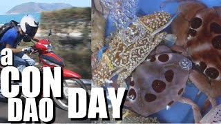
Exploring Con Dao: Vietnam's Hidden Gem
Join us as we explore Con Dao, Vietnam's hidden gem! Discover pristine beaches, crystal-clear waters, and vibrant marine life.Exploring Con Dao: Vietnam's Hidden Gem
Join us as we explore Con Dao, Vietnam's hidden gem! Discover pristine ...
Join us as we explore Con Dao, Vietnam's hidden gem! Discover pristine beaches, crystal-clear waters, and vibrant marine life.
Ultimate Phu Quoc Itinerary 🇻🇳 | 4 Day Budget Travel Guide under ₹20K
Phu Quoc in 4 Days — The Only Guide You Need Save this if you're ...
Phu Quoc in 4 Days — The Only Guide You Need Save this if you're planning Vietnam's island paradise! Day 1 – VinWonders ...
This Vietnam island is a lie
explore #travelhacks #phuquoc - #vietnam2025 #Budgettravel #visafree ...
explore #travelhacks #phuquoc - #vietnam2025 #Budgettravel #visafree #vietnam.
The ultimate Phu Quoc itinerary you’ll want to follow! Plan your trip soon before it gets crowded!
Bonus: Indians can visit visa-free if you arrive and depart directly ...
Bonus: Indians can visit visa-free if you arrive and depart directly from Phu Quoc! Note: Currently, there are no direct flights ...
Con Dao Islands travel: VIETNAM'S MUST VISIT DESTINATION
If you want to experience the best beaches and absolute stunning ...
If you want to experience the best beaches and absolute stunning island scenery in Vietnam, then I highly recommend visiting ...
TOP 10 Things To Do in CON DAO | VIETNAM travel guide
In this travel guide to Con Dao, Vietnam, I share my top 10 things to ...
In this travel guide to Con Dao, Vietnam, I share my top 10 things to do 🎟️ Find the best local tours in Con Dao (GetYourGuide) ...
Discover Con Dao Vietnam's Secret Luxury Island
Con Dao is a secret paradise in Vietnam. A treasure trove of hidden ...
Con Dao is a secret paradise in Vietnam. A treasure trove of hidden gems. ============== Recommended Tours & Activities: ...
"The Maldives of Vietnam" Sao Beach in Phu Quoc is NOT... #travel #beachcleanup #phuquoc #vietnam
Hotels we stayed in Phu Quoc: Anja Beach Resort: ...
Rare Encounter in the Rainforests of Con Dao Island, Vietnam
Incredible encounter while trekking through the rainforests of Con Dao ...
Incredible encounter while trekking through the rainforests of Con Dao Island in South Vietnam. We were shooting in the rainforest ...
These $1 CON DAO ISLAND BANH MI sit for hours in my motorbike AND still TASTE REALLY GOOD!!!
I know, I know...not eating my bánh mì straight away and keeping it ...
I know, I know...not eating my bánh mì straight away and keeping it under the seat of my motorcycle for five hours while driving ...
Da Nang Nightlife Vietnam 🇻🇳 #travel #viralvideo #trending
How I Was Deceived in Vietnam's Paradise | Phu Quoc island isn't What You Think
Phu Quoc Island, Vietnam is often promoted as a tropical paradise. But ...
Phu Quoc Island, Vietnam is often promoted as a tropical paradise. But during my 3 days there, I experienced a very different ...
The “unique” coastal route in Con Dao Island
One tourist attraction that should not be missed on a visit to Con Dao ...
One tourist attraction that should not be missed on a visit to Con Dao Island in the southern province of Ba Ria-Vung Tau is the ...
Phu Quoc Island VIETNAM Itinerary MISTAKES to Avoid
Phu Quoc Island VIETNAM Itinerary MISTAKES to Avoid #shorts ...
Phu Quoc Island VIETNAM Itinerary MISTAKES to Avoid #shorts #phuquocisland #vietnam #travel #trending #trendingshorts ...
My New Journey on Con Dao Island│Julia in the South
After almost 6 years since the first day the idea of this journey ...
After almost 6 years since the first day the idea of this journey flashed through my mind, I finally find the reason and have enough ...
How To Get To Submerged Island In Blox Fruits | #bloxfruits #roblox
BloxFruits #SubmergedIsland #Roblox #BloxFruitsGuide #roblox Quick ...
BloxFruits #SubmergedIsland #Roblox #BloxFruitsGuide #roblox Quick step-by-step to unlock the submarine at Tiki Outpost, ...
YouTuber joined North Sentinel Island... 😳
Video Credits: Slam.Dunked Island: Vanuatu.
Video Credits: Slam.Dunked Island: Vanuatu.
New Submerged island location in Blox Fruits #roblox #bloxfruits
Finding 2nd Elite Pirate Spawn Location in HYDRA Island of Blox Fruits #shorts #roblox
In this #bloxfruits #shorts we will find the 2nd Elite Pirate Spawn ...
In this #bloxfruits #shorts we will find the 2nd Elite Pirate Spawn Location on Hydra Island of Blox Fruits. Welcome to another Fisch ...
New passenger port on Con Dao Island opens to tourists
A new passenger port on Con Dao Island, off the coast of Ba Ria-Rung ...
A new passenger port on Con Dao Island, off the coast of Ba Ria-Rung Tau province, has welcomed the first high-speed boat ...
Rare Videotape of North Sentinel Island 🏝 #shorts
Western Pacific Uotsuri Jima - Diaoyu Dao Island East China Sea Japan In Google Earth and GoogleMaps
Western Pacific Ocean Uotsuri Jima - Diaoyu Dao Island East China Sea ...
Western Pacific Ocean Uotsuri Jima - Diaoyu Dao Island East China Sea Japan In Google Earth and Google Maps.
Exploring Travel and Cuisine in Con Dao, Vietnam
Hello everyone! In today's video, we will together explore the ...
Hello everyone! In today's video, we will together explore the majestic beauty of Con Dao - a paradise for travelers in Vietnam.
Con Dao island- somewhere only i know ^^
I Remember islands #island #roblox #islandsroblox #robloxislands
Like If You Enjoyed Todays Video! All Links Here - ...
Like If You Enjoyed Todays Video! All Links Here -
https://bio.site/THPlayz #islands #robloxislands #islandsroblox #island ...
China is classified as Emerging region: BRIC: Brazil, Russia, India, and China – Economies noted for their rapid growth and increasing influence on global affairs. The level of income is Upper middle income.
News – Latest Updates and Headlines from Niyu Dao
Stay informed with the most recent news and important headlines from Niyu Dao. Here’s a roundup of the latest developments.
Loading...
Please note: The data used here has been primarily extracted from satellite readings. Deviations from exact values may occur, particularly regarding the height of elevations and population density. Land area and coastline measurements refer to average values at mean high tide.