Nord Moron
Welcome to Nord Moron, a Continental island in the Gulf of Bothnia, part of the majestic Atlantic Ocean. This guide offers a comprehensive overview of what makes Nord Moron unique – from its geography and climate to its population, infrastructure, and beyond. Dive into the details:
- Geography and Size: Explore the island’s size and location.
- Climate and Weather: Weather patterns and temperature.
- Topography and Nature: Uncover the natural wonders of the island.
- Infrastructure and Travelling: Insights on reaching, staying, and making the most of your visit.
- News and Headlines: Latest News.
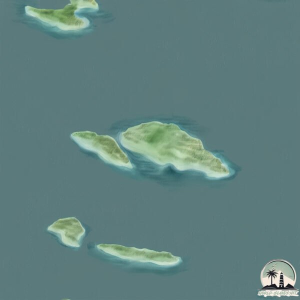
Geography and size of Nord Moron
Size: 1.339 km²
Coastline: 7.9 km
Ocean: Atlantic Ocean
Sea: Gulf of Bothnia
Continent: Europe
Nord Moron is a Small Island spanning 1.3 km² with a coastline of 7.9 km.
Archipel: –
Tectonic Plate: Eurasia – One of the world’s largest tectonic plates, the Eurasian Plate covers a significant portion of Europe and Asia. It’s characterized by diverse geological features, including the Ural Mountains, the European Plain, and the Himalayas formed from its collision with the Indian Plate.
The geographic heart of the island is pinpointed at these coordinates:
Latitude: 65.34615418 / Longitude: 21.89518554
Climate and weather of Nord Moron
Climate Zone: Continental
Climate Details: Subarctic Climate
Temperature: Cold Summer
Climate Characteristics: Characterized by long, extremely cold winters and short, cool summers, often found in northern latitudes of North America and Eurasia.
Topography and nature of Nord Moron
Timezone: UTC+01:00
Timezone places: Europe/Paris
Max. Elevation: m
Mean Elevation: m
Vegetation: Open Woodland
Tree Coverage: 60%
The mean elevation is m. The island is characterized by Mountains: High, steeply elevated landforms. Characterized by both a high maximum elevation (over 500 meters) and a high mean elevation, creating rugged, mountainous terrains on islands.
Dominating Vegetation: Open Woodland
Characterized by sparsely distributed trees with open canopy allowing sunlight to penetrate, supporting grasses and shrubs underneath. Often found in drier or transitional environments. Nord Moron has a tree cover of 60 %.
Vegetation: 1 vegetation zones – Minimal Diversity Island
These islands exhibit the most basic level of ecological diversity, often characterized by a single dominant vegetation type. This could be due to extreme environmental conditions, limited land area, or significant human impact. They represent unique ecosystems where specific species have adapted to thrive in these singular environments.
Infrastructure and Travelling to Nord Moron
Does the island have a public airport? no.
There is no public and scheduled airport on Nord Moron. The nearest airport is Luleå Airport, located 32 km away.
Does the island have a major port? no.
There are no major ports on Nord Moron. The closest major port is LULEA, approximately 39 km away.
The mean population of Nord Moron is 11 per km². Nord Moron is Gently Populated. The island belongs to Sweden.
Continuing your journey, Vargon is the next notable island, situated merely km away.
Crazy But Amazing Experience..


Sweden is classified as Developed region: nonG7: Developed economies outside of the Group of Seven, characterized by high income and advanced economic structures. The level of income is High income: OECD.
News – Latest Updates and Headlines from Nord Moron
Stay informed with the most recent news and important headlines from Nord Moron. Here’s a roundup of the latest developments.
Please note: The data used here has been primarily extracted from satellite readings. Deviations from exact values may occur, particularly regarding the height of elevations and population density. Land area and coastline measurements refer to average values at mean high tide.