Nordaustland
Welcome to Nordaustland, a Polar island in the Arctic Ocean, part of the majestic Arctic Ocean. This guide offers a comprehensive overview of what makes Nordaustland unique – from its geography and climate to its population, infrastructure, and beyond. Dive into the details:
- Geography and Size: Explore the island’s size and location.
- Climate and Weather: Weather patterns and temperature.
- Topography and Nature: Uncover the natural wonders of the island.
- Infrastructure and Travelling: Insights on reaching, staying, and making the most of your visit.
- News and Headlines: Latest News.
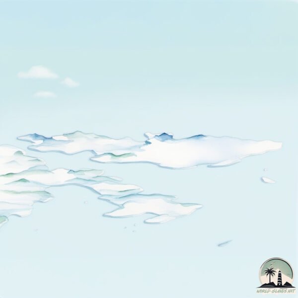
Geography and size of Nordaustland
Size: 14214 km²
Coastline: 2107 km
Ocean: Arctic Ocean
Sea: Arctic Ocean
Continent: Europe
Nordaustland is a Giant Island spanning 14214 km² with a coastline of 2107 km.
Archipel: Svalbard – A Norwegian archipelago in the Arctic Ocean, known for its rugged remote terrain, polar bears, and as a center for Arctic research.
Tectonic Plate: Eurasia – One of the world’s largest tectonic plates, the Eurasian Plate covers a significant portion of Europe and Asia. It’s characterized by diverse geological features, including the Ural Mountains, the European Plain, and the Himalayas formed from its collision with the Indian Plate.
The geographic heart of the island is pinpointed at these coordinates:
Latitude: 79.84629425 / Longitude: 22.8232175
Climate and weather of Nordaustland
Climate Zone: Polar
Climate Details: Tundra
Temperature: Cold
Climate Characteristics: The tundra climate features long, extremely cold winters and short, cool summers. Vegetation is limited to mosses, lichens, and small shrubs due to the low temperatures and short growing seasons. Biodiversity is low, but some specialized species thrive.
Topography and nature of Nordaustland
Timezone: UTC+01:00
Timezone places: Europe/Paris
Max. Elevation: 830 m
Mean Elevation: 369 m
Vegetation: Snow and Ice Covered
Tree Coverage: 4%
The mean elevation is 369 m. The highest elevation on the island reaches approximately 830 meters above sea level. The island is characterized by Mountains: High, steeply elevated landforms. Characterized by both a high maximum elevation (over 500 meters) and a high mean elevation, creating rugged, mountainous terrains on islands.
Dominating Vegetation: Snow and Ice Covered
These areas are permanently or seasonally covered in snow and ice, with little to no vegetation, such as polar regions and high mountains. Nordaustland has a tree cover of 4 %.
Vegetation: 6 vegetation zones – Very Highly Diverse Island
Islands in this range are ecological powerhouses, showcasing a wide array of vegetation zones. Each zone, from lush rainforests to arid scrublands, coastal mangroves to mountainous regions, contributes to a complex and interdependent ecosystem. These islands are often hotspots of biodiversity, supporting numerous species and intricate ecological processes.
Infrastructure and Travelling to Nordaustland
Does the island have a public airport? no.
There is no public and scheduled airport on Nordaustland. The nearest airport is Svalbard Airport, Longyear, located 326 km away.
Does the island have a major port? no.
There are no major ports on Nordaustland. The closest major port is LONGYEARBYEN, approximately 310 km away.
The mean population of Nordaustland is 0 per km². Nordaustland is Uninhabited. The island belongs to Norway.
The name of the island resonates across different cultures and languages. Here is how it is known around the world: Arabic: نورأوستلانده; German: Nordostland; Spanish: Nordaustlandet; French: Nordaustlandet; Portuguese: Nordaustlandet; Russian: Северо-Восточная Земля; Chinese: 东北地岛
Continuing your journey, Purchasneset is the next notable island, situated merely km away.
Nordaustlandet 2012


Norway is classified as Developed region: nonG7: Developed economies outside of the Group of Seven, characterized by high income and advanced economic structures. The level of income is High income: OECD.
News – Latest Updates and Headlines from Nordaustland
Stay informed with the most recent news and important headlines from Nordaustland. Here’s a roundup of the latest developments.
Social Media Posts about Nordaustland
Please note: The data used here has been primarily extracted from satellite readings. Deviations from exact values may occur, particularly regarding the height of elevations and population density. Land area and coastline measurements refer to average values at mean high tide.