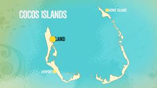
Welcome to North Keeling Island, a Tropical island in the Indian Ocean, part of the majestic Indian Ocean. This guide offers a comprehensive overview of what makes North Keeling Island unique – from its geography and climate to its population, infrastructure, and beyond. Dive into the details:
Geography and size of North Keeling Island
Size: 2.227 km²
Coastline: 6.2 km
Ocean: Indian Ocean
Sea: Indian Ocean
Continent: Seven seas (open ocean)
North Keeling Island is a Small Island spanning 2.2 km² with a coastline of 6.2 km.
Archipel: –
Tectonic Plate: Australia – A major tectonic plate covering Australia, New Zealand, and parts of the Indian and Pacific Oceans, known for its relative stability and occasional seismic activity.
The geographic heart of the island is pinpointed at these coordinates:
Latitude: -11.83215959 / Longitude: 96.82419547
Climate and weather of North Keeling Island
Climate Zone: Tropical
Climate Details: Tropical Rainforest Climate
Temperature: Hot
Climate Characteristics: This climate is typified by heavy rainfall throughout the year, high humidity, and consistently high temperatures, leading to lush rainforests and rich biodiversity. Seasonal temperature variations are minimal.
Topography and nature of North Keeling Island
Timezone: UTC+06:30
Timezone places: Indian/Cocos
Max. Elevation: 5 m
Mean Elevation: -6 m
Vegetation: Rocky Terrain
Tree Coverage: 69%
The mean elevation is -6 m. The highest elevation on the island reaches approximately 5 meters above sea level. The island is characterized by Plains: Flat, low-lying lands characterized by a maximum elevation of up to 200 meters. On islands, plains are typically coastal lowlands or central flat areas.
Dominating Vegetation: Rocky Terrain
Landscapes dominated by gravel, rock, and stone, with little to no vegetation. These areas are often found in mountainous regions or deserts. North Keeling Island has a tree cover of 69 %.
Vegetation: 2 vegetation zones – Low Diversity Island
Islands with two distinct vegetation zones offer slightly more ecological variety. These zones could be due to differences in elevation, moisture, or other environmental factors. While still limited in biodiversity, these islands may offer a contrast between the two zones, such as a coastline with mangroves and an inland area with grassland.
Infrastructure and Travelling to North Keeling Island
Does the island have a public airport? no.
There is no public and scheduled airport on North Keeling Island. The nearest airport is Cocos (Keeling) Islands Airport, located 39 km away.
Does the island have a major port? no.
There are no major ports on North Keeling Island. The closest major port is FLYING FISH COVE, approximately 998 km away.
The mean population of North Keeling Island is 0 per km². North Keeling Island is Uninhabited. The island belongs to Australia.
Continuing your journey, Enggano is the next notable island, situated merely km away.
Amazing Facts About Keeling Island 2023
Join us on a journey to the stunning Keeling Island, located in the Indian Ocean. In this video, we'll explore the fascinating history, ...Amazing Facts About Keeling Island 2023
Join us on a journey to the stunning Keeling Island, located in the ...
Join us on a journey to the stunning Keeling Island, located in the Indian Ocean. In this video, we'll explore the fascinating history, ...
Destination Australia - Understanding Cocos Keeling Islands
Jo Beth learns all that there is to know about the Cocos Keeling ...
Jo Beth learns all that there is to know about the Cocos Keeling Islands and ganders at all the accommodation available.
Cocos Keeling Islands - What you need to know before visiting? 🇨🇨
Why can't people in this remote Australian community own their houses? | ABC Australia
Forty years ago, a remote island community in the Indian Ocean voted ...
Forty years ago, a remote island community in the Indian Ocean voted to become a fully-fledged part of Australia. Malay workers ...
The Cocos (Keeling) Islands
DIRECTOR'S NOTES: Hey guys! My name is Jaxon Roberts and for the past ...
DIRECTOR'S NOTES: Hey guys! My name is Jaxon Roberts and for the past few years I have been pursuing my dream of ...
The Cocos Islands are eroding, but Defence is spending $500m on a runway | ABC News
The Australian Defence Force is about to spend more than $500 million ...
The Australian Defence Force is about to spend more than $500 million upgrading a military airstrip on the Cocos (Keeling) ...
North Keeling Documentary
A documentary created as a class assignment outlining the history, ...
A documentary created as a class assignment outlining the history, flora and fauna of North Keeling National Park.
GOOD FEELING IN COCOS KEELING
Thanks you for watching this episode, please give us a thumbs up and ...
Thanks you for watching this episode, please give us a thumbs up and subscribe. Don't forget to click the bell next to the subscribe ...
The turtles of Cocos-Keeling Islands are dying. What’s going on? | ABC Australia
As the lights fades at dusk on the Cocos (Keeling) Islands — ...
As the lights fades at dusk on the Cocos (Keeling) Islands — Australia's most remote territory — low tide reveals ancient turtles ...
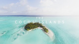
The Cocos Islands
The Cocos Islands I've been working on this project for over 4 months ...
The Cocos Islands I've been working on this project for over 4 months and I have to say, it's my favourite piece of content I have ...
Cocos Island - Mysterious Wonder of the Pacific Ocean | Free Documentary Nature
Cocos Island - Mysterious Wonder of the Pacific Ocean | Nature ...
Cocos Island - Mysterious Wonder of the Pacific Ocean | Nature Documentary Watch 'Bermuda - Island Paradise of the Atlantic ...
Filming on the most remote island in the world?? || CocosVlogs
I was lucky enough to experience one of the most remote and untouched ...
I was lucky enough to experience one of the most remote and untouched islands in the world, North Keeling Island. Did a heap of ...
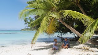
Cocos Keeling Islands - Fresh Escapes - Home Island
The Fresh Escapes team take some time to enjoy the welcoming and warm ...
The Fresh Escapes team take some time to enjoy the welcoming and warm Cocos Malay hospitality on Home Island.
Discover the Hidden Gem:Cocos(Keeling) Islands!
Discover the breathtaking Cocos (Keeling) Islands, a stunning ...
Discover the breathtaking Cocos (Keeling) Islands, a stunning Australian territory comprised of 27 small islands. Immerse yourself ...
Indian Ocean crossing - Cocos Keeling Islands - Sailing Greatcircle (ep.312)
After a couple of days on Christmas Islands it's time for the second ...
After a couple of days on Christmas Islands it's time for the second leg of the Indian Ocean crossing. 550 nm towards the ...
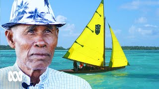
Cocos Keeling Islands - Fresh Escapes - Direction Island War History
The incredible story of the battle between the HMAS Sydney and the SMS ...
The incredible story of the battle between the HMAS Sydney and the SMS Emden is briefly recounted in this clip.
Coffee With Darwin: Surfing in the Cocos-Keeling Islands
Overlooked and odd, forgotten and underestimated coastlines seem to be ...
Overlooked and odd, forgotten and underestimated coastlines seem to be a special fascination for TSJ contributor Michael Kew, ...
Travel Oz Series 2 Episode 11 Part 2
Part Two of the remarkable story of rescuing orphaned chicks on North ...
Part Two of the remarkable story of rescuing orphaned chicks on North Keeling Island where the islands isolation creates a haven ...
North Keeling
Video Software we use:
https://amzn.to/2KpdCQF Ad-free videos. You can support us by purchasing something through our ...
Cocos (Keeling) Islands 🇨🇨 Australia's Last Unspoilt Paradise
cocoskeelingislands #indianocean #westernaustralia Australia's last ...
cocoskeelingislands #indianocean #westernaustralia Australia's last unspoilt paradise.. The Cocos (Keeling) Islands are an ...
Australien - Cocos Keeling Islands
Die westlichsten Inseln Australiens bietet Natur und Traumstrände pur. ...
Die westlichsten Inseln Australiens bietet Natur und Traumstrände pur. wer nach Christmas Island reist sollte die Chnace nutzen ...
Why Cocos Keeling Island should be on your travel bucket list!!
The Cocos (Keeling) Islands are a remote territory of Australia in the ...
The Cocos (Keeling) Islands are a remote territory of Australia in the Indian Ocean. Its 2 coral atolls comprise 27 tiny islands with ...
Saltwater Fly Paradise | Fly Fishing the Cocos Islands
The Cocos Keeling Islands don't get as much attention as other ...
The Cocos Keeling Islands don't get as much attention as other world-renowned fly fishing destinations, and maybe its better that ...
Direction Island... | Cocos Keeling Islands #beach #nature #paradise credit "Cocos Day" dive tours.
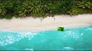
North Keeling Island
cocoskeelingislands #islandparadise #bluewaters #untouchparadise ...
cocoskeelingislands #islandparadise #bluewaters #untouchparadise #clearwaterbeach #vacation.
Australia is classified as Developed region: nonG7: Developed economies outside of the Group of Seven, characterized by high income and advanced economic structures. The level of income is High income: OECD.
News – Latest Updates and Headlines from North Keeling Island
Stay informed with the most recent news and important headlines from North Keeling Island. Here’s a roundup of the latest developments.
Loading...
Please note: The data used here has been primarily extracted from satellite readings. Deviations from exact values may occur, particularly regarding the height of elevations and population density. Land area and coastline measurements refer to average values at mean high tide.