Welcome to North Ronaldsay, a Temperate island in the North Sea, part of the majestic Atlantic Ocean. This guide offers a comprehensive overview of what makes North Ronaldsay unique – from its geography and climate to its population, infrastructure, and beyond. Dive into the details:
Geography and size of North Ronaldsay
Size: 8.206 km²
Coastline: 21.1 km
Ocean: Atlantic Ocean
Sea: North Sea
Continent: Europe
North Ronaldsay is a Small Island spanning 8.2 km² with a coastline of 21.1 km.
Archipel: Orkney Islands – An archipelago off the northeastern coast of Scotland, known for their rich history, unique landscapes, and archaeological sites.
Tectonic Plate: North America – Covers North America and parts of the Atlantic and Arctic Oceans, characterized by diverse geological features and varying levels of seismic activity.
The geographic heart of the island is pinpointed at these coordinates:
Latitude: 59.37141974 / Longitude: -2.41672222
Climate and weather of North Ronaldsay
Climate Zone: Temperate
Climate Details: Temperate Oceanic Climate
Temperature: Warm Summer
Climate Characteristics: Known for its moderate year-round temperatures with ample rainfall and no dry season. Warm summers are characteristic.
Topography and nature of North Ronaldsay
Timezone: UTC±00:00
Timezone places: Europe/London
Max. Elevation: 14 m
Mean Elevation: 7 m
Vegetation: Open Woodland
Tree Coverage: 32%
The mean elevation is 7 m. The highest elevation on the island reaches approximately 14 meters above sea level. The island is characterized by Plains: Flat, low-lying lands characterized by a maximum elevation of up to 200 meters. On islands, plains are typically coastal lowlands or central flat areas.
Dominating Vegetation: Open Woodland
Characterized by sparsely distributed trees with open canopy allowing sunlight to penetrate, supporting grasses and shrubs underneath. Often found in drier or transitional environments. North Ronaldsay has a tree cover of 32 %.
Vegetation: 9 vegetation zones – Very Highly Diverse Island
Islands in this range are ecological powerhouses, showcasing a wide array of vegetation zones. Each zone, from lush rainforests to arid scrublands, coastal mangroves to mountainous regions, contributes to a complex and interdependent ecosystem. These islands are often hotspots of biodiversity, supporting numerous species and intricate ecological processes.
Infrastructure and Travelling to North Ronaldsay
Does the island have a public airport? yes.
North Ronaldsay has a public and scheduled airport. The following airports are located on this island: North Ronaldsay Airport.
Does the island have a major port? no.
There are no major ports on North Ronaldsay. The closest major port is KETTLETOFT, approximately 22 km away.
The mean population of North Ronaldsay is 10 per km². North Ronaldsay is Gently Populated. The island belongs to United Kingdom.
Continuing your journey, Sanday Island is the next notable island, situated merely km away.
Old Photographs North Ronaldsay Orkney Islands Scotland
Tour Scotland wee video of old photographs of North Ronaldsay, the northernmost island in the archipelago of the Orkney Islands.Old Photographs North Ronaldsay Orkney Islands Scotland
Tour Scotland wee video of old photographs of North Ronaldsay, the ...
Tour Scotland wee video of old photographs of North Ronaldsay, the northernmost island in the archipelago of the Orkney Islands.
NORTH RONALDSAY - WikiVidi Documentary
North Ronaldsay is the northernmost island in the Orkney archipelago ...
North Ronaldsay is the northernmost island in the Orkney archipelago of Scotland. With an area of 690 ha, it is the ...
She Works Six Jobs to Keep Her Island Afloat
For most people, keeping track of one job is complicated enough—now, ...
For most people, keeping track of one job is complicated enough—now, imagine juggling six. On the small island of North ...
CountryFile visits North Ronaldsay 2016
A look at the plight of the North Ronaldsay sheep and the storm damage ...
A look at the plight of the North Ronaldsay sheep and the storm damage done to the island's historic sheepdyke.
North Ronaldsay Sheep Festival 2017
The 2nd annual North Ronaldsay Sheep Festival is underway at the ...
The 2nd annual North Ronaldsay Sheep Festival is underway at the moment, all aimed at raising awareness of the island's ...
Tangled: a short social history of seaweed in North Ronaldsay
Rebecca Marr presents a short social history of the innovative uses of ...
Rebecca Marr presents a short social history of the innovative uses of seaweed in North Ronaldsay. Please could you fill out this ...
Tour of North Ronaldsay, Orkney
360 degree short video of North Ronaldsay, the most northerly Orkney Island.
360 degree short video of North Ronaldsay, the most northerly Orkney Island.
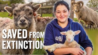
Saved from Extinction - North Ronaldsay Sheep - Adam Henson's Farm Diaries - Fridays With Fran Ep25
Welcome back to Adam Henson's Farm Diaries - Fridays with Fran! Fran's ...
Welcome back to Adam Henson's Farm Diaries - Fridays with Fran! Fran's here to tell the tale of the North Ronaldsay sheep, who ...
This woman has 9 jobs and doesn’t complain about it | New York Post
After 26-year-old Sarah Moore moved to a tiny Scottish island, she ...
After 26-year-old Sarah Moore moved to a tiny Scottish island, she took on nine different jobs. North Ronaldsay in the Orkneys has ...
Plans for the future in North Ronaldsay
It has been already been a busy summer for the residents of Orkney's ...
It has been already been a busy summer for the residents of Orkney's most northerly community in North Ronaldsay. The island's ...
Old Beacon Lighthouse On Island Of North Ronaldsay On History Visit To Orkney Islands Of Scotland
Tour Scotland short travel video clip, with Scottish music, of the Old ...
Tour Scotland short travel video clip, with Scottish music, of the Old Beacon Lighthouse on On Island Of North Ronaldsay on ...
The Seaweeds of North Ronaldsay
Short film by Alexandra Wright. A look at the seven main types of ...
Short film by Alexandra Wright. A look at the seven main types of seaweed that make up the diet of the island's rare breed of native ...
North Ronaldsay Trailer
A new trailer for the new 3 part documentary, exploring the wonders of ...
A new trailer for the new 3 part documentary, exploring the wonders of North Ronaldsay.
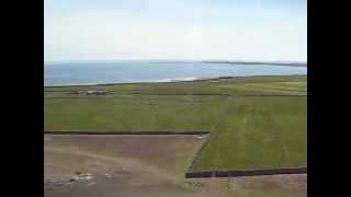
North RONALDSAY by air
Flying out of Kirkwall Airport in an 8 seater plane - June 2019. Did I ...
Flying out of Kirkwall Airport in an 8 seater plane - June 2019. Did I like it? Find out in my new video Episode 11 to be published ...
New Lighthouse On Island Of North Ronaldsay On History Visit To Orkney Islands Of Scotland
Tour Scotland short travel video clip, with Scottish music, of the new ...
Tour Scotland short travel video clip, with Scottish music, of the new Lighthouse on On Island Of North Ronaldsay on ancestry, ...
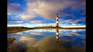
North Ronaldsay Lighthouse - Tallest land-based lighthouse in the UK
Billy Muir, the former lighthouse keeper of North Ronaldsay ...
Billy Muir, the former lighthouse keeper of North Ronaldsay Lighthouse, gives a tour of the lighthouse on a glorious June 20th day ...
North Ronaldsay Take A Visit
Lighthouse and scenery of North Ronaldsay Orkney.
Lighthouse and scenery of North Ronaldsay Orkney.
Sheep That Eat Seaweed On History Visit To North Ronaldsay Orkney Islands Scotland
Tour Scotland short 4K wildlife nature camera travel video clip of ...
Tour Scotland short 4K wildlife nature camera travel video clip of sheep that eat seaweed on ancestry, genealogy, family history ...
Seaweed Eating Sheep: Island Healthcare on North Ronaldsay MEDIVLOG Episode 3
Healthcare provision on tiny islands is a bit different to healthcare ...
Healthcare provision on tiny islands is a bit different to healthcare provision on the mainland by necessity. How does it work and ...
The Four Seasons-Life on the Land , David K Scott, David Scott, North Ronaldsay Orkney
Our islands, Our projects - North Ronaldsay Development Trust
Isle of Orkney (South Ronaldsay) - Burwick (coastal walk)- great walk to watch seals
Coastal walk from the Burwick bay when you can see seals through out ...
Coastal walk from the Burwick bay when you can see seals through out the day. South Ronaldsay is one of the Orkney Islands off ...
Coast And Waters With Music On History Visit To North Ronaldsay Orkney Islands Scotland
Tour Scotland short 4K Summer travel video clip, with Scottish music, ...
Tour Scotland short 4K Summer travel video clip, with Scottish music, of the coast and waters on ancestry, genealogy, family ...
UK Island Where Sheep Eat Seaweed (Not Grass!)
Off the coast of Scotland lies North Ronaldsay, a tiny island where ...
Off the coast of Scotland lies North Ronaldsay, a tiny island where sheep have developed a bizarre habit—they eat seaweed ...
The Lobster Chronicles: Life on the Sea David K Scott, David Scott, North Ronaldsay Orkney
Film on Life, History and Culture in the Island of North Ronaldsay, Orkney.
Film on Life, History and Culture in the Island of North Ronaldsay, Orkney.
United Kingdom is classified as Developed region: G7: Group of Seven – Major advanced economies, including Canada, France, Germany, Italy, Japan, the United Kingdom, and the United States. The level of income is High income: OECD.
News – Latest Updates and Headlines from North Ronaldsay
Stay informed with the most recent news and important headlines from North Ronaldsay. Here’s a roundup of the latest developments.
Loading...
Please note: The data used here has been primarily extracted from satellite readings. Deviations from exact values may occur, particularly regarding the height of elevations and population density. Land area and coastline measurements refer to average values at mean high tide.