Welcome to Noss, a Temperate island in the North Sea, part of the majestic Atlantic Ocean. This guide offers a comprehensive overview of what makes Noss unique – from its geography and climate to its population, infrastructure, and beyond. Dive into the details:
Geography and size of Noss
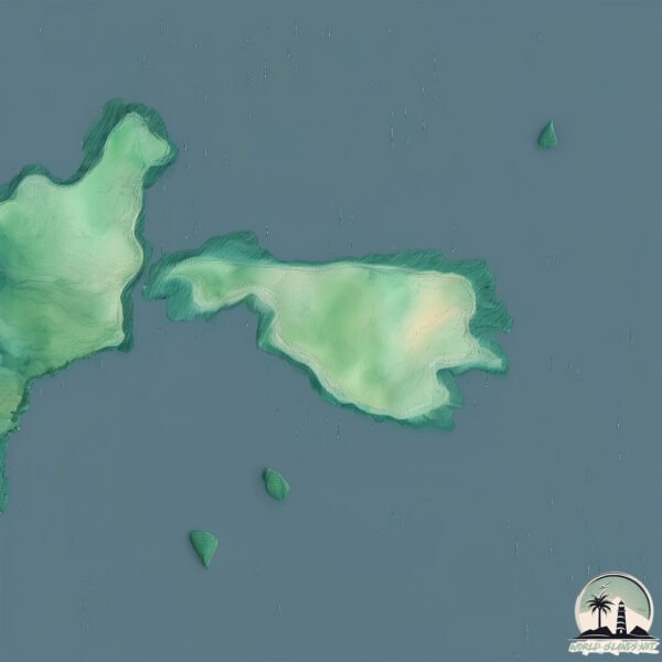
Size: 3.402 km²
Coastline: 10.4 km
Ocean: Atlantic Ocean
Sea: North Sea
Continent: Europe
Noss is a Small Island spanning 3.4 km² with a coastline of 10.4 km.
Archipel: Shetland Islands – Located northeast of mainland Scotland, these islands are known for their rugged terrain, unique cultural heritage, and abundant birdlife.
Tectonic Plate: North America – Covers North America and parts of the Atlantic and Arctic Oceans, characterized by diverse geological features and varying levels of seismic activity.
The geographic heart of the island is pinpointed at these coordinates:
Latitude: 60.14413857 / Longitude: -1.02034686
Climate and weather of Noss
Climate Zone: Temperate
Climate Details: Temperate Oceanic Climate
Temperature: Warm Summer
Climate Characteristics: Known for its moderate year-round temperatures with ample rainfall and no dry season. Warm summers are characteristic.
Topography and nature of Noss
Timezone: UTC±00:00
Timezone places: Europe/London
Max. Elevation: 155 m
Mean Elevation: 96 m
Vegetation: Open Woodland
Tree Coverage: 79%
The mean elevation is 96 m. The highest elevation on the island reaches approximately 155 meters above sea level. The island is characterized by Plains: Flat, low-lying lands characterized by a maximum elevation of up to 200 meters. On islands, plains are typically coastal lowlands or central flat areas.
Dominating Vegetation: Open Woodland
Characterized by sparsely distributed trees with open canopy allowing sunlight to penetrate, supporting grasses and shrubs underneath. Often found in drier or transitional environments. Noss has a tree cover of 79 %.
Vegetation: 8 vegetation zones – Very Highly Diverse Island
Islands in this range are ecological powerhouses, showcasing a wide array of vegetation zones. Each zone, from lush rainforests to arid scrublands, coastal mangroves to mountainous regions, contributes to a complex and interdependent ecosystem. These islands are often hotspots of biodiversity, supporting numerous species and intricate ecological processes.
Infrastructure and Travelling to Noss
Does the island have a public airport? no.
There is no public and scheduled airport on Noss. The nearest airport is Lerwick / Tingwall Airport, located 22 km away.
Does the island have a major port? no.
There are no major ports on Noss. The closest major port is LERWICK, approximately 11 km away.
The mean population of Noss is 9 per km². Noss is Gently Populated. The island belongs to United Kingdom.
Continuing your journey, Holm of Mel is the next notable island, situated merely km away.
A trip to the island of Noss National Nature reserve - hiking and puffins in Shetland
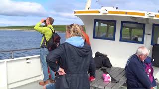
Join me as we take the small boat over to the uninhabited island of Noss. Explore the impressive coastal scenery, including cliffs, ...A trip to the island of Noss National Nature reserve - hiking and puffins in Shetland
Join me as we take the small boat over to the uninhabited island of ...
Join me as we take the small boat over to the uninhabited island of Noss. Explore the impressive coastal scenery, including cliffs, ...
The Isle of Noss
Tom Weir Visits The Isle of Noss.
Tom Weir Visits The Isle of Noss.
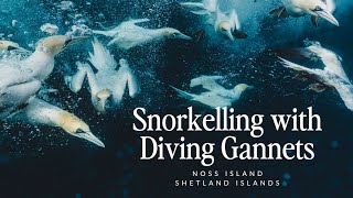
Snorkelling with diving gannets - Noss Island - Shetland Islands - Rebecca Douglas Photography
CONTENT WARNING ABOUT PART OF THIS FOOTAGE..... On the way to snorkel ...
CONTENT WARNING ABOUT PART OF THIS FOOTAGE..... On the way to snorkel with the diving gannets, I encounter a very ...
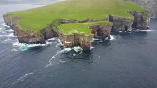
Southern bank of Noss island
Noss is a small, inhabited island in Shetland and became National ...
Noss is a small, inhabited island in Shetland and became National Nature Reserve in 1955 and since then is managed by ...
Gannets on Noss island Shetland
View Britain's best bird cliffs aboard Shetland's wildlife tour boat ...
View Britain's best bird cliffs aboard Shetland's wildlife tour boat 'Seabird'.
Seabirds at the Island of Noss
Living in Shetland, What it's actually like
Wildlife boat and the island of Noss RSPB Reserve Shetland Scotland UK
Filmed 2.7.18.
Filmed 2.7.18.
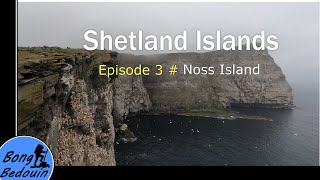
Shetland Islands | Episode 3 - Noss Island
Noss Island is a very small island in Shetland. It is a nature reserve ...
Noss Island is a very small island in Shetland. It is a nature reserve and hosts a number of migratory birds during the summer ...
The Shetland Islands - Is this the most beautiful part of UK?
How to make the most of limited time in Shetland. Starting at Lerwick, ...
How to make the most of limited time in Shetland. Starting at Lerwick, and exploring the main island in just one day. Keep me ...
A Shetland Welcome
Whatever time of year you visit Shetland, you will receive a warm ...
Whatever time of year you visit Shetland, you will receive a warm welcome. There will always be people around to make you feel ...
One of the Most Beautiful Island in Scotland "Visit Shetland"
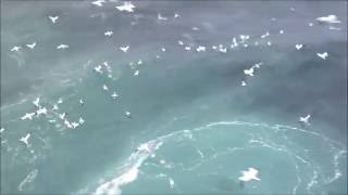
Close-up of gannets diving off Noss island, Shetland
Pretty close (and shaky) view of gannets diving off the island of Noss ...
Pretty close (and shaky) view of gannets diving off the island of Noss in Shetland, taken from the ferry from Lerwick to Aberdeen ...
Driving in Shetland | Shetland Life
Marjolein is a comedian fromShetland - a Scottish island known for its ...
Marjolein is a comedian fromShetland - a Scottish island known for its tiny horses, and being quite remote. Now, the best way to ...
SHETLAND BY CAMPERVAN | The WILDEST Island in the UK
Join us on an unforgettable campervan adventure to the Shetland ...
Join us on an unforgettable campervan adventure to the Shetland Islands! Discover a hidden gem of Scotland as we explore this ...
Gannet Colony on Noss, Shetland
Boat Trip to Noss
These are the clffs on the island of Noss that my great great ...
These are the clffs on the island of Noss that my great great grandfather fell off of in May of 1860.
Islands of Scotland - The Shetland Islands (1/3)
4) The Shetland Islands The Shetland Islands comprisies more than a ...
4) The Shetland Islands The Shetland Islands comprisies more than a hundred islands, just 15 of them inhabited, span the ...
Holes of Scraada, Eshaness, Shetland
Another amazing discovery during our circular walk around the Eshaness ...
Another amazing discovery during our circular walk around the Eshaness coastline. The Holes of Scraada is an area of beach ...
Islands of Scotland The Shetland Islands (3/3)
4) The Shetland Islands The Shetland Islands comprisies more than a ...
4) The Shetland Islands The Shetland Islands comprisies more than a hundred islands, just 15 of them inhabited, span the ...
Shetland - Esha Ness, Whalsay, Yell
Esha Ness on the west coast of Shetland Mainland - formed by fire and ...
Esha Ness on the west coast of Shetland Mainland - formed by fire and ice. Whalsay - "The bonny isle". Yell - "The big brown ...
Shetland: Winter in the wildest corner of Britain
Simon Parker braves the rain and wind to see Shetland's wonderful ...
Simon Parker braves the rain and wind to see Shetland's wonderful wildlife and stunning landscapes minus the summer crowds.
The Noop of Noss Shetlands June 23 6
Shetland Islands underwhelmed by Scotland vote | Journal
There are just hours remaining before Scotland votes on whether stay ...
There are just hours remaining before Scotland votes on whether stay part of Britain. The independence debate has recharged ...
LERWICK, Shetland | 4K Narrated Walking Tour | Let's Walk 2024
Join me for a walk around the riveting town of Lerwick, the capital of ...
Join me for a walk around the riveting town of Lerwick, the capital of the Shetland Islands, and the most northerly major town in the ...
United Kingdom is classified as Developed region: G7: Group of Seven – Major advanced economies, including Canada, France, Germany, Italy, Japan, the United Kingdom, and the United States. The level of income is High income: OECD.
News – Latest Updates and Headlines from Noss
Stay informed with the most recent news and important headlines from Noss. Here’s a roundup of the latest developments.
Loading...
Please note: The data used here has been primarily extracted from satellite readings. Deviations from exact values may occur, particularly regarding the height of elevations and population density. Land area and coastline measurements refer to average values at mean high tide.