Nosy Manomboy
Welcome to Nosy Manomboy, a Tropical island in the Indian Ocean, part of the majestic Indian Ocean. This guide offers a comprehensive overview of what makes Nosy Manomboy unique – from its geography and climate to its population, infrastructure, and beyond. Dive into the details:
- Geography and Size: Explore the island’s size and location.
- Climate and Weather: Weather patterns and temperature.
- Topography and Nature: Uncover the natural wonders of the island.
- Infrastructure and Travelling: Insights on reaching, staying, and making the most of your visit.
- News and Headlines: Latest News.
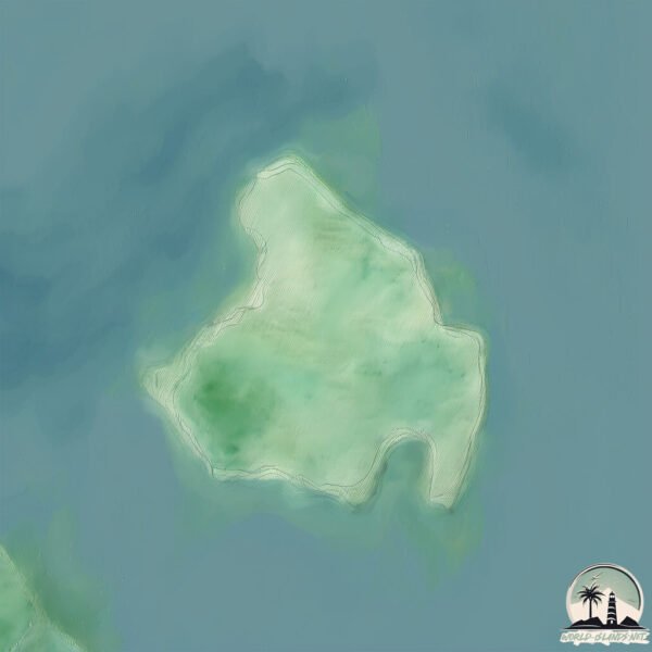
Geography and size of Nosy Manomboy
Size: 2.812 km²
Coastline: 8.1 km
Ocean: Indian Ocean
Sea: Indian Ocean
Continent: Africa
Nosy Manomboy is a Small Island spanning 2.8 km² with a coastline of 8.1 km.
Archipel: –
Tectonic Plate: Somalia – A large tectonic plate covering the Horn of Africa and parts of the Indian Ocean, known for the East African Rift where it’s splitting away from the African Plate.
The geographic heart of the island is pinpointed at these coordinates:
Latitude: -12.76955921 / Longitude: 49.77343068
Climate and weather of Nosy Manomboy
Climate Zone: Tropical
Climate Details: Tropical Savanna, Wet
Temperature: Hot
Climate Characteristics: Defined by distinct wet and dry seasons with high temperatures year-round. Pronounced rainfall occurs during the wet season, while the dry season is marked by drought.
Topography and nature of Nosy Manomboy
Timezone: UTC+03:00
Timezone places: Asia/Riyadh
Max. Elevation: 10 m
Mean Elevation: 7 m
Vegetation: Evergreen Broadleaf Forest
Tree Coverage: 94%
The mean elevation is 7 m. The highest elevation on the island reaches approximately 10 meters above sea level. The island is characterized by Plains: Flat, low-lying lands characterized by a maximum elevation of up to 200 meters. On islands, plains are typically coastal lowlands or central flat areas.
Dominating Vegetation: Evergreen Broadleaf Forest
Characterized by dense, lush canopies of broadleaf trees that retain their leaves year-round. These forests are typically found in tropical and subtropical regions and are known for their high biodiversity. Nosy Manomboy has a tree cover of 94 %.
Vegetation: 3 vegetation zones – Moderately Diverse Island
These islands start to show a broader range of ecological niches. With three vegetation zones, they may offer a mix of ecosystems like coastal areas, inland woods, and perhaps a distinct wetland or dry area. This diversity supports a wider range of flora and fauna, making these islands more ecologically complex than those with minimal diversity.
Infrastructure and Travelling to Nosy Manomboy
Does the island have a public airport? no.
There is no public and scheduled airport on Nosy Manomboy. The nearest airport is Arrachart Airport, located 70 km away.
Does the island have a major port? no.
There are no major ports on Nosy Manomboy. The closest major port is IHARANA, approximately 68 km away.
The mean population of Nosy Manomboy is 9 per km². Nosy Manomboy is Gently Populated. The island belongs to Madagascar.
Continuing your journey, Nosy Mitsio is the next notable island, situated merely km away.
Madagascar is classified as Least developed region: Countries that exhibit the lowest indicators of socioeconomic development, with the lowest Human Development Index ratings. The level of income is Low income.
News – Latest Updates and Headlines from Nosy Manomboy
Stay informed with the most recent news and important headlines from Nosy Manomboy. Here’s a roundup of the latest developments.
- Madagascar is Set to Boost Summer Travel with Stunning Beaches, Crystal Clear Waters, Unique Wildlife and Eco Tourism Adventures - Travel And Tour Worldby "Nosy Mitsio island" - Google News on 31 August 2025
Madagascar is Set to Boost Summer Travel with Stunning Beaches, Crystal Clear Waters, Unique Wildlife and Eco Tourism Adventures Travel And Tour World
- Diving in Madagascar 2026-2027 - Rove.meby "Nosy Mitsio island" - Google News on 8 November 2024
Diving in Madagascar 2026-2027 Rove.me
- Madagascar's breathtaking beaches: 10 hidden paradises for adventurous travelers - Journée Mondialeby "Nosy Mitsio island" - Google News on 20 October 2024
Madagascar's breathtaking beaches: 10 hidden paradises for adventurous travelers Journée Mondiale
- Madagascar • Rajoelina's infighting advisers pursue their own business interests - 29/09/2023 - Africa Intelligenceby "Nosy Mitsio island" - Google News on 29 September 2023
Madagascar • Rajoelina's infighting advisers pursue their own business interests - 29/09/2023 Africa Intelligence
- An ancient island's greatest secret - BBCby "Nosy Mitsio island" - Google News on 28 February 2022
An ancient island's greatest secret BBC
- Embrace undertourism: The world's most remote hotels - The Telegraphby "Nosy Mitsio island" - Google News on 24 December 2019
Embrace undertourism: The world's most remote hotels The Telegraph
- NATURALLY NOSY - Divernetby "Nosy Mitsio island" - Google News on 10 April 2017
NATURALLY NOSY Divernet
- Seychelles Paradise to the rescue: tanker helps distressed vessel ride safely to Madagascar - Seychelles News Agencyby "Nosy Mitsio island" - Google News on 17 April 2015
Seychelles Paradise to the rescue: tanker helps distressed vessel ride safely to Madagascar Seychelles News Agency
- A family follows God’s call to Madagascar - Mission Network Newsby "Nosy Mitsio island" - Google News on 27 November 2013
A family follows God’s call to Madagascar Mission Network News
- Our Amorphophallus is smaller - EurekAlert!by "Nosy Mitsio island" - Google News on 6 February 2012
Our Amorphophallus is smaller EurekAlert!
Please note: The data used here has been primarily extracted from satellite readings. Deviations from exact values may occur, particularly regarding the height of elevations and population density. Land area and coastline measurements refer to average values at mean high tide.