Welcome to Nusa Tepulimabole, a Tropical island in the Savu Sea, part of the majestic Pacific Ocean. This guide offers a comprehensive overview of what makes Nusa Tepulimabole unique – from its geography and climate to its population, infrastructure, and beyond. Dive into the details:
Geography and size of Nusa Tepulimabole
Size: 14.2 km²
Coastline: 36 km
Ocean: Pacific Ocean
Sea: Savu Sea
Continent: Asia
Nusa Tepulimabole is a Medium Island spanning 14 km² with a coastline of 36 km.
Archipel: Malay Archipelago – The world’s largest archipelago, located between mainland Southeast Asia and Australia, known for its immense biodiversity and cultural diversity.
Tectonic Plate: Sunda – Extends across Southeast Asia, encompassing parts of the Sunda Shelf, known for its interaction with the Australian Plate, contributing to volcanic activity in Indonesia.
The geographic heart of the island is pinpointed at these coordinates:
Latitude: -8.65474452 / Longitude: 119.57688713
Climate and weather of Nusa Tepulimabole
Climate Zone: Tropical
Climate Details: Tropical Savanna, Wet
Temperature: Hot
Climate Characteristics: Defined by distinct wet and dry seasons with high temperatures year-round. Pronounced rainfall occurs during the wet season, while the dry season is marked by drought.
Topography and nature of Nusa Tepulimabole
Timezone: UTC+08:00
Timezone places: Australia/Perth
Max. Elevation: 113 m
Mean Elevation: 54 m
Vegetation: Agricultural Mosaic
Tree Coverage: 32%
The mean elevation is 54 m. The highest elevation on the island reaches approximately 113 meters above sea level. The island is characterized by Plains: Flat, low-lying lands characterized by a maximum elevation of up to 200 meters. On islands, plains are typically coastal lowlands or central flat areas.
Dominating Vegetation: Agricultural Mosaic
A mix of cropland and natural vegetation, often seen in rural landscapes where agricultural fields are interspersed with patches of natural habitats. Nusa Tepulimabole has a tree cover of 32 %.
Vegetation: 8 vegetation zones – Very Highly Diverse Island
Islands in this range are ecological powerhouses, showcasing a wide array of vegetation zones. Each zone, from lush rainforests to arid scrublands, coastal mangroves to mountainous regions, contributes to a complex and interdependent ecosystem. These islands are often hotspots of biodiversity, supporting numerous species and intricate ecological processes.
Infrastructure and Travelling to Nusa Tepulimabole
Does the island have a public airport? no.
There is no public and scheduled airport on Nusa Tepulimabole. The nearest airport is Komodo Airport, located 36 km away.
Does the island have a major port? no.
There are no major ports on Nusa Tepulimabole. The closest major port is WAINGAPU, approximately 127 km away.
The mean population of Nusa Tepulimabole is 89 per km². Nusa Tepulimabole is Gently Populated. The island belongs to Indonesia.
Continuing your journey, Rinca is the next notable island, situated merely km away.
BALI: NUSA LEMBONGAN - Travel Guide to ALL Beaches & TOP Sights in 4K
Bali is Southeast Asia's paradise for surfers, culture vultures and beach lovers. In this episode I show you a beautiful island, half ...BALI: NUSA LEMBONGAN - Travel Guide to ALL Beaches & TOP Sights in 4K
Bali is Southeast Asia's paradise for surfers, culture vultures and ...
Bali is Southeast Asia's paradise for surfers, culture vultures and beach lovers. In this episode I show you a beautiful island, half ...
3 Days in NUSA LEMBONGAN, Bali 2025 | Travel Guide | Best things to do
OUR Favourite island in Bali hands down!! - 3 days in Nusa Lembongan: ...
OUR Favourite island in Bali hands down!! - 3 days in Nusa Lembongan: With crystal-clear blue water, epic food, and a super chill ...
Nusa Lembongan Travel Guide What to Do, Where to Stay & How to Get Around
How to Get to Nusa Lembongan + What to Do on the Island | Bali Island ...
How to Get to Nusa Lembongan + What to Do on the Island | Bali Island Guide Planning a trip to Nusa Lembongan? In this ...
✈️ BUCKETLIST: Nusa Lembongan! #indonesia #lembongan #bali #nusalembongan #YelloBridgeLembongan
Looking for a tropical vacation? Look no further than Nusa Lembongan! ...
Looking for a tropical vacation? Look no further than Nusa Lembongan! The idyllic island is known for its crystal-clear beaches, ...
Nusa Lembongan's Best wave? #shorts #laceration
Spot: Lacerations, Nusa Lembongan ,Indonesia Thanks for watching! ...
Spot: Lacerations, Nusa Lembongan ,Indonesia Thanks for watching! #shorts #surfrawfiles #laceration.
Exploring Nusa Lembongan Harbour + what to do on Lembongan Island
Exploring Nusa Lembongan Harbour Jungut Batu Bay Beach Bali. Checking ...
Exploring Nusa Lembongan Harbour Jungut Batu Bay Beach Bali. Checking out the hotels and restaurants along the beach front.
Unseen Island Beauty of Nusa Lembongan & Ceningan | BALI WALKING TOUR 2025 [4K/60FPS]
If you're looking for a peaceful escape from the busy side of Bali, ...
If you're looking for a peaceful escape from the busy side of Bali, Nusa Lembongan and Ceningan are the perfect spots.
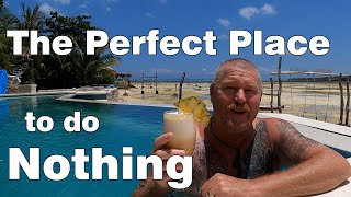
Nusa Lembongan The Perfect place to do Nothing!!
This weekend we visited Nusa Lembongan and had a look around. It was a ...
This weekend we visited Nusa Lembongan and had a look around. It was a relaxing and much needed getaway!!
Nusa Lembongan The perfect place to relax
Vie and I headed to our special place for her birthday. Nusa Lembongan ...
Vie and I headed to our special place for her birthday. Nusa Lembongan is on 30 minutes from Bali, the Island of the Gods.
Most beautiful island in Bali 🌞 Nusa Lembongan vlog 🐚 snorkelling with Manta rays & best beaches
We are heading to one of the islands just off the coast of Bali called ...
We are heading to one of the islands just off the coast of Bali called Nusa Lembongan! We explore the island & discover some of ...
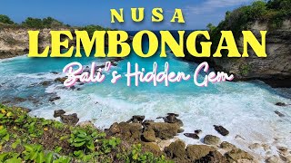
Nusa Lembongan: The Island You Can't Forget
Join me on an unforgettable journey to Nusa Lembongan, a hidden gem ...
Join me on an unforgettable journey to Nusa Lembongan, a hidden gem off the coast of Bali, Indonesia. This stunning island is a ...
Nusa Lembongan, Bali | Family Adventure to Mushroom Beach, Yellow Bridge & Snorkeling
Join us on our family adventure to Nusa Lembongan, a small paradise ...
Join us on our family adventure to Nusa Lembongan, a small paradise island just 30 minutes from Bali. In this video we: ...
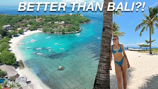
Lembongan in 4K- Better than Bali?
From face-planting into beach waves to chasing coconuts like they owe ...
From face-planting into beach waves to chasing coconuts like they owe me money—this day trip turned into a full-blown island ...
🇮🇩| So Much Beauty On This Island In INDONESIA 🏝️Lembongan
A full tour of the island Lembongan, right next to Bali in Indonesia. ...
A full tour of the island Lembongan, right next to Bali in Indonesia. | Best and sharpest priced mic for content creators: ...
BALI'S HIDDEN GEM: LEMBONGAN ISLAND❤️ 2 Day Itinerary. Epic Views. 4K Video
Time Codes: 00:00 Intro 02:07 Tawe Ocean Villa 03:04 Scenic Spots ...
Time Codes: 00:00 Intro 02:07 Tawe Ocean Villa 03:04 Scenic Spots 04:47 Dream Beach 10:29 Blue Lagoon 11:33 Flip Cliff ...
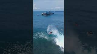
Surfing Over Crystal Clear Water - Shipwrecks, Nusa Lembongan
Fun and rippable rights at Shipwrecks, Nusa Lembongan Island (just off ...
Fun and rippable rights at Shipwrecks, Nusa Lembongan Island (just off Bali). If you like the content, please subscribe to the ...
Exploring the Nusa Islands: The Best Things to do in Nusa Lembongan
We've recently been exploring the Nusa Islands and here are the 9 best ...
We've recently been exploring the Nusa Islands and here are the 9 best things to do in Nusa Lembongan. Nusa Lembongan is ...
Lembongan Stroll: Exploring JungutBatu's Lively Main Street
Bali Vlog: Exploring the Nusa Lembongan Island | Travel Adventure
Bali Vlog: Exploring the Nusa Lembongan Island | Travel Adventure For ...
Bali Vlog: Exploring the Nusa Lembongan Island | Travel Adventure For more such videos, subscribe to our YouTube channel ...
SKIP BALI! Why Nusa Lembongan Is a Secret Island You Need to Visit?
It's a tropical paradise beyond Bali! Nusa Lembongan is an underrated ...
It's a tropical paradise beyond Bali! Nusa Lembongan is an underrated gem just off Bali's coast. In this video, I'll take you on a ...
On Island Time | Batu Karang Lembongan Resort & Spa
Escape to the restorative oasis of Batu Karang Lembongan Resort & Spa, ...
Escape to the restorative oasis of Batu Karang Lembongan Resort & Spa, a five star retreat where you'll find nothing but pure ...
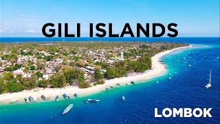
GILI ISLANDS, Lombok - Ultimate TRAVEL GUIDE to ALL Beaches, Snorkeling, TURTLES in 4K
Discover the Gili Islands: Indonesia's Most Beautiful Coral Paradise | ...
Discover the Gili Islands: Indonesia's Most Beautiful Coral Paradise | Ultimate Island Hopping Guide ▶️ Join us as we explore ...
Evening Walking Tour of Nusa Lembongan: Bars, Restaurants & Island Vibes
NusaLembongan #EveningTour #IslandVibes Join me on an evening walking ...
NusaLembongan #EveningTour #IslandVibes Join me on an evening walking tour of the main road in Nusa Lembongan, where I ...
Indonesia is classified as Emerging region: MIKT: Mexico, Indonesia, South Korea, and Turkey – Economies recognized for their development potential and emerging market status. The level of income is Lower middle income.
News – Latest Updates and Headlines from Nusa Tepulimabole
Stay informed with the most recent news and important headlines from Nusa Tepulimabole. Here’s a roundup of the latest developments.
Loading...
Please note: The data used here has been primarily extracted from satellite readings. Deviations from exact values may occur, particularly regarding the height of elevations and population density. Land area and coastline measurements refer to average values at mean high tide.


![Unseen Island Beauty of Nusa Lembongan & Ceningan | BALI WALKING TOUR 2025 [4K/60FPS]](https://i.ytimg.com/vi/FNcgJt8RD_w/mqdefault.jpg)