Orango
Welcome to Orango, a Tropical island in the North Atlantic Ocean, part of the majestic Atlantic Ocean. This guide offers a comprehensive overview of what makes Orango unique – from its geography and climate to its population, infrastructure, and beyond. Dive into the details:
- Geography and Size: Explore the island’s size and location.
- Climate and Weather: Weather patterns and temperature.
- Topography and Nature: Uncover the natural wonders of the island.
- Infrastructure and Travelling: Insights on reaching, staying, and making the most of your visit.
- News and Headlines: Latest News.
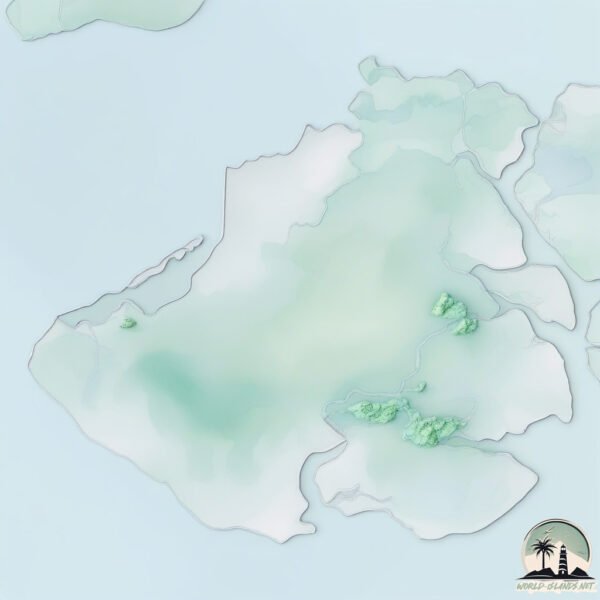
Geography and size of Orango
Size: 239.8 km²
Coastline: 202.3 km
Ocean: Atlantic Ocean
Sea: North Atlantic Ocean
Continent: Africa
Orango is a Large Island spanning 240 km² with a coastline of 202 km.
Archipel: Bijagós Islands – Located off the coast of Guinea-Bissau in West Africa, these islands are known for their unique biodiversity and traditional African culture.
Tectonic Plate: Australia – A major tectonic plate covering Australia, New Zealand, and parts of the Indian and Pacific Oceans, known for its relative stability and occasional seismic activity.
The geographic heart of the island is pinpointed at these coordinates:
Latitude: 11.1103217 / Longitude: -16.13266594
Climate and weather of Orango
Climate Zone: Tropical
Climate Details: Tropical Savanna, Wet
Temperature: Hot
Climate Characteristics: Defined by distinct wet and dry seasons with high temperatures year-round. Pronounced rainfall occurs during the wet season, while the dry season is marked by drought.
Topography and nature of Orango
Timezone: UTC±00:00
Timezone places: Europe/Lisbon
Max. Elevation: 28 m
Mean Elevation: 12 m
Vegetation: Open Woodland
Tree Coverage: 41%
The mean elevation is 12 m. The highest elevation on the island reaches approximately 28 meters above sea level. The island is characterized by Plains: Flat, low-lying lands characterized by a maximum elevation of up to 200 meters. On islands, plains are typically coastal lowlands or central flat areas.
Dominating Vegetation: Open Woodland
Characterized by sparsely distributed trees with open canopy allowing sunlight to penetrate, supporting grasses and shrubs underneath. Often found in drier or transitional environments. Orango has a tree cover of 41 %.
Vegetation: 12 vegetation zones – Exceptionally Diverse Island
Islands with more than ten vegetation zones are among the most ecologically rich and varied in the world. These islands are akin to miniature continents, boasting an incredible array of ecosystems. The sheer range of habitats, from high peaks to deep valleys, rainforests to deserts, creates a mosaic of life that is unparalleled. They are crucial for conservation and ecological studies.
Infrastructure and Travelling to Orango
Does the island have a public airport? no.
There is no public and scheduled airport on Orango. The nearest airport is Osvaldo Vieira International Airport, located 90 km away.
Does the island have a major port? no.
There are no major ports on Orango. The closest major port is BISSAU, approximately 89 km away.
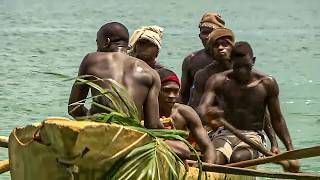
The mean population of Orango is 17 per km². Orango is Gently Populated. The island belongs to Guinea-Bissau.
Continuing your journey, Ilha de Orango is the next notable island, situated merely km away.
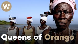
Bissagos Islands, on the Mysterious Islands of West Africa

Guinea-Bissau is classified as Least developed region: Countries that exhibit the lowest indicators of socioeconomic development, with the lowest Human Development Index ratings. The level of income is Low income.
News – Latest Updates and Headlines from Orango
Stay informed with the most recent news and important headlines from Orango. Here’s a roundup of the latest developments.
Please note: The data used here has been primarily extracted from satellite readings. Deviations from exact values may occur, particularly regarding the height of elevations and population density. Land area and coastline measurements refer to average values at mean high tide.