Ostrov Gafovicha
Welcome to Ostrov Gafovicha, a Continental island in the Sea of Okhotsk, part of the majestic Pacific Ocean. This guide offers a comprehensive overview of what makes Ostrov Gafovicha unique – from its geography and climate to its population, infrastructure, and beyond. Dive into the details:
- Geography and Size: Explore the island’s size and location.
- Climate and Weather: Weather patterns and temperature.
- Topography and Nature: Uncover the natural wonders of the island.
- Infrastructure and Travelling: Insights on reaching, staying, and making the most of your visit.
- News and Headlines: Latest News.
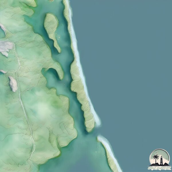
Geography and size of Ostrov Gafovicha
Size: 8.565 km²
Coastline: 41.2 km
Ocean: Pacific Ocean
Sea: Sea of Okhotsk
Continent: Asia
Ostrov Gafovicha is a Small Island spanning 8.6 km² with a coastline of 41.2 km.
Archipel: –
Tectonic Plate: Okhotsk – Located in the northwest Pacific Ocean, the Okhotsk Plate encompasses the Sea of Okhotsk, the Kamchatka Peninsula, and parts of Japan. It’s involved in complex interactions with the Pacific and North American plates, contributing to seismic activity in the region.
The geographic heart of the island is pinpointed at these coordinates:
Latitude: 52.02419216 / Longitude: 143.15742425
Climate and weather of Ostrov Gafovicha
Climate Zone: Continental
Climate Details: Subarctic Climate
Temperature: Cold Summer
Climate Characteristics: Characterized by long, extremely cold winters and short, cool summers, often found in northern latitudes of North America and Eurasia.
Topography and nature of Ostrov Gafovicha
Timezone: UTC+11:00
Timezone places: Asia/Vladivostok
Max. Elevation: 3 m
Mean Elevation: -1 m
Vegetation: Sparse Vegetation
Tree Coverage: 46%
The mean elevation is -1 m. The highest elevation on the island reaches approximately 3 meters above sea level. The island is characterized by Plains: Flat, low-lying lands characterized by a maximum elevation of up to 200 meters. On islands, plains are typically coastal lowlands or central flat areas.
Dominating Vegetation: Sparse Vegetation
These regions have limited plant growth, typically due to extreme conditions like aridity or poor soils. Vegetation is scattered and consists of hardy plant species. Ostrov Gafovicha has a tree cover of 46 %.
Vegetation: 7 vegetation zones – Very Highly Diverse Island
Islands in this range are ecological powerhouses, showcasing a wide array of vegetation zones. Each zone, from lush rainforests to arid scrublands, coastal mangroves to mountainous regions, contributes to a complex and interdependent ecosystem. These islands are often hotspots of biodiversity, supporting numerous species and intricate ecological processes.
Infrastructure and Travelling to Ostrov Gafovicha
Does the island have a public airport? no.
There is no public and scheduled airport on Ostrov Gafovicha. The nearest airport is Nogliki Airport, located 22 km away.
Does the island have a major port? no.
There are no major ports on Ostrov Gafovicha. The closest major port is VITAZ MARINE TERMINAL, approximately 82 km away.
The mean population of Ostrov Gafovicha is 1 per km². Ostrov Gafovicha is Gently Populated. The island belongs to Russia.
The name of the island resonates across different cultures and languages. Here is how it is known around the world: Arabic: سخالين; German: Sachalin; Spanish: Sajalín; French: Sakhaline; Portuguese: Sacalina; Russian: Сахалин; Chinese: 库页岛
Continuing your journey, Ostrov Ush is the next notable island, situated merely km away.
Russia is classified as Emerging region: BRIC: Brazil, Russia, India, and China – Economies noted for their rapid growth and increasing influence on global affairs. The level of income is Upper middle income.
News – Latest Updates and Headlines from Ostrov Gafovicha
Stay informed with the most recent news and important headlines from Ostrov Gafovicha. Here’s a roundup of the latest developments.
Please note: The data used here has been primarily extracted from satellite readings. Deviations from exact values may occur, particularly regarding the height of elevations and population density. Land area and coastline measurements refer to average values at mean high tide.