Ostrov Ptichiy
Welcome to Ostrov Ptichiy, a Continental island in the Sea of Okhotsk, part of the majestic Pacific Ocean. This guide offers a comprehensive overview of what makes Ostrov Ptichiy unique – from its geography and climate to its population, infrastructure, and beyond. Dive into the details:
- Geography and Size: Explore the island’s size and location.
- Climate and Weather: Weather patterns and temperature.
- Topography and Nature: Uncover the natural wonders of the island.
- Infrastructure and Travelling: Insights on reaching, staying, and making the most of your visit.
- News and Headlines: Latest News.
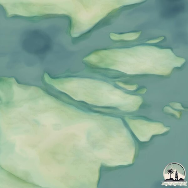
Geography and size of Ostrov Ptichiy
Size: 1.218 km²
Coastline: 8.7 km
Ocean: Pacific Ocean
Sea: Sea of Okhotsk
Continent: Asia
Ostrov Ptichiy is a Small Island spanning 1.2 km² with a coastline of 8.7 km.
Archipel: –
Tectonic Plate: Amur – A minor tectonic plate in the region of the Amur River at the border of Russia and China, involved in complex interactions with the Pacific and Eurasian plates.
The geographic heart of the island is pinpointed at these coordinates:
Latitude: 52.50119627 / Longitude: 156.39382556
Climate and weather of Ostrov Ptichiy
Climate Zone: Continental
Climate Details: Dry-Summer Subarctic Climate
Temperature: Cold Summer
Climate Characteristics: Short, mild summers with significantly less moisture, and prolonged cold periods. Found in northern, inland regions.
Topography and nature of Ostrov Ptichiy
Timezone: UTC+12:00
Timezone places: Asia/Kamchatka
Max. Elevation: 26 m
Mean Elevation: 25 m
Vegetation: Wetland
Tree Coverage: 3%
The mean elevation is 25 m. The highest elevation on the island reaches approximately 26 meters above sea level. The island is characterized by Plains: Flat, low-lying lands characterized by a maximum elevation of up to 200 meters. On islands, plains are typically coastal lowlands or central flat areas.
Dominating Vegetation: Wetland
These areas are saturated with water, either permanently or seasonally, and support aquatic plants. Wetlands are important for biodiversity and water filtration. Ostrov Ptichiy has a tree cover of 3 %.
Vegetation: 1 vegetation zones – Minimal Diversity Island
These islands exhibit the most basic level of ecological diversity, often characterized by a single dominant vegetation type. This could be due to extreme environmental conditions, limited land area, or significant human impact. They represent unique ecosystems where specific species have adapted to thrive in these singular environments.
Infrastructure and Travelling to Ostrov Ptichiy
Does the island have a public airport? no.
There is no public and scheduled airport on Ostrov Ptichiy. The nearest airport is Avachinskiy Heliport, located 232 km away.
Does the island have a major port? no.
There are no major ports on Ostrov Ptichiy. The closest major port is PETROPAVLOVSK, approximately 257 km away.
The mean population of Ostrov Ptichiy is 0 per km². Ostrov Ptichiy is Uninhabited. The island belongs to Russia.
Continuing your journey, Shumshu is the next notable island, situated merely km away.
R23RRC Ptichiy Island. From dxnews.com

![ОСТРОВ ПТИЧИЙ "ОГНЕННАЯ ЗЕМЛЯ". Взгляд с неба [4K] (11.04.2021)](https://i.ytimg.com/vi/oGTb9fx4J3g/mqdefault.jpg)

Russia is classified as Emerging region: BRIC: Brazil, Russia, India, and China – Economies noted for their rapid growth and increasing influence on global affairs. The level of income is Upper middle income.
News – Latest Updates and Headlines from Ostrov Ptichiy
Stay informed with the most recent news and important headlines from Ostrov Ptichiy. Here’s a roundup of the latest developments.
Please note: The data used here has been primarily extracted from satellite readings. Deviations from exact values may occur, particularly regarding the height of elevations and population density. Land area and coastline measurements refer to average values at mean high tide.