Ostrov Yankicha
Welcome to Ostrov Yankicha, a Polar island in the North Pacific Ocean, part of the majestic Pacific Ocean. This guide offers a comprehensive overview of what makes Ostrov Yankicha unique – from its geography and climate to its population, infrastructure, and beyond. Dive into the details:
- Geography and Size: Explore the island’s size and location.
- Climate and Weather: Weather patterns and temperature.
- Topography and Nature: Uncover the natural wonders of the island.
- Infrastructure and Travelling: Insights on reaching, staying, and making the most of your visit.
- News and Headlines: Latest News.
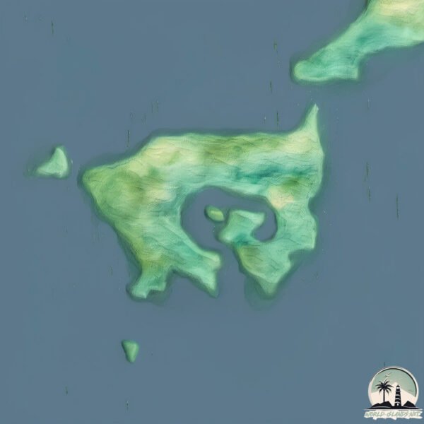
Geography and size of Ostrov Yankicha
Size: 3.491 km²
Coastline: 19 km
Ocean: Pacific Ocean
Sea: North Pacific Ocean
Continent: Asia
Ostrov Yankicha is a Small Island spanning 3.5 km² with a coastline of 19 km.
Archipel: Kuril Islands – A volcanic archipelago stretching from Japan to Russia, known for their rugged landscapes and abundant marine life.
Tectonic Plate: Okhotsk – Located in the northwest Pacific Ocean, the Okhotsk Plate encompasses the Sea of Okhotsk, the Kamchatka Peninsula, and parts of Japan. It’s involved in complex interactions with the Pacific and North American plates, contributing to seismic activity in the region.
The geographic heart of the island is pinpointed at these coordinates:
Latitude: 47.51445028 / Longitude: 152.81247339
Climate and weather of Ostrov Yankicha
Climate Zone: Polar
Climate Details: Tundra
Temperature: Cold
Climate Characteristics: The tundra climate features long, extremely cold winters and short, cool summers. Vegetation is limited to mosses, lichens, and small shrubs due to the low temperatures and short growing seasons. Biodiversity is low, but some specialized species thrive.
Topography and nature of Ostrov Yankicha
Timezone: UTC+11:00
Timezone places: Asia/Vladivostok
Max. Elevation: 139 m
Mean Elevation: 63 m
Vegetation: Open Woodland
Tree Coverage: 99%
The mean elevation is 63 m. The highest elevation on the island reaches approximately 139 meters above sea level. The island is characterized by Plains: Flat, low-lying lands characterized by a maximum elevation of up to 200 meters. On islands, plains are typically coastal lowlands or central flat areas.
Dominating Vegetation: Open Woodland
Characterized by sparsely distributed trees with open canopy allowing sunlight to penetrate, supporting grasses and shrubs underneath. Often found in drier or transitional environments. Ostrov Yankicha has a tree cover of 99 %.
Vegetation: 8 vegetation zones – Very Highly Diverse Island
Islands in this range are ecological powerhouses, showcasing a wide array of vegetation zones. Each zone, from lush rainforests to arid scrublands, coastal mangroves to mountainous regions, contributes to a complex and interdependent ecosystem. These islands are often hotspots of biodiversity, supporting numerous species and intricate ecological processes.
Infrastructure and Travelling to Ostrov Yankicha
Does the island have a public airport? no.
There is no public and scheduled airport on Ostrov Yankicha. The nearest airport is Iturup Airport, located 593 km away.
Does the island have a major port? no.
There are no major ports on Ostrov Yankicha. The closest major port is SHAKOTAN, approximately 776 km away.
The mean population of Ostrov Yankicha is 1 per km². Ostrov Yankicha is Uninhabited. The island belongs to Russia.
Continuing your journey, Ostrov Rasshua is the next notable island, situated merely km away.
Zodiac Yankicha Island Kuril Islands


Russia is classified as Emerging region: BRIC: Brazil, Russia, India, and China – Economies noted for their rapid growth and increasing influence on global affairs. The level of income is Upper middle income.
News – Latest Updates and Headlines from Ostrov Yankicha
Stay informed with the most recent news and important headlines from Ostrov Yankicha. Here’s a roundup of the latest developments.
Please note: The data used here has been primarily extracted from satellite readings. Deviations from exact values may occur, particularly regarding the height of elevations and population density. Land area and coastline measurements refer to average values at mean high tide.