Welcome to Otočić Bršćak, a Temperate island in the Adriatic Sea, part of the majestic Atlantic Ocean. This guide offers a comprehensive overview of what makes Otočić Bršćak unique – from its geography and climate to its population, infrastructure, and beyond. Dive into the details:
Geography and size of Otočić Bršćak
Size: 0.22 km²
Coastline: 2.1 km
Ocean: Atlantic Ocean
Sea: Adriatic Sea
Continent: Europe
Otočić Bršćak is a Tiny Island spanning 0.22 km² with a coastline of 2.1 km.
Archipel: –
Tectonic Plate: Eurasia – One of the world’s largest tectonic plates, the Eurasian Plate covers a significant portion of Europe and Asia. It’s characterized by diverse geological features, including the Ural Mountains, the European Plain, and the Himalayas formed from its collision with the Indian Plate.
The geographic heart of the island is pinpointed at these coordinates:
Latitude: 44.18170289 / Longitude: 14.85478455
Climate and weather of Otočić Bršćak
Climate Zone: Temperate
Climate Details: Hot-Summer Mediterranean Climate
Temperature: Hot Summer
Climate Characteristics: Characterized by hot, dry summers and mild, wet winters, typical of coastal areas with abundant sunshine.
Topography and nature of Otočić Bršćak
Timezone: UTC+01:00
Timezone places: Europe/Paris
Max. Elevation: 4 m
Mean Elevation: 1 m
Vegetation: Evergreen Needleleaf Forest
Tree Coverage: 81%
The mean elevation is 1 m. The highest elevation on the island reaches approximately 4 meters above sea level. The island is characterized by Plains: Flat, low-lying lands characterized by a maximum elevation of up to 200 meters. On islands, plains are typically coastal lowlands or central flat areas.
Dominating Vegetation: Evergreen Needleleaf Forest
Dominated by evergreen coniferous trees such as pines and firs, which retain their needle-like leaves throughout the year. These forests are often found in cooler climates. Otočić Bršćak has a tree cover of 81 %.
Vegetation: 1 vegetation zones – Minimal Diversity Island
These islands exhibit the most basic level of ecological diversity, often characterized by a single dominant vegetation type. This could be due to extreme environmental conditions, limited land area, or significant human impact. They represent unique ecosystems where specific species have adapted to thrive in these singular environments.
Infrastructure and Travelling to Otočić Bršćak
Does the island have a public airport? no.
There is no public and scheduled airport on Otočić Bršćak. The nearest airport is Zadar Airport, located 56 km away.
Does the island have a major port? no.
There are no major ports on Otočić Bršćak. The closest major port is ZADAR, approximately 41 km away.
The mean population of Otočić Bršćak is 5 per km². Otočić Bršćak is Gently Populated. The island belongs to Croatia.
Continuing your journey, Otok Molat is the next notable island, situated merely km away.
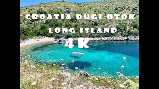
DUGI OTOK ISLAND - VACATION IN CROATIA
Hello People!, Today I am sharing my vacation video from Croatia Dugi ...
Hello People!, Today I am sharing my vacation video from Croatia Dugi Otok island. Enjoy! ◇ Music provided by ...
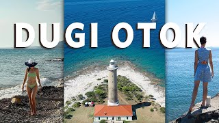
Dugi Otok Island Beaches, Croatia
Božava - Long Island (Dugi otok) Croatia - Destination guide
Božava is a village and a small port on the northwest side of Dugi ...
Božava is a village and a small port on the northwest side of Dugi otok, and is located in a bay surrounded by pine forests. It is one ...
Dugi Otok in November | Croatia’s 🇭🇷 Hidden Island Magic
Join us on a November journey to Dugi Otok, Croatia's “Long Island,” ...
Join us on a November journey to Dugi Otok, Croatia's “Long Island,” just off the coast of Zadar. This ancient island carries ...
CROATIA: My Visit To Magical DUGI OTOK Island
I'm taking you on a beautiful and picturesque journey around Dugi Otok ...
I'm taking you on a beautiful and picturesque journey around Dugi Otok island, one of the most gorgeous islands in the Adriatic ...
Can’t wait to show you this gorgeous Croatian island Dugi Otok (Long Island in English) 😍 #Shorts
The video is out by the end of January 2022.
The video is out by the end of January 2022.
Dugi Otok Hike to Orljak || Croatia’s Hidden Island Peak || 4K
Join us as we hike to the highest point of Dugi Otok, Orljak (338m), ...
Join us as we hike to the highest point of Dugi Otok, Orljak (338m), starting from an old quarry near Sali. This relaxed but scenic ...
DUGI OTOK: Croatian "Long island"
An island full of diversity, beautiful views and incredibly ...
An island full of diversity, beautiful views and incredibly well-preserved nature, Dugi otok is one of the most beautiful Croatian ...
Exploring Croatia's Hidden Gem Dugi Otok Island and Telascica Nature Park
Explore Croatia for your next travel destination.
Explore Croatia for your next travel destination.
Island of the Week: Dugi Otok
Discover Croatia's Long Island. Dugi Otok is a natural paradise, with ...
Discover Croatia's Long Island. Dugi Otok is a natural paradise, with some of the best beaches on the Adriatic.
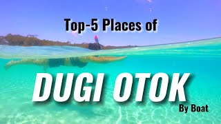
Top 5 places of Dugi Otok to visit by boat from Zadar | Explore the stunning beaches of Zadar
For inquiries, email us at :
travelllingtrio@gmail.com To book a boat trip from Zadar to Dugi Otok and other itinerary, please email ...
Zaliv Pantera, Dugi Otok (Hrvaška)
Sidrišče je v dobro zaščitenem zalivu Pantera na severni strani Dugega ...
Sidrišče je v dobro zaščitenem zalivu Pantera na severni strani Dugega otoka. V zaliv vplujemo južno od zelenega svetilnika, ...
Hotel Lavanda - Božava, Dugi otok Island Hotels, Croatia
Hotel Lavanda 3 Stars Hotel in Božava, Dugi otok Island , Croatia ...
Hotel Lavanda 3 Stars Hotel in Božava, Dugi otok Island , Croatia Within US Travel Directory One of our top picks in Božava.
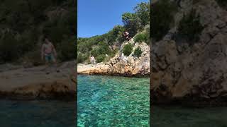
Speed Boat Zadar - Cliff jumping @ Dugi Otok
Explore Zadar archipelago privately with your friends and family. ...
Explore Zadar archipelago privately with your friends and family. Visit the nicest locations and avoid overcrowded beaches with ...
Božava Croatia 🌴 4K Walking Tour (2025) 🇭🇷 | Dugi Otok Island Hidden Gem Walk
Welcome to Božava, the Dugi Otok Island hidden gem in Croatia! Walk ...
Welcome to Božava, the Dugi Otok Island hidden gem in Croatia! Walk with us in this 4K no-commentary walking tour ...
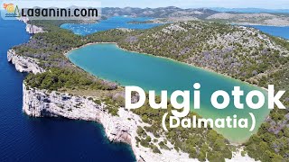
Dugi otok (Dalmatia), Croatia | Laganini.com
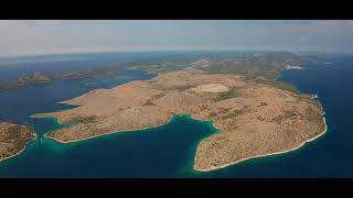
Dugi Otok is the largest and most remote island in the North Dalmatian ...
Dugi Otok is the largest and most remote island in the North Dalmatian islands and its name justifies a length of about 45 km.
telašćica #telascica #Croatia #adriaticsea #hrvatska #kroatien #croazia #adriatic #dugiotok
Telascica Nature Park is a stunning natural reserve on the island of ...
Telascica Nature Park is a stunning natural reserve on the island of Dugi Otok, the Adriatic Sea in Croatia. It is known for its ...
A Travel Guide to Dugi otok (Long Island), Croatia
Being one of Croatia's best-kept secrets, Dugi otok is among few ...
Being one of Croatia's best-kept secrets, Dugi otok is among few bigger islands which are still undisturbed by mass tourism.
somewhere on the island of Dugi otok #adriaticsea #travel #biketours #dugiotok
Sometimes somewhere beach on the island of Dugi otok, Zadar region, ...
Sometimes somewhere beach on the island of Dugi otok, Zadar region, northern Dalmatia, Croatia. #dalmatia #zadar #islandlife.
Property on Dugi otok island Zaglav adriatic seaside real estate 6058
Campsite property on remote location with panoramic view, 15 min. from ...
Campsite property on remote location with panoramic view, 15 min. from town and Telašćica nature park.
Lighthouse Veli Rat on Island Dugi Otok,Croatia; Svjetionik Veli Rat na Dugom otoku
Lighthouse Veli Rat on Island Dugi Otok; Svjetionik Veli Rat na Dugom otoku.
Lighthouse Veli Rat on Island Dugi Otok; Svjetionik Veli Rat na Dugom otoku.
Croatia is classified as Developed region: nonG7: Developed economies outside of the Group of Seven, characterized by high income and advanced economic structures. The level of income is High income: nonOECD.
News – Latest Updates and Headlines from Otočić Bršćak
Stay informed with the most recent news and important headlines from Otočić Bršćak. Here’s a roundup of the latest developments.
Loading...
Please note: The data used here has been primarily extracted from satellite readings. Deviations from exact values may occur, particularly regarding the height of elevations and population density. Land area and coastline measurements refer to average values at mean high tide.