Otok Olib
Welcome to Otok Olib, a Temperate island in the Adriatic Sea, part of the majestic Atlantic Ocean. This guide offers a comprehensive overview of what makes Otok Olib unique – from its geography and climate to its population, infrastructure, and beyond. Dive into the details:
- Geography and Size: Explore the island’s size and location.
- Climate and Weather: Weather patterns and temperature.
- Topography and Nature: Uncover the natural wonders of the island.
- Infrastructure and Travelling: Insights on reaching, staying, and making the most of your visit.
- News and Headlines: Latest News.
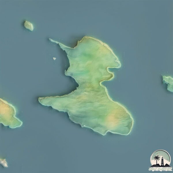
Geography and size of Otok Olib
Size: 26.8 km²
Coastline: 33.2 km
Ocean: Atlantic Ocean
Sea: Adriatic Sea
Continent: Europe
Otok Olib is a Medium Island spanning 27 km² with a coastline of 33 km.
Archipel: –
Tectonic Plate: Eurasia – One of the world’s largest tectonic plates, the Eurasian Plate covers a significant portion of Europe and Asia. It’s characterized by diverse geological features, including the Ural Mountains, the European Plain, and the Himalayas formed from its collision with the Indian Plate.
The geographic heart of the island is pinpointed at these coordinates:
Latitude: 44.37867649 / Longitude: 14.78787256
Climate and weather of Otok Olib
Climate Zone: Temperate
Climate Details: Hot-Summer Mediterranean Climate
Temperature: Hot Summer
Climate Characteristics: Characterized by hot, dry summers and mild, wet winters, typical of coastal areas with abundant sunshine.
Topography and nature of Otok Olib
Timezone: UTC+01:00
Timezone places: Europe/Paris
Max. Elevation: 64 m
Mean Elevation: 20 m
Vegetation: Evergreen Needleleaf Forest
Tree Coverage: 66%
The mean elevation is 20 m. The highest elevation on the island reaches approximately 64 meters above sea level. The island is characterized by Plains: Flat, low-lying lands characterized by a maximum elevation of up to 200 meters. On islands, plains are typically coastal lowlands or central flat areas.
Dominating Vegetation: Evergreen Needleleaf Forest
Dominated by evergreen coniferous trees such as pines and firs, which retain their needle-like leaves throughout the year. These forests are often found in cooler climates. Otok Olib has a tree cover of 66 %.
Vegetation: 6 vegetation zones – Very Highly Diverse Island
Islands in this range are ecological powerhouses, showcasing a wide array of vegetation zones. Each zone, from lush rainforests to arid scrublands, coastal mangroves to mountainous regions, contributes to a complex and interdependent ecosystem. These islands are often hotspots of biodiversity, supporting numerous species and intricate ecological processes.
Infrastructure and Travelling to Otok Olib
Does the island have a public airport? no.
There is no public and scheduled airport on Otok Olib. The nearest airport is Zadar Airport, located 66 km away.
Does the island have a major port? no.
There are no major ports on Otok Olib. The closest major port is ZADAR, approximately 51 km away.
The mean population of Otok Olib is 5 per km². Otok Olib is Gently Populated. The island belongs to Croatia.
Continuing your journey, Otok Silba is the next notable island, situated merely km away.
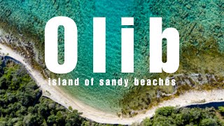
OLIB: island of most beautiful sandy beaches in Croatia

Croatia is classified as Developed region: nonG7: Developed economies outside of the Group of Seven, characterized by high income and advanced economic structures. The level of income is High income: nonOECD.
News – Latest Updates and Headlines from Otok Olib
Stay informed with the most recent news and important headlines from Otok Olib. Here’s a roundup of the latest developments.
Please note: The data used here has been primarily extracted from satellite readings. Deviations from exact values may occur, particularly regarding the height of elevations and population density. Land area and coastline measurements refer to average values at mean high tide.