Otto Rud
Welcome to Otto Rud, a Polar island in the North Atlantic Ocean, part of the majestic Atlantic Ocean. This guide offers a comprehensive overview of what makes Otto Rud unique – from its geography and climate to its population, infrastructure, and beyond. Dive into the details:
- Geography and Size: Explore the island’s size and location.
- Climate and Weather: Weather patterns and temperature.
- Topography and Nature: Uncover the natural wonders of the island.
- Infrastructure and Travelling: Insights on reaching, staying, and making the most of your visit.
- News and Headlines: Latest News.
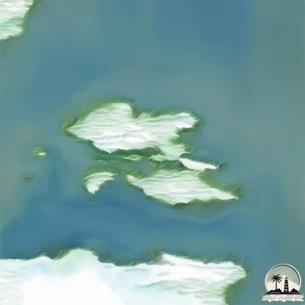
Geography and size of Otto Rud
Size: 1.284 km²
Coastline: 6.5 km
Ocean: Atlantic Ocean
Sea: North Atlantic Ocean
Continent: North America
Otto Rud is a Small Island spanning 1.3 km² with a coastline of 6.5 km.
Archipel: –
Tectonic Plate: Eurasia – One of the world’s largest tectonic plates, the Eurasian Plate covers a significant portion of Europe and Asia. It’s characterized by diverse geological features, including the Ural Mountains, the European Plain, and the Himalayas formed from its collision with the Indian Plate.
The geographic heart of the island is pinpointed at these coordinates:
Latitude: 62.06653761 / Longitude: -42.21253326
Climate and weather of Otto Rud
Climate Zone: Polar
Climate Details: Tundra
Temperature: Cold
Climate Characteristics: The tundra climate features long, extremely cold winters and short, cool summers. Vegetation is limited to mosses, lichens, and small shrubs due to the low temperatures and short growing seasons. Biodiversity is low, but some specialized species thrive.
Topography and nature of Otto Rud
Timezone: UTC-03:00
Timezone places: America/Sao_Paulo
Max. Elevation: 70 m
Mean Elevation: 58 m
Vegetation: Herbaceous Cover
Tree Coverage: 51%
The mean elevation is 58 m. The highest elevation on the island reaches approximately 70 meters above sea level. The island is characterized by Plains: Flat, low-lying lands characterized by a maximum elevation of up to 200 meters. On islands, plains are typically coastal lowlands or central flat areas.
Dominating Vegetation: Herbaceous Cover
Comprising mainly of grasses, herbs, and ferns, these areas are common in prairies, meadows, and savannas, and can vary widely in species composition. Otto Rud has a tree cover of 51 %.
Vegetation: 2 vegetation zones – Low Diversity Island
Islands with two distinct vegetation zones offer slightly more ecological variety. These zones could be due to differences in elevation, moisture, or other environmental factors. While still limited in biodiversity, these islands may offer a contrast between the two zones, such as a coastline with mangroves and an inland area with grassland.
Infrastructure and Travelling to Otto Rud
Does the island have a public airport? no.
There is no public and scheduled airport on Otto Rud. The nearest airport is Aappilattoq Heliport, located 313 km away.
Does the island have a major port? no.
There are no major ports on Otto Rud. The closest major port is KUSANARTOQ, approximately 32 km away.
The mean population of Otto Rud is 0 per km². Otto Rud is Uninhabited. The island belongs to Denmark.
Continuing your journey, Ikermiit is the next notable island, situated merely km away.
【絶景の隠れ宿】露天風呂と海鮮料理が自慢のコスパ最強温泉旅館!人気の露天風呂付き客室に宿泊♨️静岡県伊豆の絶景巡りと「海辺のかくれ湯 清流」


Denmark is classified as Developed region: nonG7: Developed economies outside of the Group of Seven, characterized by high income and advanced economic structures. The level of income is High income: OECD.
News – Latest Updates and Headlines from Otto Rud
Stay informed with the most recent news and important headlines from Otto Rud. Here’s a roundup of the latest developments.
Please note: The data used here has been primarily extracted from satellite readings. Deviations from exact values may occur, particularly regarding the height of elevations and population density. Land area and coastline measurements refer to average values at mean high tide.