Pender
Welcome to Pender, a Polar island in the Indian Ocean, part of the majestic Indian Ocean. This guide offers a comprehensive overview of what makes Pender unique – from its geography and climate to its population, infrastructure, and beyond. Dive into the details:
- Geography and Size: Explore the island’s size and location.
- Climate and Weather: Weather patterns and temperature.
- Topography and Nature: Uncover the natural wonders of the island.
- Infrastructure and Travelling: Insights on reaching, staying, and making the most of your visit.
- News and Headlines: Latest News.
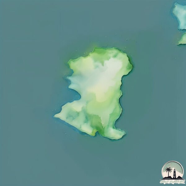
Geography and size of Pender
Size: 0.755 km²
Coastline: 4.8 km
Ocean: Indian Ocean
Sea: Indian Ocean
Continent: Seven seas (open ocean)
Pender is a Tiny Island spanning 0.755 km² with a coastline of 4.8 km.
Archipel: Kerguelen Islands – A group of islands in the southern Indian Ocean, often referred to as the “Desolation Islands,” known for their isolation and harsh environment.
Tectonic Plate: Antarctica – Covers the Antarctic continent and extends outward, characterized by interactions with surrounding oceanic plates and known for its seismic activity along the periphery.
The geographic heart of the island is pinpointed at these coordinates:
Latitude: -49.40352818 / Longitude: 70.00944937
Climate and weather of Pender
Climate Zone: Polar
Climate Details: Tundra
Temperature: Cold
Climate Characteristics: The tundra climate features long, extremely cold winters and short, cool summers. Vegetation is limited to mosses, lichens, and small shrubs due to the low temperatures and short growing seasons. Biodiversity is low, but some specialized species thrive.
Topography and nature of Pender
Timezone: UTC+05:00
Timezone places: Asia/Karachi
Max. Elevation: 12 m
Mean Elevation: 1 m
Vegetation: Herbaceous Cover
Tree Coverage: 71%
The mean elevation is 1 m. The highest elevation on the island reaches approximately 12 meters above sea level. The island is characterized by Plains: Flat, low-lying lands characterized by a maximum elevation of up to 200 meters. On islands, plains are typically coastal lowlands or central flat areas.
Dominating Vegetation: Herbaceous Cover
Comprising mainly of grasses, herbs, and ferns, these areas are common in prairies, meadows, and savannas, and can vary widely in species composition. Pender has a tree cover of 71 %.
Vegetation: 1 vegetation zones – Minimal Diversity Island
These islands exhibit the most basic level of ecological diversity, often characterized by a single dominant vegetation type. This could be due to extreme environmental conditions, limited land area, or significant human impact. They represent unique ecosystems where specific species have adapted to thrive in these singular environments.
Infrastructure and Travelling to Pender
Does the island have a public airport? no.
There is no public and scheduled airport on Pender. The nearest airport is Sir Charles Gaetan Duval Airport, located 3375 km away.
Does the island have a major port? no.
There are no major ports on Pender. The closest major port is PORT MATHURIN, approximately 3382 km away.
The mean population of Pender is per km². Pender is . The island belongs to Fr. S. Antarctic Lands.
Continuing your journey, Rennes is the next notable island, situated merely km away.
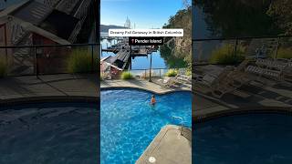
A day on Pender Island 2025 // Southern Gulf Island


Fr. S. Antarctic Lands is classified as Developed region: G7: Group of Seven – Major advanced economies, including Canada, France, Germany, Italy, Japan, the United Kingdom, and the United States. The level of income is High income: OECD.
News – Latest Updates and Headlines from Pender
Stay informed with the most recent news and important headlines from Pender. Here’s a roundup of the latest developments.
Please note: The data used here has been primarily extracted from satellite readings. Deviations from exact values may occur, particularly regarding the height of elevations and population density. Land area and coastline measurements refer to average values at mean high tide.