Peter
Welcome to Peter, a Tropical island in the Caribbean Sea, part of the majestic Atlantic Ocean. This guide offers a comprehensive overview of what makes Peter unique – from its geography and climate to its population, infrastructure, and beyond. Dive into the details:
- Geography and Size: Explore the island’s size and location.
- Climate and Weather: Weather patterns and temperature.
- Topography and Nature: Uncover the natural wonders of the island.
- Infrastructure and Travelling: Insights on reaching, staying, and making the most of your visit.
- News and Headlines: Latest News.
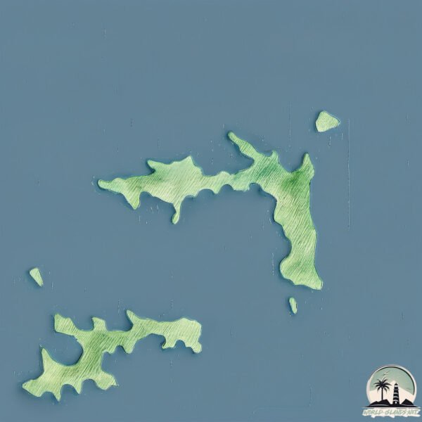
Geography and size of Peter
Size: 4.384 km²
Coastline: 20.7 km
Ocean: Atlantic Ocean
Sea: Caribbean Sea
Continent: North America
Peter is a Small Island spanning 4.4 km² with a coastline of 20.7 km.
Archipel: Virgin Islands – A group of Caribbean islands and islets, known for their beautiful beaches, coral reefs, and vibrant culture.
Tectonic Plate: Caribbean – Covering the Caribbean Sea and surrounding regions, this plate is bordered by the North American Plate and the South American Plate. Known for seismic activity, including earthquakes and volcanic eruptions, and features like the Puerto Rico Trench.
The geographic heart of the island is pinpointed at these coordinates:
Latitude: 18.34888048 / Longitude: -64.58127867
Climate and weather of Peter
Climate Zone: Tropical
Climate Details: Tropical Monsoon Climate
Temperature: Hot
Climate Characteristics: Characterized by heavy rainfall, high humidity, and uniformly high temperatures, but with a distinct short dry season. It features a seasonal reversal of prevailing wind directions.
Topography and nature of Peter
Timezone: UTC-04:00
Timezone places: America/La_Paz
Max. Elevation: 61 m
Mean Elevation: 40 m
Vegetation: Evergreen Needleleaf Forest
Tree Coverage: 63%
The mean elevation is 40 m. The highest elevation on the island reaches approximately 61 meters above sea level. The island is characterized by Plains: Flat, low-lying lands characterized by a maximum elevation of up to 200 meters. On islands, plains are typically coastal lowlands or central flat areas.
Dominating Vegetation: Evergreen Needleleaf Forest
Dominated by evergreen coniferous trees such as pines and firs, which retain their needle-like leaves throughout the year. These forests are often found in cooler climates. Peter has a tree cover of 63 %.
Vegetation: 4 vegetation zones – Diverse Island
Four distinct vegetation zones mark these islands as ecologically diverse. They might feature varied landscapes such as forests, beaches, grasslands, and rocky areas. Such diversity reflects the island’s complex ecological interactions and varied habitats, which can support a rich array of wildlife and plant species.
Infrastructure and Travelling to Peter
Does the island have a public airport? no.
There is no public and scheduled airport on Peter. The nearest airport is Terrance B. Lettsome International Airport, located 10 km away.
Does the island have a major port? no.
There are no major ports on Peter. The closest major port is ROAD HARBOR, approximately 7 km away.
The mean population of Peter is 3 per km². Peter is Gently Populated. The island belongs to United Kingdom.
Continuing your journey, Tortola is the next notable island, situated merely km away.
United Kingdom is classified as Developed region: G7: Group of Seven – Major advanced economies, including Canada, France, Germany, Italy, Japan, the United Kingdom, and the United States. The level of income is High income: OECD.
News – Latest Updates and Headlines from Peter
Stay informed with the most recent news and important headlines from Peter. Here’s a roundup of the latest developments.
Please note: The data used here has been primarily extracted from satellite readings. Deviations from exact values may occur, particularly regarding the height of elevations and population density. Land area and coastline measurements refer to average values at mean high tide.