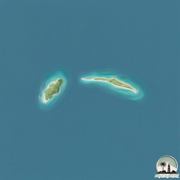
Plana Cays
Welcome to Plana Cays, a Tropical island in the North Atlantic Ocean, part of the majestic Atlantic Ocean. This guide offers a comprehensive overview of what makes Plana Cays unique – from its geography and climate to its population, infrastructure, and beyond. Dive into the details:
- Geography and Size: Explore the island’s size and location.
- Climate and Weather: Weather patterns and temperature.
- Topography and Nature: Uncover the natural wonders of the island.
- Infrastructure and Travelling: Insights on reaching, staying, and making the most of your visit.
- News and Headlines: Latest News.
Geography and size of Plana Cays
Size: 8.744 km²
Coastline: 14.4 km
Ocean: Atlantic Ocean
Sea: North Atlantic Ocean
Continent: North America
Plana Cays is a Small Island spanning 8.7 km² with a coastline of 14.4 km.
Archipel: Bahama Islands – An archipelago in the Atlantic Ocean, known for their stunning beaches, coral reefs, and vibrant culture.
Tectonic Plate: North America – Covers North America and parts of the Atlantic and Arctic Oceans, characterized by diverse geological features and varying levels of seismic activity.
The geographic heart of the island is pinpointed at these coordinates:
Latitude: 22.59844489 / Longitude: -73.5647307
Climate and weather of Plana Cays
Climate Zone: Tropical
Climate Details: Tropical Savanna, Wet
Temperature: Hot
Climate Characteristics: Defined by distinct wet and dry seasons with high temperatures year-round. Pronounced rainfall occurs during the wet season, while the dry season is marked by drought.
Topography and nature of Plana Cays
Timezone: UTC-05:00
Timezone places: America/New_York
Max. Elevation: 6 m
Mean Elevation: 3 m
Vegetation: Open Woodland
Tree Coverage: 58%
The mean elevation is 3 m. The highest elevation on the island reaches approximately 6 meters above sea level. The island is characterized by Plains: Flat, low-lying lands characterized by a maximum elevation of up to 200 meters. On islands, plains are typically coastal lowlands or central flat areas.
Dominating Vegetation: Open Woodland
Characterized by sparsely distributed trees with open canopy allowing sunlight to penetrate, supporting grasses and shrubs underneath. Often found in drier or transitional environments. Plana Cays has a tree cover of 58 %.
Vegetation: 10 vegetation zones – Very Highly Diverse Island
Islands in this range are ecological powerhouses, showcasing a wide array of vegetation zones. Each zone, from lush rainforests to arid scrublands, coastal mangroves to mountainous regions, contributes to a complex and interdependent ecosystem. These islands are often hotspots of biodiversity, supporting numerous species and intricate ecological processes.
Infrastructure and Travelling to Plana Cays
Does the island have a public airport? no.
There is no public and scheduled airport on Plana Cays. The nearest airport is Spring Point Airport, located 41 km away.
Does the island have a major port? no.
There are no major ports on Plana Cays. The closest major port is MATTHEW TOWN, approximately 180 km away.
The mean population of Plana Cays is 1 per km². Plana Cays is Gently Populated. The island belongs to The Bahamas.
Continuing your journey, Acklins is the next notable island, situated merely km away.
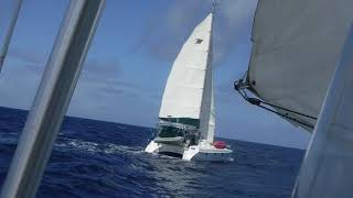
What If sailing near Plana Cays, Bahamas

The Bahamas is classified as Developing region: Regions characterized by lower income levels, with economies in the process of industrialization and modernization. The level of income is High income: nonOECD.
News – Latest Updates and Headlines from Plana Cays
Stay informed with the most recent news and important headlines from Plana Cays. Here’s a roundup of the latest developments.
Please note: The data used here has been primarily extracted from satellite readings. Deviations from exact values may occur, particularly regarding the height of elevations and population density. Land area and coastline measurements refer to average values at mean high tide.