Welcome to Point Island, a Tropical island in the Bay of Bengal, part of the majestic Indian Ocean. This guide offers a comprehensive overview of what makes Point Island unique – from its geography and climate to its population, infrastructure, and beyond. Dive into the details:
Geography and size of Point Island
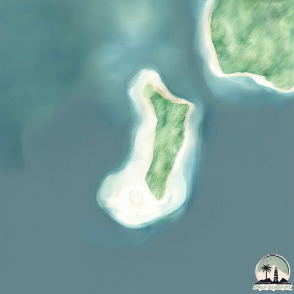
Size: 1.962 km²
Coastline: 7 km
Ocean: Indian Ocean
Sea: Bay of Bengal
Continent: Seven seas (open ocean)
Point Island is a Small Island spanning 2 km² with a coastline of 7 km.
Archipel: Andaman Islands – Situated in the Bay of Bengal, the Andaman Islands are part of the Indian territory and are known for their picturesque beaches, clear waters, and lush forests. These islands are home to a variety of indigenous tribes and have a rich biodiversity, including unique flora and fauna. The Andamans also have a significant history, notably during the British colonial period.
Tectonic Plate: India – A major tectonic plate that initially moved northward at a rapid pace before colliding with the Eurasian Plate. This collision is responsible for the uplift of the Himalayas and the Tibetan Plateau.
The geographic heart of the island is pinpointed at these coordinates:
Latitude: 13.4093485 / Longitude: 92.81337113
Climate and weather of Point Island
Climate Zone: Tropical
Climate Details: Tropical Monsoon Climate
Temperature: Hot
Climate Characteristics: Characterized by heavy rainfall, high humidity, and uniformly high temperatures, but with a distinct short dry season. It features a seasonal reversal of prevailing wind directions.
Topography and nature of Point Island
Timezone: UTC+05:30
Timezone places:
Max. Elevation: 6 m
Mean Elevation: 3 m
Vegetation: Evergreen Broadleaf Forest
Tree Coverage: 99%
The mean elevation is 3 m. The highest elevation on the island reaches approximately 6 meters above sea level. The island is characterized by Plains: Flat, low-lying lands characterized by a maximum elevation of up to 200 meters. On islands, plains are typically coastal lowlands or central flat areas.
Dominating Vegetation: Evergreen Broadleaf Forest
Characterized by dense, lush canopies of broadleaf trees that retain their leaves year-round. These forests are typically found in tropical and subtropical regions and are known for their high biodiversity. Point Island has a tree cover of 99 %.
Vegetation: 1 vegetation zones – Minimal Diversity Island
These islands exhibit the most basic level of ecological diversity, often characterized by a single dominant vegetation type. This could be due to extreme environmental conditions, limited land area, or significant human impact. They represent unique ecosystems where specific species have adapted to thrive in these singular environments.
Infrastructure and Travelling to Point Island
Does the island have a public airport? no.
There is no public and scheduled airport on Point Island. The nearest airport is Veer Savarkar International Airport / INS Utkrosh, located 196 km away.
Does the island have a major port? no.
There are no major ports on Point Island. The closest major port is PORT BLAIR, approximately 191 km away.
The mean population of Point Island is 31 per km². Point Island is Gently Populated. The island belongs to India.
Continuing your journey, North Andaman is the next notable island, situated merely km away.
Discovering the Unseen: Nature's Unimaginable Island-Ception Secrets
Join us as we explore the mind-boggling island-ception phenomenon in the Philippines, where Vulcan Point Island rests within a ...Discovering the Unseen: Nature's Unimaginable Island-Ception Secrets
Join us as we explore the mind-boggling island-ception phenomenon in ...
Join us as we explore the mind-boggling island-ception phenomenon in the Philippines, where Vulcan Point Island rests within a ...
Sandy Point on Hayling Island, Chichester Harbour beach fishing mark, Hants, England, UK
Angling video guides to English South Coast shore fishing marks at: ...
What If You Were Stranded on the World's Most Remote Island?
Watch more than 20 additional RealLifeLore videos in my Modern ...
12 Things to Do Mackinac Island | What to Expect + Where to Stay
Michigan's Mackinac Island is one of the most unique destinations in ...
Michigan's Mackinac Island is one of the most unique destinations in the United States. Before you go, it's helpful to have a plan of ...
Canyonlands National Park | Island in the Sky | Guide: Mesa Arch, Grand View Point & Upheaval Dome
Canyonlands is Utah's biggest national park and home to three distinct ...
Canyonlands is Utah's biggest national park and home to three distinct areas. In this video we spend the day exploring just the ...
Fraser Island shenanigans 😂 #4x4 #chunkytravellers #bogged #boogedtothediff #fraserisland #noidea
Ya see it all on Fraser Island #4x4 #chunkytravellers #bogged ...
Ya see it all on Fraser Island #4x4 #chunkytravellers #bogged #boogedtothediff #fraserisland #noidea #rangerlife.
The Most Remote Uninhabited Island in the World 📍 Bouvet Island 🏝️#map #geography #explanation
Did you know where is the most remote uninhibited island in the world? ...
Did you know where is the most remote uninhibited island in the world? Where is Bouvet Island? Transcription: What if you want to ...
The largest island in the largest lake on the largest island in the largest lake in the world
The recursive island that almost was. // Dream Islands is an ...
The recursive island that almost was. // Dream Islands is an indulgence in getting digitally lost, using the wonder that is Google ...
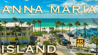
Anna Maria Island Florida #1 Paradise Destination
Here is some of the BEST Anna Maria Island Florida has to offer! 7 ...
Here is some of the BEST Anna Maria Island Florida has to offer! 7 miles of Florida Paradise. - What is Anna Maria Island known ...
Destination Unknown West Point Island, Falkland Islands
Travel around the world I finally get to explore my seven Continent ...
Travel around the world I finally get to explore my seven Continent and along the way I visit the Falkland Island, South Georgia ...
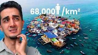
Visiting the Most Crowded Island on Earth (I can’t forget what I saw)
Santa Cruz del Islote has an area of just one percent of a square ...
Santa Cruz del Islote has an area of just one percent of a square kilometer in size where 816 people squeeze their entire lives.
Noosa to Double Island Point 4wd Beach Tour & Teewah Camping Sites - Queensland
Hi everyone and welcome to this weeks addition on a 4x4 beach driving ...
Hi everyone and welcome to this weeks addition on a 4x4 beach driving tour from Noosa to Double Island Point, 4WD beach tour, ...
The REAL TRUTH of the UK's most Northerly ISLAND - SHETLAND
We travel to the most Northern islands in the UK, the Shetland islands ...
We travel to the most Northern islands in the UK, the Shetland islands in this travel vlog where we explore the beautiful shetland ...
The Point: The history of Rottnest Island
Rottnest Island, or Wadejmup, is an internationally known tourism ...
Rottnest Island, or Wadejmup, is an internationally known tourism destination in Western Australia. What many people don't know ...
Beautiful Maldives in the 5* resort Como Cocoa Island 🤩🏝️ #maldives #luxurytravel #bestresorts
Como Cocoa Island is a 5* Luxury Resort in the Maldives with 30 ...
Como Cocoa Island is a 5* Luxury Resort in the Maldives with 30 overwater villas.
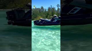
Wow this is paradise - Anna Maria Island🏝️ Jewfish Key Sandbar. #beach #explore #travel #jetski
Some of the most beautiful water in the Sarasota Bradenton area can be ...
Some of the most beautiful water in the Sarasota Bradenton area can be found on Anna Maria Island. Jewfish Key is located ...
Dark Secrets of the World’s Most Isolated Island
Start your free trial with Shopify at this link! ...
Start your free trial with Shopify at this link!
http://shopify.com/yestheory This week, I traveled to the most remotely inhabited island ...
Ark Resource Locations on The Island! #shorts
ark #arksurvivalevolved #ark2 #pebblehost.
ark #arksurvivalevolved #ark2 #pebblehost.
How to 4wd & Camp Double ISLAND !
Tips, Tricks, and all the info you need to enjoy arguably one of ...
Tips, Tricks, and all the info you need to enjoy arguably one of Australia's best beaches to camp and 4wd on. MY STORE: ...
10 Lines on Island/ Essay on Island in english/ Island Essay in english
essayonisland #islandessayinenglish #10linesonisland ...
essayonisland #islandessayinenglish #10linesonisland #islandessayinenglish #treyankushlearning.
The Weirdest Island on Earth!
The best Catalina Island day trip itinerary ☀️
Who's looking for a full day trip to Catalina Island? Fill your day ...
Who's looking for a full day trip to Catalina Island? Fill your day with sightseeing on a golf cart or jet skiing around Avalon!
Parker Point, Rottnest Island
Parker Point, located on the south-east end of Rottnest Island, is a ...
Parker Point, located on the south-east end of Rottnest Island, is a breathtaking bay that has been named one of Australia's best ...
City Island | Point of View | PBS KIDS
Watt, Windy, Lidia, and Mark all disagree about a mysterious event ...
Watt, Windy, Lidia, and Mark all disagree about a mysterious event they witness, and come to understand that there can be ...
Loneliest Place In The World 😳 | Point Nemo #travel #shorts #pointnemo
Would you ever want to visit point nemo? Remember to subscribe and ...
Would you ever want to visit point nemo? Remember to subscribe and share, thanks for watching. Have you ever heard of Point ...
India is classified as Emerging region: BRIC: Brazil, Russia, India, and China – Economies noted for their rapid growth and increasing influence on global affairs. The level of income is Lower middle income.
News – Latest Updates and Headlines from Point Island
Stay informed with the most recent news and important headlines from Point Island. Here’s a roundup of the latest developments.
Loading...
Please note: The data used here has been primarily extracted from satellite readings. Deviations from exact values may occur, particularly regarding the height of elevations and population density. Land area and coastline measurements refer to average values at mean high tide.