Pollap
Welcome to Pollap, a Tropical island in the North Pacific Ocean, part of the majestic Pacific Ocean. This guide offers a comprehensive overview of what makes Pollap unique – from its geography and climate to its population, infrastructure, and beyond. Dive into the details:
- Geography and Size: Explore the island’s size and location.
- Climate and Weather: Weather patterns and temperature.
- Topography and Nature: Uncover the natural wonders of the island.
- Infrastructure and Travelling: Insights on reaching, staying, and making the most of your visit.
- News and Headlines: Latest News.
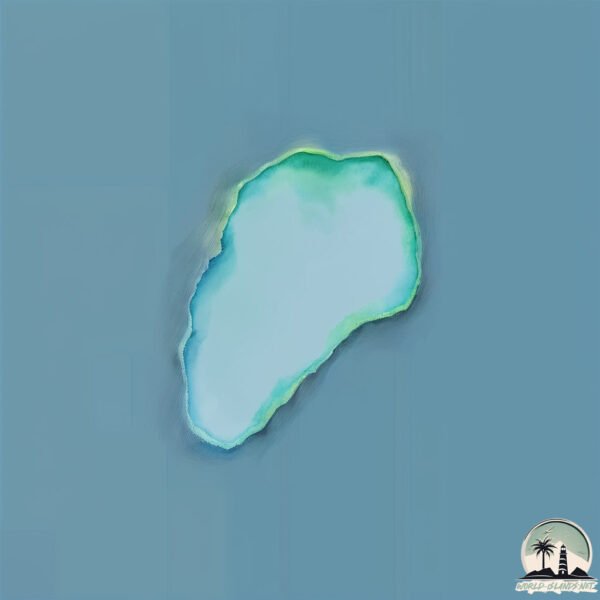
Geography and size of Pollap
Size: 0.716 km²
Coastline: 3.4 km
Ocean: Pacific Ocean
Sea: North Pacific Ocean
Continent: Oceania
Pollap is a Tiny Island spanning 0.716 km² with a coastline of 3.4 km.
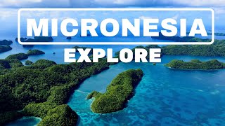
Archipel: Micronesia – A region in the western Pacific Ocean comprising thousands of small islands, known for their unique cultures, languages, and marine ecosystems.
Tectonic Plate: Pacific – The world’s largest tectonic plate, covering much of the Pacific Ocean, known for the Pacific Ring of Fire with extensive seismic and volcanic activity.
The geographic heart of the island is pinpointed at these coordinates:
Latitude: 7.63793194 / Longitude: 149.42940909
Climate and weather of Pollap
Climate Zone: Tropical
Climate Details: Tropical Rainforest Climate
Temperature: Hot
Climate Characteristics: This climate is typified by heavy rainfall throughout the year, high humidity, and consistently high temperatures, leading to lush rainforests and rich biodiversity. Seasonal temperature variations are minimal.
Topography and nature of Pollap
Timezone: UTC+10:00
Timezone places: Australia/Sydney
Max. Elevation: 6 m
Mean Elevation: 3 m
Vegetation: Evergreen Broadleaf Forest
Tree Coverage: 90%
The mean elevation is 3 m. The highest elevation on the island reaches approximately 6 meters above sea level. The island is characterized by Plains: Flat, low-lying lands characterized by a maximum elevation of up to 200 meters. On islands, plains are typically coastal lowlands or central flat areas.
Dominating Vegetation: Evergreen Broadleaf Forest
Characterized by dense, lush canopies of broadleaf trees that retain their leaves year-round. These forests are typically found in tropical and subtropical regions and are known for their high biodiversity. Pollap has a tree cover of 90 %.
Vegetation: 1 vegetation zones – Minimal Diversity Island
These islands exhibit the most basic level of ecological diversity, often characterized by a single dominant vegetation type. This could be due to extreme environmental conditions, limited land area, or significant human impact. They represent unique ecosystems where specific species have adapted to thrive in these singular environments.
Infrastructure and Travelling to Pollap
Does the island have a public airport? no.
There is no public and scheduled airport on Pollap. The nearest airport is Chuuk International Airport, located 268 km away.
Does the island have a major port? no.
There are no major ports on Pollap. The closest major port is MOEN, approximately 268 km away.
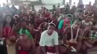
The mean population of Pollap is 1765 per km². Pollap is Densely Populated. The island belongs to Federated States of Micronesia.
Continuing your journey, Polle Island is the next notable island, situated merely km away.
Pollap Island - Micronesia


Federated States of Micronesia is classified as Developing region: Regions characterized by lower income levels, with economies in the process of industrialization and modernization. The level of income is Lower middle income.
News – Latest Updates and Headlines from Pollap
Stay informed with the most recent news and important headlines from Pollap. Here’s a roundup of the latest developments.
Please note: The data used here has been primarily extracted from satellite readings. Deviations from exact values may occur, particularly regarding the height of elevations and population density. Land area and coastline measurements refer to average values at mean high tide.