Prince Edward
Welcome to Prince Edward, a Continental island in the Gulf of St. Lawrence, part of the majestic Atlantic Ocean. This guide offers a comprehensive overview of what makes Prince Edward unique – from its geography and climate to its population, infrastructure, and beyond. Dive into the details:
- Geography and Size: Explore the island’s size and location.
- Climate and Weather: Weather patterns and temperature.
- Topography and Nature: Uncover the natural wonders of the island.
- Infrastructure and Travelling: Insights on reaching, staying, and making the most of your visit.
- News and Headlines: Latest News.
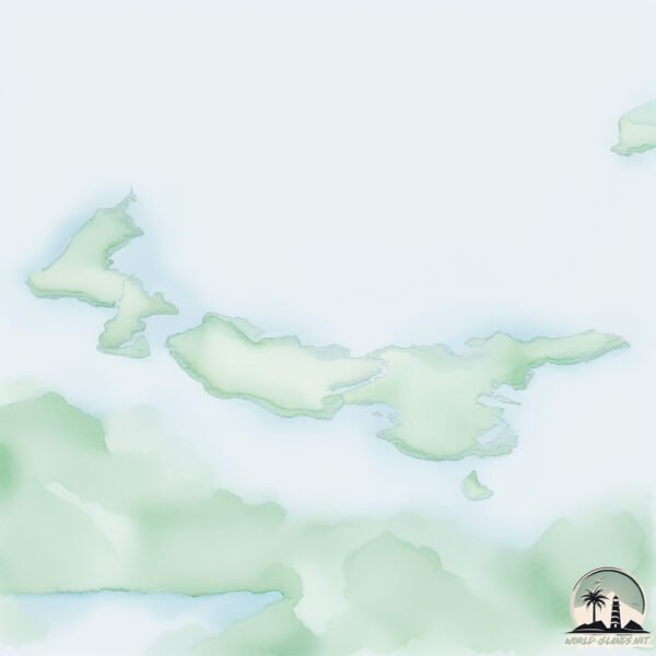
Geography and size of Prince Edward
Size: 5741 km²
Coastline: 1797 km
Ocean: Atlantic Ocean
Sea: Gulf of St. Lawrence
Continent: North America
Prince Edward is a Very Large Island spanning 5741 km² with a coastline of 1797 km.
Archipel: –
Tectonic Plate: North America – Covers North America and parts of the Atlantic and Arctic Oceans, characterized by diverse geological features and varying levels of seismic activity.
The geographic heart of the island is pinpointed at these coordinates:
Latitude: 46.38976165 / Longitude: -63.24311999
Climate and weather of Prince Edward
Climate Zone: Continental
Climate Details: Warm-Summer Humid Continental Climate
Temperature: Warm Summer
Climate Characteristics: Features warm summers and cold winters with consistent precipitation, common in higher latitudes.
Topography and nature of Prince Edward
Timezone: UTC-04:00
Timezone places: America/La_Paz
Max. Elevation: 131 m
Mean Elevation: 31 m
Vegetation: Agricultural Mosaic
Tree Coverage: 37%
The mean elevation is 31 m. The highest elevation on the island reaches approximately 131 meters above sea level. The island is characterized by Plains: Flat, low-lying lands characterized by a maximum elevation of up to 200 meters. On islands, plains are typically coastal lowlands or central flat areas.
Dominating Vegetation: Agricultural Mosaic
A mix of cropland and natural vegetation, often seen in rural landscapes where agricultural fields are interspersed with patches of natural habitats. Prince Edward has a tree cover of 37 %.
Vegetation: 14 vegetation zones – Exceptionally Diverse Island
Islands with more than ten vegetation zones are among the most ecologically rich and varied in the world. These islands are akin to miniature continents, boasting an incredible array of ecosystems. The sheer range of habitats, from high peaks to deep valleys, rainforests to deserts, creates a mosaic of life that is unparalleled. They are crucial for conservation and ecological studies.
Infrastructure and Travelling to Prince Edward
Does the island have a public airport? yes.
Prince Edward has a public and scheduled airport. The following airports are located on this island: Charlottetown Airport.
Does the island have a major port? yes.
Prince Edward is home to a major port. The following ports are situated on the island: CHARLOTTETOWN, GEORGETOWN, SUMMERSIDE.
The mean population of Prince Edward is 27 per km². Prince Edward is Gently Populated. The island belongs to Canada.
The name of the island resonates across different cultures and languages. Here is how it is known around the world: Arabic: جزيرة الأمير إدوارد; German: Prinz-Edward-Insel; Spanish: Isla del Príncipe Eduardo; French: île du Prince-Édouard; Portuguese: Ilha do Príncipe Eduardo; Russian: остров Принца Эдуарда; Chinese: 爱德华王子岛
Continuing your journey, Pictou Island is the next notable island, situated merely km away.
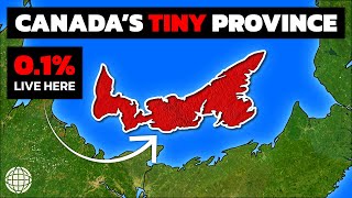
PRINCE EDWARD ISLAND | ULTIMATE TRAVEL GUIDE | CANADA


Canada is classified as Developed region: G7: Group of Seven – Major advanced economies, including Canada, France, Germany, Italy, Japan, the United Kingdom, and the United States. The level of income is High income: OECD.
News – Latest Updates and Headlines from Prince Edward
Stay informed with the most recent news and important headlines from Prince Edward. Here’s a roundup of the latest developments.
Social Media Posts about Prince Edward
Please note: The data used here has been primarily extracted from satellite readings. Deviations from exact values may occur, particularly regarding the height of elevations and population density. Land area and coastline measurements refer to average values at mean high tide.