Prosper Island
Welcome to Prosper Island, a Continental island in the Gulf of St. Lawrence, part of the majestic Atlantic Ocean. This guide offers a comprehensive overview of what makes Prosper Island unique – from its geography and climate to its population, infrastructure, and beyond. Dive into the details:
- Geography and Size: Explore the island’s size and location.
- Climate and Weather: Weather patterns and temperature.
- Topography and Nature: Uncover the natural wonders of the island.
- Infrastructure and Travelling: Insights on reaching, staying, and making the most of your visit.
- News and Headlines: Latest News.
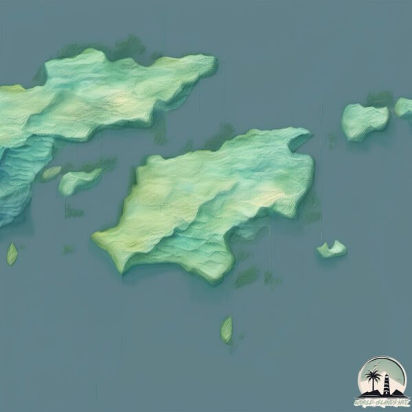
Geography and size of Prosper Island
Size: 1.987 km²
Coastline: 11.7 km
Ocean: Atlantic Ocean
Sea: Gulf of St. Lawrence
Continent: North America
Prosper Island is a Small Island spanning 2 km² with a coastline of 11.7 km.
Archipel: –
Tectonic Plate: North America – Covers North America and parts of the Atlantic and Arctic Oceans, characterized by diverse geological features and varying levels of seismic activity.
The geographic heart of the island is pinpointed at these coordinates:
Latitude: 51.59887732 / Longitude: -55.8436603
Climate and weather of Prosper Island
Climate Zone: Continental
Climate Details: Subarctic Climate
Temperature: Cold Summer
Climate Characteristics: Characterized by long, extremely cold winters and short, cool summers, often found in northern latitudes of North America and Eurasia.
Topography and nature of Prosper Island
Timezone: UTC-03:30
Timezone places: America/St_Johns
Max. Elevation: 4 m
Mean Elevation: 3 m
Vegetation: Herbaceous Cover
Tree Coverage: 22%
The mean elevation is 3 m. The highest elevation on the island reaches approximately 4 meters above sea level. The island is characterized by Plains: Flat, low-lying lands characterized by a maximum elevation of up to 200 meters. On islands, plains are typically coastal lowlands or central flat areas.
Dominating Vegetation: Herbaceous Cover
Comprising mainly of grasses, herbs, and ferns, these areas are common in prairies, meadows, and savannas, and can vary widely in species composition. Prosper Island has a tree cover of 22 %.
Vegetation: 3 vegetation zones – Moderately Diverse Island
These islands start to show a broader range of ecological niches. With three vegetation zones, they may offer a mix of ecosystems like coastal areas, inland woods, and perhaps a distinct wetland or dry area. This diversity supports a wider range of flora and fauna, making these islands more ecologically complex than those with minimal diversity.
Infrastructure and Travelling to Prosper Island
Does the island have a public airport? no.
There is no public and scheduled airport on Prosper Island. The nearest airport is St. Anthony Airport, located 34 km away.
Does the island have a major port? no.
There are no major ports on Prosper Island. The closest major port is BLANC SABLON, approximately 143 km away.
The mean population of Prosper Island is 3 per km². Prosper Island is Gently Populated. The island belongs to Canada.
Continuing your journey, Belle Isle is the next notable island, situated merely km away.
Canada is classified as Developed region: G7: Group of Seven – Major advanced economies, including Canada, France, Germany, Italy, Japan, the United Kingdom, and the United States. The level of income is High income: OECD.
News – Latest Updates and Headlines from Prosper Island
Stay informed with the most recent news and important headlines from Prosper Island. Here’s a roundup of the latest developments.
- Belle Isle Casino to reopen after 5-year renovation; new island projects on tap - Crain's Detroit Businessby "Belle Isle island" - Google News on 11 March 2026
Belle Isle Casino to reopen after 5-year renovation; new island projects on tap Crain's Detroit Business
- More than "Just a park" - Rebranding Detroit's Iconic Belle Isle - Little Black Book | LBBOnlineby "Belle Isle island" - Google News on 9 March 2026
More than "Just a park" - Rebranding Detroit's Iconic Belle Isle Little Black Book | LBBOnline
- Belle Isle Casino Swings Back Open As 313 Day Takes Over The Island - Hoodlineby "Belle Isle island" - Google News on 8 March 2026
Belle Isle Casino Swings Back Open As 313 Day Takes Over The Island Hoodline
- Belle Isle Marks 313 Day With Free Family Events and Reopening of Historic Casino - The Michigan Chronicleby "Belle Isle island" - Google News on 8 March 2026
Belle Isle Marks 313 Day With Free Family Events and Reopening of Historic Casino The Michigan Chronicle
- 5 Leadership Decisions High-Performing Operators Make Every Day (Panel Discussion at Prosper Forum, Ritz-Carlton Amelia Island) - California Employment Law Reportby "Prosper Island island" - Google News on 13 February 2026
5 Leadership Decisions High-Performing Operators Make Every Day (Panel Discussion at Prosper Forum, Ritz-Carlton Amelia Island) California Employment Law Report
- Flor de Cuba, about those who thrive on the island: “Living better in a prison does not mean loving the prison.” - CiberCubaby "Prosper Island island" - Google News on 4 February 2026
Flor de Cuba, about those who thrive on the island: “Living better in a prison does not mean loving the prison.” CiberCuba
- Mauritius’ claim to disputed islands concerns Chagos community in Seychelles - Seychelles News Agencyby "Prosper Island island" - Google News on 3 February 2026
Mauritius’ claim to disputed islands concerns Chagos community in Seychelles Seychelles News Agency
- Chagossian islanders' court case scheduled for May hearing in U.K. - Seychelles News Agencyby "Prosper Island island" - Google News on 3 February 2026
Chagossian islanders' court case scheduled for May hearing in U.K. Seychelles News Agency
- Seychelles-based Chagossians refuse to take part in visits to the Chagos islands - Seychelles News Agencyby "Prosper Island island" - Google News on 2 February 2026
Seychelles-based Chagossians refuse to take part in visits to the Chagos islands Seychelles News Agency
- Shiver on the River coming to Detroit's Belle Isle on Feb. 1 - Michigan State Universityby "Belle Isle island" - Google News on 1 February 2026
Shiver on the River coming to Detroit's Belle Isle on Feb. 1 Michigan State University
Please note: The data used here has been primarily extracted from satellite readings. Deviations from exact values may occur, particularly regarding the height of elevations and population density. Land area and coastline measurements refer to average values at mean high tide.