Puerto Rico
Welcome to Puerto Rico, a Tropical island in the Caribbean Sea, part of the majestic Atlantic Ocean. This guide offers a comprehensive overview of what makes Puerto Rico unique – from its geography and climate to its population, infrastructure, and beyond. Dive into the details:
- Geography and Size: Explore the island’s size and location.
- Climate and Weather: Weather patterns and temperature.
- Topography and Nature: Uncover the natural wonders of the island.
- Infrastructure and Travelling: Insights on reaching, staying, and making the most of your visit.
- News and Headlines: Latest News.
Geography and size of Puerto Rico
Size: 8759 km²
Coastline: 742 km
Ocean: Atlantic Ocean
Sea: Caribbean Sea
Continent: North America
Puerto Rico is a Very Large Island spanning 8759 km² with a coastline of 742 km.
Archipel: Greater Antilles – A major island group in the Caribbean, including Cuba, Jamaica, Hispaniola, and Puerto Rico, known for their rich history and diverse cultures.
Tectonic Plate: Caribbean – Covering the Caribbean Sea and surrounding regions, this plate is bordered by the North American Plate and the South American Plate. Known for seismic activity, including earthquakes and volcanic eruptions, and features like the Puerto Rico Trench.
The geographic heart of the island is pinpointed at these coordinates:
Latitude: 18.22465235 / Longitude: -66.47941894
Climate and weather of Puerto Rico
Climate Zone: Tropical
Climate Details: Tropical Rainforest Climate
Temperature: Hot
Climate Characteristics: This climate is typified by heavy rainfall throughout the year, high humidity, and consistently high temperatures, leading to lush rainforests and rich biodiversity. Seasonal temperature variations are minimal.
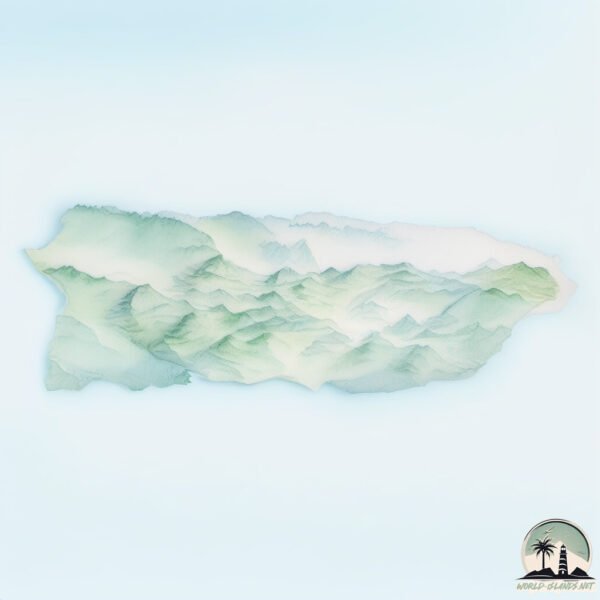
Topography and nature of Puerto Rico
Timezone: UTC-04:00
Timezone places: America/La_Paz
Max. Elevation: 1224 m
Mean Elevation: 240 m
Vegetation: Evergreen Broadleaf Forest
Tree Coverage: 42%
The mean elevation is 240 m. The highest elevation on the island reaches approximately 1224 meters above sea level. The island is characterized by Plateau: Elevated flatlands rising sharply above the surrounding area, with a maximum elevation over 500 meters but a mean elevation less than 300 meters, forming unique highland areas on islands.
Dominating Vegetation: Evergreen Broadleaf Forest
Characterized by dense, lush canopies of broadleaf trees that retain their leaves year-round. These forests are typically found in tropical and subtropical regions and are known for their high biodiversity. Puerto Rico has a tree cover of 42 %.
Vegetation: 15 vegetation zones – Exceptionally Diverse Island
Islands with more than ten vegetation zones are among the most ecologically rich and varied in the world. These islands are akin to miniature continents, boasting an incredible array of ecosystems. The sheer range of habitats, from high peaks to deep valleys, rainforests to deserts, creates a mosaic of life that is unparalleled. They are crucial for conservation and ecological studies.
Infrastructure and Travelling to Puerto Rico
Does the island have a public airport? yes.
Puerto Rico has a public and scheduled airport. The following airports are located on this island: Rafael Hernández International Airport, Fernando Luis Ribas Dominicci Airport, Eugenio Maria De Hostos Airport, Mercedita Airport, José Aponte de la Torre Airport, Luis Munoz Marin International Airport.
Does the island have a major port? yes.
Puerto Rico is home to a major port. The following ports are situated on the island: AGUADILLA, SAN JUAN, BAHIA DE FAJARDO, ENSENADA HONDA, PLAYA DE HUMACAO, PUERTO YABUCOA, ARROYO, LAS MAREAS, PLAYA DE PONCE, PLAYA DE GUAYANILLA, PLAYA DE GUANICA, MAYAGUEZ.
The mean population of Puerto Rico is 423 per km². Puerto Rico is Moderately Inhabited. The island belongs to United States of America.
The name of the island resonates across different cultures and languages. Here is how it is known around the world: Arabic: بورتوريكو; German: Puerto Rico; Spanish: Puerto Rico; French: Porto Rico; Portuguese: Porto Rico; Russian: Пуэрто-Рико; Chinese: 波多黎各地理
Continuing your journey, Viegues is the next notable island, situated merely km away.
10 Best Places To Visit In Puerto Rico


United States of America is classified as Developed region: G7: Group of Seven – Major advanced economies, including Canada, France, Germany, Italy, Japan, the United Kingdom, and the United States. The level of income is High income: OECD.
News – Latest Updates and Headlines from Puerto Rico
Stay informed with the most recent news and important headlines from Puerto Rico. Here’s a roundup of the latest developments.
Social Media Posts about Puerto Rico
Please note: The data used here has been primarily extracted from satellite readings. Deviations from exact values may occur, particularly regarding the height of elevations and population density. Land area and coastline measurements refer to average values at mean high tide.