Welcome to Pulau Baam, a Tropical island in the Ceram Sea, part of the majestic Pacific Ocean. This guide offers a comprehensive overview of what makes Pulau Baam unique – from its geography and climate to its population, infrastructure, and beyond. Dive into the details:
Geography and size of Pulau Baam
Size: 1.264 km²
Coastline: 5.5 km
Ocean: Pacific Ocean
Sea: Ceram Sea
Continent: Oceania
Pulau Baam is a Small Island spanning 1.3 km² with a coastline of 5.5 km.
Archipel: Melanesia – A subregion of Oceania in the southwestern Pacific Ocean, including countries like Fiji, Solomon Islands, and Vanuatu, known for their diverse cultures and languages.
Tectonic Plate: Pacific – The world’s largest tectonic plate, covering much of the Pacific Ocean, known for the Pacific Ring of Fire with extensive seismic and volcanic activity.
The geographic heart of the island is pinpointed at these coordinates:
Latitude: -4.59311124 / Longitude: 131.69541647
Climate and weather of Pulau Baam
Climate Zone: Tropical
Climate Details: Tropical Rainforest Climate
Temperature: Hot
Climate Characteristics: This climate is typified by heavy rainfall throughout the year, high humidity, and consistently high temperatures, leading to lush rainforests and rich biodiversity. Seasonal temperature variations are minimal.
Topography and nature of Pulau Baam
Timezone: UTC+09:00
Timezone places: Asia/Tokyo
Max. Elevation: 20 m
Mean Elevation: 2 m
Vegetation: Open Woodland
Tree Coverage: 83%
The mean elevation is 2 m. The highest elevation on the island reaches approximately 20 meters above sea level. The island is characterized by Plains: Flat, low-lying lands characterized by a maximum elevation of up to 200 meters. On islands, plains are typically coastal lowlands or central flat areas.
Dominating Vegetation: Open Woodland
Characterized by sparsely distributed trees with open canopy allowing sunlight to penetrate, supporting grasses and shrubs underneath. Often found in drier or transitional environments. Pulau Baam has a tree cover of 83 %.
Vegetation: 4 vegetation zones – Diverse Island
Four distinct vegetation zones mark these islands as ecologically diverse. They might feature varied landscapes such as forests, beaches, grasslands, and rocky areas. Such diversity reflects the island’s complex ecological interactions and varied habitats, which can support a rich array of wildlife and plant species.
Infrastructure and Travelling to Pulau Baam
Does the island have a public airport? no.
There is no public and scheduled airport on Pulau Baam. The nearest airport is Karel Sadsuitubun Airport, located 174 km away.
Does the island have a major port? no.
There are no major ports on Pulau Baam. The closest major port is FAKFAK, approximately 195 km away.
The mean population of Pulau Baam is 22 per km². Pulau Baam is Gently Populated. The island belongs to Indonesia.
Continuing your journey, Pulau Kisyui is the next notable island, situated merely km away.
BATAM ISLAND, INDONESIA - Popular with Asians but not Western tourists!
In today's Batam Island video, we take you on an adventure to a destination often overlooked by tourists but packed with hidden ...BATAM ISLAND, INDONESIA - Popular with Asians but not Western tourists!
In today's Batam Island video, we take you on an adventure to a ...
In today's Batam Island video, we take you on an adventure to a destination often overlooked by tourists but packed with hidden ...
🇮🇩 Why do men always go to Batam?
Let's hop on the quick ferry from Singapore to Batam to find out ...
Let's hop on the quick ferry from Singapore to Batam to find out #singapore #batam #ferry #singapore #travel #sea ...
Is Batam Island the new Bali?
Today I am discussing Batam Island in Indonesia. Is this island the ...
Today I am discussing Batam Island in Indonesia. Is this island the new Bali? #indonesia #batamisland #batam.
Top 30 Places to Visit in Batam Indonesia - Updated 2023 List
batam #batamindonesia #singaporetobatam Top 30 places in Batam ...
batam #batamindonesia #singaporetobatam Top 30 places in Batam Indonesia - Updated latest in 2023 1. Take a shopping trip ...
MENARIK DI KUNJUNGI!! INILAH 7 WISATA PALING POPULER DI BATAM KEPULAUAN RIAU
Kota Batam, Kepulauan Riau, menyajikan keindahan alam dan budaya yang ...
Kota Batam, Kepulauan Riau, menyajikan keindahan alam dan budaya yang sangat menarik bagi wisatawan. Ada banyak tempat ...
Top 10 Must-Visit Places in Batam, Indonesia! 🇮🇩
Discover the beautiful island of Batam, Indonesia with our guide to ...
Discover the beautiful island of Batam, Indonesia with our guide to the top 10 must-visit spots! From the stunning Barelang Bridge ...
NIRUP ISLAND | Amazing Batam
Udah nonton PROGRAM lainnya BATAM TELEVISI, belum? ...
Udah nonton PROGRAM lainnya BATAM TELEVISI, belum? ==================== JANGAN LUPA DI SUBSCRIBE YA ...
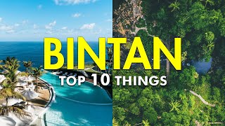
Top 10 best things in BINTAN Getaway| Bintan Travel Guide
Discover the wonders of a Bintan getaway! Delve into our ultimate ...
Discover the wonders of a Bintan getaway! Delve into our ultimate Bintan travel guide as we unveil the best things Bintan has to ...
Travelog Ep-13 : Batam - Diluar Sangkaanku | Jelajah 7 Pulau 6 Jambatan
Ingin bercuti murah ke Indonesia? Tidak perlu menaiki kapal terbang ...
Ingin bercuti murah ke Indonesia? Tidak perlu menaiki kapal terbang dengan hanya menaiki feri sahaja bagi menjimatkan kos ...
Ultimate Batam Travel Guide! 🇮🇩 Best 3D2N Itinerary & Tips
Planning a trip to Batam? Here's the perfect 3D2N itinerary! 🏝️✨ Batam ...
Planning a trip to Batam? Here's the perfect 3D2N itinerary! 🏝️✨ Batam is one of the most popular getaway destinations from ...
The SAR Team Continues To Search For Victims Of The Fast Boat Accident In The Waters Baam Island
Badan SAR telah mengerahkan pesawat dan kapal untuk mencari delapan ...
Badan SAR telah mengerahkan pesawat dan kapal untuk mencari delapan dari 13 korban kecelakaan kapal cepat di perairan ...
Things to do in Batam 🇮🇩 #travel #indonesia
The Top 3 Malls in Batam, Indonesia — which one have you been to? #batam #batamtravel #indonesia
The best place for a short getaway!! #batam #travel #travelvlog
SINGAPORE TO BINTAN, INDONESIA 🇮🇩 BY FERRY #singapore #indonesia #bintan #island #ferry
THIS IS RANOH ISLAND in Batam, Indonesia💦
Meet This Singaporean Living in Batam
Most of us lament having to travel to far-flung places such as Jurong ...
Most of us lament having to travel to far-flung places such as Jurong and Tampines for work. Then there are Singaporeans like Ali, ...
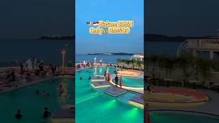
Batam travel guide 3D2N only 💰400 #batam #batamvlog #batamtravel #travelvlog #traveling
pantai wisata di batam..ayo merapat kesana kawan
Is Batam Island the new Bali of Indonesia? You decide!
Today I am touring Batam Island, Indonesia for one last time. In the ...
Today I am touring Batam Island, Indonesia for one last time. In the morning I enjoy a buffet breakfast at the Pacific Palace Hotel.
Batam - Things You Should Know Before Going There
If you're planning on going to Indonesia, Batam, then here we have ...
If you're planning on going to Indonesia, Batam, then here we have listed some tips and tricks to help you get the best out of your ...
My 1st Time In Indonesia 🇮🇩 Batam 1st Impressions
I'm finally in Indonesia! Batam Island first impressions! Previous ...
I'm finally in Indonesia! Batam Island first impressions! Previous video from Sentosa Island, Singapore ...
Batam ISLAND #shortvideo #drone #dji #vlogujangcell #batam2025 #travel #explorebatam
Batam ISLAND #shortvideo #drone #dji #vlogujangcell #batam2025 #travel ...
Batam ISLAND #shortvideo #drone #dji #vlogujangcell #batam2025 #travel #explorebatam.
How to Travel from Singapore to Batam | Step-by-Step Guide |
How to Travel from Singapore to Batam | Step-by-Step Guide Planning a ...
How to Travel from Singapore to Batam | Step-by-Step Guide Planning a trip from Singapore to Batam, Indonesia? In this video, I'll ...
10 Must-Do Activities in Batam #travel
Just 40 minutes from Singapore, Batam is the perfect weekend escape! ...
Just 40 minutes from Singapore, Batam is the perfect weekend escape! From relaxing spas to island hopping and amazing ...
Indonesia is classified as Emerging region: MIKT: Mexico, Indonesia, South Korea, and Turkey – Economies recognized for their development potential and emerging market status. The level of income is Lower middle income.
News – Latest Updates and Headlines from Pulau Baam
Stay informed with the most recent news and important headlines from Pulau Baam. Here’s a roundup of the latest developments.
Loading...
Please note: The data used here has been primarily extracted from satellite readings. Deviations from exact values may occur, particularly regarding the height of elevations and population density. Land area and coastline measurements refer to average values at mean high tide.