Pulau Bajo
Welcome to Pulau Bajo, a Tropical island in the Flores Sea, part of the majestic Pacific Ocean. This guide offers a comprehensive overview of what makes Pulau Bajo unique – from its geography and climate to its population, infrastructure, and beyond. Dive into the details:
- Geography and Size: Explore the island’s size and location.
- Climate and Weather: Weather patterns and temperature.
- Topography and Nature: Uncover the natural wonders of the island.
- Infrastructure and Travelling: Insights on reaching, staying, and making the most of your visit.
- News and Headlines: Latest News.
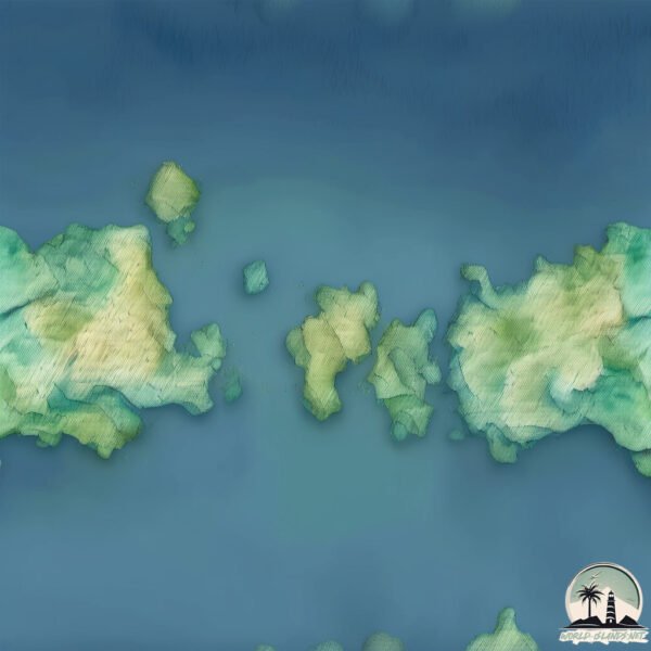
Geography and size of Pulau Bajo
Size: 0.268 km²
Coastline: 2.4 km
Ocean: Pacific Ocean
Sea: Flores Sea
Continent: Asia
Pulau Bajo is a Tiny Island spanning 0.268 km² with a coastline of 2.4 km.
Archipel: Malay Archipelago – The world’s largest archipelago, located between mainland Southeast Asia and Australia, known for its immense biodiversity and cultural diversity.
Tectonic Plate: Sunda – Extends across Southeast Asia, encompassing parts of the Sunda Shelf, known for its interaction with the Australian Plate, contributing to volcanic activity in Indonesia.
The geographic heart of the island is pinpointed at these coordinates:
Latitude: -8.51102215 / Longitude: 119.64449333
Climate and weather of Pulau Bajo
Climate Zone: Tropical
Climate Details: Tropical Savanna, Wet
Temperature: Hot
Climate Characteristics: Defined by distinct wet and dry seasons with high temperatures year-round. Pronounced rainfall occurs during the wet season, while the dry season is marked by drought.
Topography and nature of Pulau Bajo
Timezone: UTC+08:00
Timezone places: Australia/Perth
Max. Elevation: 17 m
Mean Elevation: 0 m
Vegetation: Sparse Vegetation
Tree Coverage: 64%
The mean elevation is 0 m. The highest elevation on the island reaches approximately 17 meters above sea level. The island is characterized by Plains: Flat, low-lying lands characterized by a maximum elevation of up to 200 meters. On islands, plains are typically coastal lowlands or central flat areas.
Dominating Vegetation: Sparse Vegetation
These regions have limited plant growth, typically due to extreme conditions like aridity or poor soils. Vegetation is scattered and consists of hardy plant species. Pulau Bajo has a tree cover of 64 %.
Vegetation: 4 vegetation zones – Diverse Island
Four distinct vegetation zones mark these islands as ecologically diverse. They might feature varied landscapes such as forests, beaches, grasslands, and rocky areas. Such diversity reflects the island’s complex ecological interactions and varied habitats, which can support a rich array of wildlife and plant species.
Infrastructure and Travelling to Pulau Bajo
Does the island have a public airport? no.
There is no public and scheduled airport on Pulau Bajo. The nearest airport is Komodo Airport, located 2 km away.
Does the island have a major port? no.
There are no major ports on Pulau Bajo. The closest major port is WAINGAPU, approximately 132 km away.
The mean population of Pulau Bajo is 96 per km². Pulau Bajo is Gently Populated. The island belongs to Indonesia.
The name of the island resonates across different cultures and languages. Here is how it is known around the world: Arabic: سومباوا; German: Sumbawa; Spanish: Sumbawa; French: Sumbawa; Portuguese: Sumbawa; Russian: Сумбава; Chinese: 松巴哇島
Continuing your journey, Rinca is the next notable island, situated merely km away.
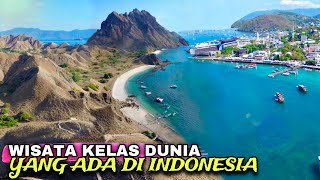
TEMPAT WISATA DI LABUAN BAJO YANG WAJIB DI KUNJUNGI | TRIP KOMODO ISLAND 2023


Indonesia is classified as Emerging region: MIKT: Mexico, Indonesia, South Korea, and Turkey – Economies recognized for their development potential and emerging market status. The level of income is Lower middle income.
News – Latest Updates and Headlines from Pulau Bajo
Stay informed with the most recent news and important headlines from Pulau Bajo. Here’s a roundup of the latest developments.
Please note: The data used here has been primarily extracted from satellite readings. Deviations from exact values may occur, particularly regarding the height of elevations and population density. Land area and coastline measurements refer to average values at mean high tide.