Pulau Benglaut
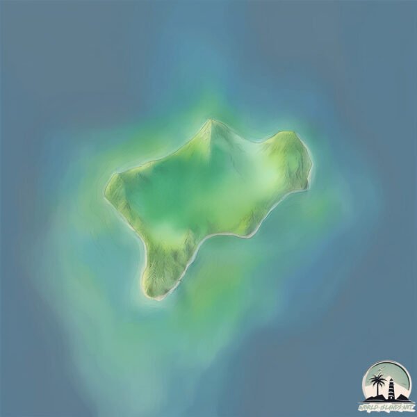
Welcome to Pulau Benglaut, a Tropical island in the Philippine Sea, part of the majestic Pacific Ocean. This guide offers a comprehensive overview of what makes Pulau Benglaut unique – from its geography and climate to its population, infrastructure, and beyond. Dive into the details:
- Geography and Size: Explore the island’s size and location.
- Climate and Weather: Weather patterns and temperature.
- Topography and Nature: Uncover the natural wonders of the island.
- Infrastructure and Travelling: Insights on reaching, staying, and making the most of your visit.
- News and Headlines: Latest News.
Geography and size of Pulau Benglaut
Size: 0.452 km²
Coastline: 3.1 km
Ocean: Pacific Ocean
Sea: Philippine Sea
Continent: Asia
Pulau Benglaut is a Tiny Island spanning 0.452 km² with a coastline of 3.1 km.
Archipel: Malay Archipelago – The world’s largest archipelago, located between mainland Southeast Asia and Australia, known for its immense biodiversity and cultural diversity.
Tectonic Plate: Sunda – Extends across Southeast Asia, encompassing parts of the Sunda Shelf, known for its interaction with the Australian Plate, contributing to volcanic activity in Indonesia.
The geographic heart of the island is pinpointed at these coordinates:
Latitude: 3.48080739 / Longitude: 125.73189976
Climate and weather of Pulau Benglaut
Climate Zone: Tropical
Climate Details: Tropical Rainforest Climate
Temperature: Hot
Climate Characteristics: This climate is typified by heavy rainfall throughout the year, high humidity, and consistently high temperatures, leading to lush rainforests and rich biodiversity. Seasonal temperature variations are minimal.
Topography and nature of Pulau Benglaut
Timezone: UTC+08:00
Timezone places: Australia/Perth
Max. Elevation: -29 m
Mean Elevation: -32 m
Vegetation: Open Woodland
Tree Coverage: 89%
The mean elevation is -32 m. Remarkably, this unique island barely emerges above the sea level, showcasing nature’s fascinating interplay with the ocean. The island is characterized by Plains: Flat, low-lying lands characterized by a maximum elevation of up to 200 meters. On islands, plains are typically coastal lowlands or central flat areas.
Dominating Vegetation: Open Woodland
Characterized by sparsely distributed trees with open canopy allowing sunlight to penetrate, supporting grasses and shrubs underneath. Often found in drier or transitional environments. Pulau Benglaut has a tree cover of 89 %.
Vegetation: 2 vegetation zones – Low Diversity Island
Islands with two distinct vegetation zones offer slightly more ecological variety. These zones could be due to differences in elevation, moisture, or other environmental factors. While still limited in biodiversity, these islands may offer a contrast between the two zones, such as a coastline with mangroves and an inland area with grassland.
Infrastructure and Travelling to Pulau Benglaut
Does the island have a public airport? no.
There is no public and scheduled airport on Pulau Benglaut. The nearest airport is Naha Airport, located 32 km away.
Does the island have a major port? no.
There are no major ports on Pulau Benglaut. The closest major port is TAHUNA, approximately 31 km away.
The mean population of Pulau Benglaut is 141 per km². Pulau Benglaut is Moderately Inhabited. The island belongs to Indonesia.
Continuing your journey, Sangir is the next notable island, situated merely km away.
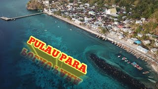
Unboxing menuju pulau beng laut, beng darat bersama ungke sanger


Indonesia is classified as Emerging region: MIKT: Mexico, Indonesia, South Korea, and Turkey – Economies recognized for their development potential and emerging market status. The level of income is Lower middle income.
News – Latest Updates and Headlines from Pulau Benglaut
Stay informed with the most recent news and important headlines from Pulau Benglaut. Here’s a roundup of the latest developments.
Please note: The data used here has been primarily extracted from satellite readings. Deviations from exact values may occur, particularly regarding the height of elevations and population density. Land area and coastline measurements refer to average values at mean high tide.