Pulau Bojo
Welcome to Pulau Bojo, a Tropical island in the Indian Ocean, part of the majestic Indian Ocean. This guide offers a comprehensive overview of what makes Pulau Bojo unique – from its geography and climate to its population, infrastructure, and beyond. Dive into the details:
- Geography and Size: Explore the island’s size and location.
- Climate and Weather: Weather patterns and temperature.
- Topography and Nature: Uncover the natural wonders of the island.
- Infrastructure and Travelling: Insights on reaching, staying, and making the most of your visit.
- News and Headlines: Latest News.
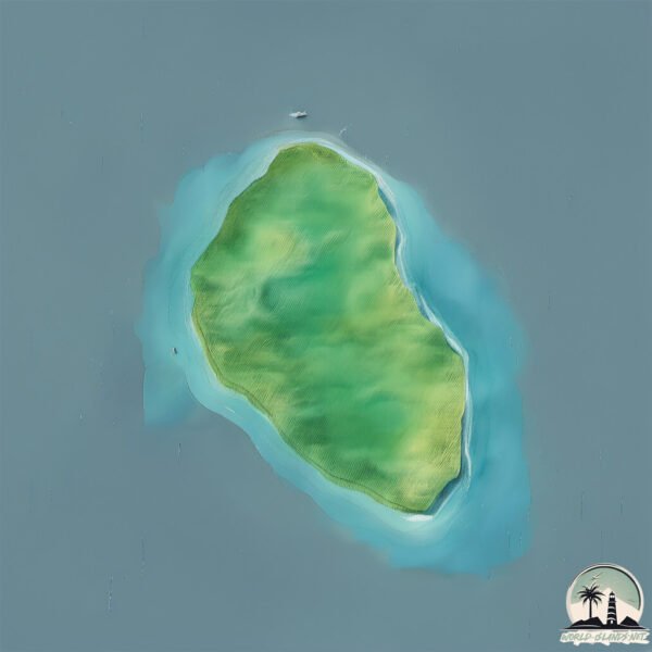
Geography and size of Pulau Bojo
Size: 11.3 km²
Coastline: 13.8 km
Ocean: Indian Ocean
Sea: Indian Ocean
Continent: Asia
Pulau Bojo is a Medium Island spanning 11 km² with a coastline of 14 km.
Archipel: Malay Archipelago – The world’s largest archipelago, located between mainland Southeast Asia and Australia, known for its immense biodiversity and cultural diversity.
Tectonic Plate: India – A major tectonic plate that initially moved northward at a rapid pace before colliding with the Eurasian Plate. This collision is responsible for the uplift of the Himalayas and the Tibetan Plateau.
The geographic heart of the island is pinpointed at these coordinates:
Latitude: -0.61722895 / Longitude: 98.50528661
Climate and weather of Pulau Bojo
Climate Zone: Tropical
Climate Details: Tropical Rainforest Climate
Temperature: Hot
Climate Characteristics: This climate is typified by heavy rainfall throughout the year, high humidity, and consistently high temperatures, leading to lush rainforests and rich biodiversity. Seasonal temperature variations are minimal.
Topography and nature of Pulau Bojo
Timezone: UTC+07:00
Timezone places: Asia/Jakarta
Max. Elevation: 91 m
Mean Elevation: 42 m
Vegetation: Evergreen Broadleaf Forest
Tree Coverage: 85%
The mean elevation is 42 m. The highest elevation on the island reaches approximately 91 meters above sea level. The island is characterized by Plains: Flat, low-lying lands characterized by a maximum elevation of up to 200 meters. On islands, plains are typically coastal lowlands or central flat areas.
Dominating Vegetation: Evergreen Broadleaf Forest
Characterized by dense, lush canopies of broadleaf trees that retain their leaves year-round. These forests are typically found in tropical and subtropical regions and are known for their high biodiversity. Pulau Bojo has a tree cover of 85 %.
Vegetation: 7 vegetation zones – Very Highly Diverse Island
Islands in this range are ecological powerhouses, showcasing a wide array of vegetation zones. Each zone, from lush rainforests to arid scrublands, coastal mangroves to mountainous regions, contributes to a complex and interdependent ecosystem. These islands are often hotspots of biodiversity, supporting numerous species and intricate ecological processes.
Infrastructure and Travelling to Pulau Bojo
Does the island have a public airport? no.
There is no public and scheduled airport on Pulau Bojo. The nearest airport is Lasondre Airport, located 68 km away.
Does the island have a major port? no.
There are no major ports on Pulau Bojo. The closest major port is TELUK BAYUR, approximately 209 km away.
The mean population of Pulau Bojo is 132 per km². Pulau Bojo is Moderately Inhabited. The island belongs to Indonesia.
Continuing your journey, Tanahbala is the next notable island, situated merely km away.
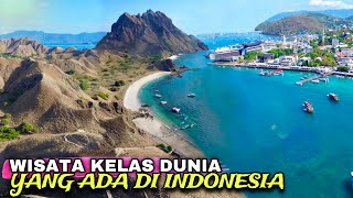
This is Labuan Bajo! Indonesia’s Gem that should be on your travel list! 🌴✨


Indonesia is classified as Emerging region: MIKT: Mexico, Indonesia, South Korea, and Turkey – Economies recognized for their development potential and emerging market status. The level of income is Lower middle income.
News – Latest Updates and Headlines from Pulau Bojo
Stay informed with the most recent news and important headlines from Pulau Bojo. Here’s a roundup of the latest developments.
Please note: The data used here has been primarily extracted from satellite readings. Deviations from exact values may occur, particularly regarding the height of elevations and population density. Land area and coastline measurements refer to average values at mean high tide.