Pulau Bontubontu Timur
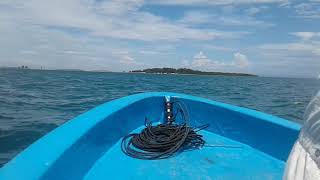
Welcome to Pulau Bontubontu Timur, a Tropical island in the Banda Sea, part of the majestic Pacific Ocean. This guide offers a comprehensive overview of what makes Pulau Bontubontu Timur unique – from its geography and climate to its population, infrastructure, and beyond. Dive into the details:
- Geography and Size: Explore the island’s size and location.
- Climate and Weather: Weather patterns and temperature.
- Topography and Nature: Uncover the natural wonders of the island.
- Infrastructure and Travelling: Insights on reaching, staying, and making the most of your visit.
- News and Headlines: Latest News.
Geography and size of Pulau Bontubontu Timur
Size: 0.78 km²
Coastline: 5.1 km
Ocean: Pacific Ocean
Sea: Banda Sea
Continent: Asia
Pulau Bontubontu Timur is a Tiny Island spanning 0.78 km² with a coastline of 5.1 km.
Archipel: Greater Sunda Islands – A group of large islands in Southeast Asia, including Borneo, Sumatra, Java, and Sulawesi, known for their rich biodiversity and cultural diversity.
Tectonic Plate: Banda Sea – A small plate in the eastern Indonesian region, known for complex interactions with the Australian and Pacific plates, leading to notable seismic and volcanic activity.
The geographic heart of the island is pinpointed at these coordinates:
Latitude: -4.59930133 / Longitude: 122.72230811
Climate and weather of Pulau Bontubontu Timur
Climate Zone: Tropical
Climate Details: Tropical Monsoon Climate
Temperature: Hot
Climate Characteristics: Characterized by heavy rainfall, high humidity, and uniformly high temperatures, but with a distinct short dry season. It features a seasonal reversal of prevailing wind directions.
Topography and nature of Pulau Bontubontu Timur
Timezone: UTC+08:00
Timezone places: Australia/Perth
Max. Elevation: -3 m
Mean Elevation: -5 m
Vegetation: Evergreen Needleleaf Forest
Tree Coverage: 46%
The mean elevation is -5 m. Remarkably, this unique island barely emerges above the sea level, showcasing nature’s fascinating interplay with the ocean. The island is characterized by Plains: Flat, low-lying lands characterized by a maximum elevation of up to 200 meters. On islands, plains are typically coastal lowlands or central flat areas.
Dominating Vegetation: Evergreen Needleleaf Forest
Dominated by evergreen coniferous trees such as pines and firs, which retain their needle-like leaves throughout the year. These forests are often found in cooler climates. Pulau Bontubontu Timur has a tree cover of 46 %.
Vegetation: 2 vegetation zones – Low Diversity Island
Islands with two distinct vegetation zones offer slightly more ecological variety. These zones could be due to differences in elevation, moisture, or other environmental factors. While still limited in biodiversity, these islands may offer a contrast between the two zones, such as a coastline with mangroves and an inland area with grassland.
Infrastructure and Travelling to Pulau Bontubontu Timur
Does the island have a public airport? no.
There is no public and scheduled airport on Pulau Bontubontu Timur. The nearest airport is Haluoleo Airport, located 66 km away.
Does the island have a major port? no.
There are no major ports on Pulau Bontubontu Timur. The closest major port is RAHA ROADSTEAD, approximately 27 km away.
The mean population of Pulau Bontubontu Timur is 136 per km². Pulau Bontubontu Timur is Moderately Inhabited. The island belongs to Indonesia.
Continuing your journey, Pulau Tobea Besar is the next notable island, situated merely km away.
Siswa SMA T3rc3bur ke Laut di Kecamatan Towea, Tempuh Perjalanan Jauh untuk Sekolah


Indonesia is classified as Emerging region: MIKT: Mexico, Indonesia, South Korea, and Turkey – Economies recognized for their development potential and emerging market status. The level of income is Lower middle income.
News – Latest Updates and Headlines from Pulau Bontubontu Timur
Stay informed with the most recent news and important headlines from Pulau Bontubontu Timur. Here’s a roundup of the latest developments.
Please note: The data used here has been primarily extracted from satellite readings. Deviations from exact values may occur, particularly regarding the height of elevations and population density. Land area and coastline measurements refer to average values at mean high tide.