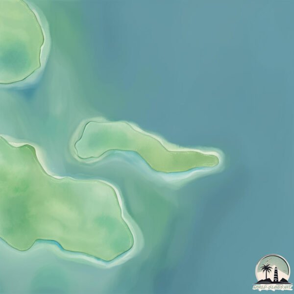
Welcome to Pulau Korek Rapat, a Tropical island in the South China Sea, part of the majestic Pacific Ocean. This guide offers a comprehensive overview of what makes Pulau Korek Rapat unique – from its geography and climate to its population, infrastructure, and beyond. Dive into the details:
Geography and size of Pulau Korek Rapat
Size: 0.182 km²
Coastline: 2.4 km
Ocean: Pacific Ocean
Sea: South China Sea
Continent: Asia
Pulau Korek Rapat is a Tiny Island spanning 0.182 km² with a coastline of 2.4 km.
Archipel: Greater Sunda Islands – A group of large islands in Southeast Asia, including Borneo, Sumatra, Java, and Sulawesi, known for their rich biodiversity and cultural diversity.
Tectonic Plate: Sunda – Extends across Southeast Asia, encompassing parts of the Sunda Shelf, known for its interaction with the Australian Plate, contributing to volcanic activity in Indonesia.
The geographic heart of the island is pinpointed at these coordinates:
Latitude: 0.67771682 / Longitude: 104.34267859
Climate and weather of Pulau Korek Rapat
Climate Zone: Tropical
Climate Details: Tropical Rainforest Climate
Temperature: Hot
Climate Characteristics: This climate is typified by heavy rainfall throughout the year, high humidity, and consistently high temperatures, leading to lush rainforests and rich biodiversity. Seasonal temperature variations are minimal.
Topography and nature of Pulau Korek Rapat
Timezone: UTC+07:00
Timezone places: Asia/Jakarta
Max. Elevation: 2 m
Mean Elevation: 1 m
Vegetation: Evergreen Needleleaf Forest
Tree Coverage: 88%
The mean elevation is 1 m. The highest elevation on the island reaches approximately 2 meters above sea level. The island is characterized by Plains: Flat, low-lying lands characterized by a maximum elevation of up to 200 meters. On islands, plains are typically coastal lowlands or central flat areas.
Dominating Vegetation: Evergreen Needleleaf Forest
Dominated by evergreen coniferous trees such as pines and firs, which retain their needle-like leaves throughout the year. These forests are often found in cooler climates. Pulau Korek Rapat has a tree cover of 88 %.
Vegetation: 2 vegetation zones – Low Diversity Island
Islands with two distinct vegetation zones offer slightly more ecological variety. These zones could be due to differences in elevation, moisture, or other environmental factors. While still limited in biodiversity, these islands may offer a contrast between the two zones, such as a coastline with mangroves and an inland area with grassland.
Infrastructure and Travelling to Pulau Korek Rapat
Does the island have a public airport? no.
There is no public and scheduled airport on Pulau Korek Rapat. The nearest airport is Raja Haji Fisabilillah International Airport, located 34 km away.
Does the island have a major port? no.
There are no major ports on Pulau Korek Rapat. The closest major port is TANJUNGPINANG, approximately 29 km away.
The mean population of Pulau Korek Rapat is 1877 per km². Pulau Korek Rapat is Densely Populated. The island belongs to Indonesia.
Continuing your journey, Pulau Galang Baru is the next notable island, situated merely km away.
Keindahan Exsotis Pulau Korek Abadi
Pulau Korek Abadi merupakan salah satu pulau yang terletak jauh dari pulau Batam. Jika teman-teman mau mengunjungi pulau ...Keindahan Exsotis Pulau Korek Abadi
Pulau Korek Abadi merupakan salah satu pulau yang terletak jauh dari ...
Pulau Korek Abadi merupakan salah satu pulau yang terletak jauh dari pulau Batam. Jika teman-teman mau mengunjungi pulau ...
Keindahan Pulau Korek Batam island Season 2
Babon Ikan Kaci,Pulau Korek Batam
BAKSOS KEMERDEKAAN KE PULAU KOREK #batam #alqusais #tabunganakhirat #batamindonesia
Alhamdulillah kegiatan silaturahmi kita sukses atas izin Allah.. ...
Alhamdulillah kegiatan silaturahmi kita sukses atas izin Allah.. MasyaAllah tabarakallah Allah kirimkan kawan2 relawan yang ...
MASYARAKAT PULAU KOREK NIKMATI PENERANGAN BERKAT RIRIN WARSITI
Penantian panjang masyarakat pulau Korek untuk mendapatkan penerangan ...
Penantian panjang masyarakat pulau Korek untuk mendapatkan penerangan akhirnya terjawab. Bersama pemerintah provinsi ...
KENYA : Le plus grand safari d'Afrique
Plongez au cœur du berceau de l'humanité pour une aventure hors du ...
Plongez au cœur du berceau de l'humanité pour une aventure hors du commun ! De l'équateur aux rives de l'Océan Indien, ...
pesta strike trip pulau korek batam
mancing sport fenomenal pulau korek barelang
SEPUTAR INEWS KEPRI PERESMIAN ANGKUTAN PELAJAR HINTERLAND
MINIMNYA SARANA TRANSPORTASI LAUT DIWILAYAH HINTERLAND/ MEMBUAT ...
MINIMNYA SARANA TRANSPORTASI LAUT DIWILAYAH HINTERLAND/ MEMBUAT RATUSAN PELAJAR DI PULAU SEMBUR/ ...
POV: Mengaji Dengan Ustaz Garang #comedyshorts #comedy
Bobby Nekat Masuk Ke Rumah Kebakaran! #Kilauuangkaget #Kilaubedahrumah #mnctvofficial
Bobby Nekat Masuk Ke Rumah Kebakaran! #Kilauuangkaget #Kilaubedahrumah ...
Bobby Nekat Masuk Ke Rumah Kebakaran! #Kilauuangkaget #Kilaubedahrumah #mnctvofficial ...
Motif Rumah Perajin Bambu Dirusak dan Dibakar Warga, Dituduh Kuasai Ilmu Hitam dan Santet Tetangga
Baca selengkapnya di ...
Baca selengkapnya di ...
MutiSUB💥隐居长生老祖下山意外闯入直播间💥修国宝、治绝症、凭空造物大显神通震惊网友,打脸质疑者冲上热搜受全民追捧!【沉睡万年的我,被直播曝光了】
點擊此連結⏩⏩https://star-cps.onelink.me/etLJ/hhqydkbj 輸入劇名,即可觀看全集!#drama ...
點擊此連結⏩⏩https://star-cps.onelink.me/etLJ/hhqydkbj 輸入劇名,即可觀看全集!#drama #短劇#短劇全集#電影#CEO #言情# ...
Once Upon a Crush | COMEDY | Full Movie in English
Two childhood friends travel to Coney Island to find a long-lost ...
Two childhood friends travel to Coney Island to find a long-lost companion, uncovering strange truths about their past along the ...
江黎為替嗜賭母親還債砸了賭場,一身倔強撞進羅靳延的眼底。四年後江黎成為頂流女星,為再見羅靳延一面主動赴遊艇派對。戲子無情,商人趨利,試探間曖昧拉扯,惹火心動#chinesedrama #熱播劇
短劇萬花筒|甜寵、懸疑、現實、搞笑全涵蓋!每天更新不重樣~ 訂閱解鎖更多風格短劇,評論區點更你想看的題材! Short ...
短劇萬花筒|甜寵、懸疑、現實、搞笑全涵蓋!每天更新不重樣~ 訂閱解鎖更多風格短劇,評論區點更你想看的題材! Short ...
Tiap Rumah ada satu Pura - Bali Island😍
Tiap Rumah ada satu Pura - Bali Island #bali #purabali #wisatabali ...
Tiap Rumah ada satu Pura - Bali Island #bali #purabali #wisatabali #baliviral #viralvideo #shorts.
EP1-16 Mecha Girl Era | MULTI SUB
donghua #3d #3danimation #国漫 Thanks for watching! Feel free to hit ...
donghua #3d #3danimation #国漫 Thanks for watching! Feel free to hit subscribe! Latest anime full episodes, wonderful ...
Troyanus Selfianus Kalami
Troyanus Selfianus Kalami, perutusan politik Masyarakat Adat Malamoi. ...
Troyanus Selfianus Kalami, perutusan politik Masyarakat Adat Malamoi. Ia diutus maju sebagai Calon Anggota DPRD Kabupaten ...
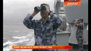
Kapal selam kecil buru isyarat ping
Buat kali pertama pasukan mencari dan menjejak MH370 menghantar ...
Buat kali pertama pasukan mencari dan menjejak MH370 menghantar sejenis kapal selam kecil tanpa pemandu ke dalam Lautan ...
Warga Protes Proyek Listrik Panas Bumi
Apenas Uma Vila Contra o Bloop
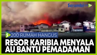
Resor Karibia Kebakaran Hebat, 200 Rumah Hancur Terbakar
SERAMBINEWS.COM, GUANAJA - Lebih dari 200 rumah hancur akibat ...
SERAMBINEWS.COM, GUANAJA - Lebih dari 200 rumah hancur akibat kebakaran hebat yang terjadi pada Sabtu pagi di pulau ...
Bug tergokil dan aneh di map keren Treasure Island,mapnya kok malah gini 😱
Bug tergokil dan aneh di map keren Treasure Island,mapnya kok malah ...
Bug tergokil dan aneh di map keren Treasure Island,mapnya kok malah gini #stumbleguys #shorts Yok mabar ges bareng aku ...
【高燃抗日電影】神槍高手精准射擊,一槍秒殺百名日軍,日軍徹底崩潰 ❗⚔️#抗日 #槍戰 #動作 #抗日電影 #中國電視劇
每天定時更新精彩功夫,武俠,戰爭系列影視內容,歡迎訂閱! Thanks watching ,We update clips ...
每天定時更新精彩功夫,武俠,戰爭系列影視內容,歡迎訂閱! Thanks watching ,We update clips everyday. 更多内容请看: ...
Les nouveaux candidats s'affrontent ! | EP01 Complet | Koh Lanta 2026 Reliques du Destin
Retrouver la saison 2026 de Koh Lanta : Les Reliques du Destin ! Fan ...
Retrouver la saison 2026 de Koh Lanta : Les Reliques du Destin ! Fan de l'émission Koh-Lanta ? L'intégrale des émissions est ...
Indonesia is classified as Emerging region: MIKT: Mexico, Indonesia, South Korea, and Turkey – Economies recognized for their development potential and emerging market status. The level of income is Lower middle income.
News – Latest Updates and Headlines from Pulau Korek Rapat
Stay informed with the most recent news and important headlines from Pulau Korek Rapat. Here’s a roundup of the latest developments.
Loading...
Please note: The data used here has been primarily extracted from satellite readings. Deviations from exact values may occur, particularly regarding the height of elevations and population density. Land area and coastline measurements refer to average values at mean high tide.