Pulau Leti
Welcome to Pulau Leti, a Tropical island in the Timor Sea, part of the majestic Indian Ocean. This guide offers a comprehensive overview of what makes Pulau Leti unique – from its geography and climate to its population, infrastructure, and beyond. Dive into the details:
- Geography and Size: Explore the island’s size and location.
- Climate and Weather: Weather patterns and temperature.
- Topography and Nature: Uncover the natural wonders of the island.
- Infrastructure and Travelling: Insights on reaching, staying, and making the most of your visit.
- News and Headlines: Latest News.
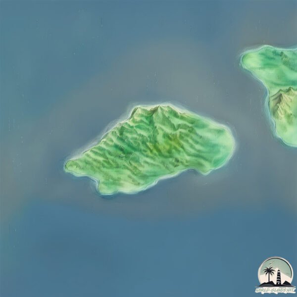
Geography and size of Pulau Leti
Size: 91.9 km²
Coastline: 43.5 km
Ocean: Indian Ocean
Sea: Timor Sea
Continent: Asia
Pulau Leti is a Medium Island spanning 92 km² with a coastline of 44 km.
Archipel: Malay Archipelago – The world’s largest archipelago, located between mainland Southeast Asia and Australia, known for its immense biodiversity and cultural diversity.
Tectonic Plate: Timor – A small tectonic plate in the Timor region, primarily under the Timor Sea. It’s involved in the collision between the Australian and Eurasian plates, contributing to the region’s seismic activity and the uplift of the island of Timor.
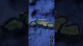
The geographic heart of the island is pinpointed at these coordinates:
Latitude: -8.19766956 / Longitude: 127.68160375
Climate and weather of Pulau Leti
Climate Zone: Tropical
Climate Details: Tropical Savanna, Wet
Temperature: Hot
Climate Characteristics: Defined by distinct wet and dry seasons with high temperatures year-round. Pronounced rainfall occurs during the wet season, while the dry season is marked by drought.
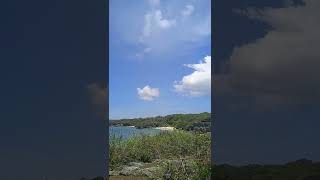
Topography and nature of Pulau Leti
Timezone: UTC+09:00
Timezone places: Asia/Tokyo
Max. Elevation: 284 m
Mean Elevation: 62 m
Vegetation: Evergreen Broadleaf Forest
Tree Coverage: 27%
The mean elevation is 62 m. The highest elevation on the island reaches approximately 284 meters above sea level. The island is characterized by Hills: Gently sloping landforms with rounded tops, having a maximum elevation between 200 and 500 meters. Hills contribute to a varied landscape on islands.
Dominating Vegetation: Evergreen Broadleaf Forest
Characterized by dense, lush canopies of broadleaf trees that retain their leaves year-round. These forests are typically found in tropical and subtropical regions and are known for their high biodiversity. Pulau Leti has a tree cover of 27 %.
Vegetation: 10 vegetation zones – Very Highly Diverse Island
Islands in this range are ecological powerhouses, showcasing a wide array of vegetation zones. Each zone, from lush rainforests to arid scrublands, coastal mangroves to mountainous regions, contributes to a complex and interdependent ecosystem. These islands are often hotspots of biodiversity, supporting numerous species and intricate ecological processes.
Infrastructure and Travelling to Pulau Leti
Does the island have a public airport? no.
There is no public and scheduled airport on Pulau Leti. The nearest airport is Jos Orno Imsula Airport, located 18 km away.
Does the island have a major port? no.
There are no major ports on Pulau Leti. The closest major port is DILI, approximately 227 km away.
The mean population of Pulau Leti is 18 per km². Pulau Leti is Gently Populated. The island belongs to Indonesia.
Continuing your journey, Moa Island is the next notable island, situated merely km away.
Pulau Letti, Maluku Barat Daya, Nuwewang 2


Indonesia is classified as Emerging region: MIKT: Mexico, Indonesia, South Korea, and Turkey – Economies recognized for their development potential and emerging market status. The level of income is Lower middle income.
News – Latest Updates and Headlines from Pulau Leti
Stay informed with the most recent news and important headlines from Pulau Leti. Here’s a roundup of the latest developments.
Please note: The data used here has been primarily extracted from satellite readings. Deviations from exact values may occur, particularly regarding the height of elevations and population density. Land area and coastline measurements refer to average values at mean high tide.