Pulau Longos
Welcome to Pulau Longos, a Tropical island in the Flores Sea, part of the majestic Pacific Ocean. This guide offers a comprehensive overview of what makes Pulau Longos unique – from its geography and climate to its population, infrastructure, and beyond. Dive into the details:
- Geography and Size: Explore the island’s size and location.
- Climate and Weather: Weather patterns and temperature.
- Topography and Nature: Uncover the natural wonders of the island.
- Infrastructure and Travelling: Insights on reaching, staying, and making the most of your visit.
- News and Headlines: Latest News.
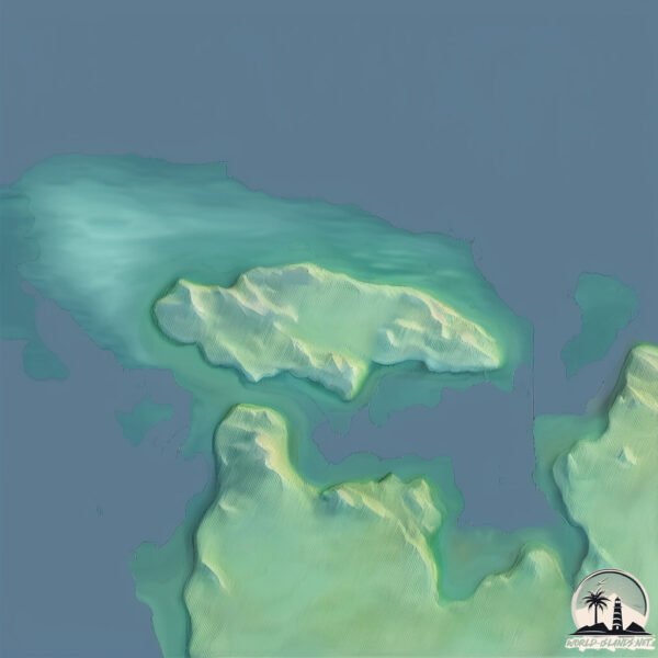
Geography and size of Pulau Longos
Size: 5.111 km²
Coastline: 11.6 km
Ocean: Pacific Ocean
Sea: Flores Sea
Continent: Asia
Pulau Longos is a Small Island spanning 5.1 km² with a coastline of 11.6 km.
Archipel: Malay Archipelago – The world’s largest archipelago, located between mainland Southeast Asia and Australia, known for its immense biodiversity and cultural diversity.
Tectonic Plate: Woodlark – Situated in the eastern part of Papua New Guinea, the Woodlark Plate is a small tectonic plate primarily consisting of oceanic crust and undergoing active rifting, contributing to the complex geology of the region.
The geographic heart of the island is pinpointed at these coordinates:
Latitude: -8.34603399 / Longitude: 120.13180922
Climate and weather of Pulau Longos
Climate Zone: Tropical
Climate Details: Tropical Savanna, Wet
Temperature: Hot
Climate Characteristics: Defined by distinct wet and dry seasons with high temperatures year-round. Pronounced rainfall occurs during the wet season, while the dry season is marked by drought.
Topography and nature of Pulau Longos
Timezone: UTC+08:00
Timezone places: Australia/Perth
Max. Elevation: 22 m
Mean Elevation: 13 m
Vegetation: Mangrove Forest
Tree Coverage: 86%
The mean elevation is 13 m. The highest elevation on the island reaches approximately 22 meters above sea level. The island is characterized by Plains: Flat, low-lying lands characterized by a maximum elevation of up to 200 meters. On islands, plains are typically coastal lowlands or central flat areas.
Dominating Vegetation: Mangrove Forest
Found in coastal areas and river deltas, these unique wetland ecosystems are adapted to saline conditions and are crucial for coastal protection and biodiversity. Pulau Longos has a tree cover of 86 %.
Vegetation: 5 vegetation zones – Highly Diverse Island
With five different vegetation zones, these islands offer a rich tapestry of ecosystems. The variety could include dense forests, open meadows, wetlands, coastal zones, and more. This level of diversity supports an intricate web of life, with each zone playing a vital role in the overall ecological health and balance of the island.
Infrastructure and Travelling to Pulau Longos
Does the island have a public airport? no.
There is no public and scheduled airport on Pulau Longos. The nearest airport is Komodo Airport, located 29 km away.
Does the island have a major port? no.
There are no major ports on Pulau Longos. The closest major port is WAINGAPU, approximately 142 km away.
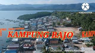
The mean population of Pulau Longos is 89 per km². Pulau Longos is Gently Populated. The island belongs to Indonesia.
Continuing your journey, Rinca is the next notable island, situated merely km away.
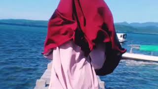
liburan sambil bersilaturahmi sama warga pulau longos, NTT🥰🫶🏻 #ahhamedia #attahalilintar #ntt


Indonesia is classified as Emerging region: MIKT: Mexico, Indonesia, South Korea, and Turkey – Economies recognized for their development potential and emerging market status. The level of income is Lower middle income.
News – Latest Updates and Headlines from Pulau Longos
Stay informed with the most recent news and important headlines from Pulau Longos. Here’s a roundup of the latest developments.
Please note: The data used here has been primarily extracted from satellite readings. Deviations from exact values may occur, particularly regarding the height of elevations and population density. Land area and coastline measurements refer to average values at mean high tide.