Welcome to Pulau Marampit, a Tropical island in the Philippine Sea, part of the majestic Pacific Ocean. This guide offers a comprehensive overview of what makes Pulau Marampit unique – from its geography and climate to its population, infrastructure, and beyond. Dive into the details:
Geography and size of Pulau Marampit
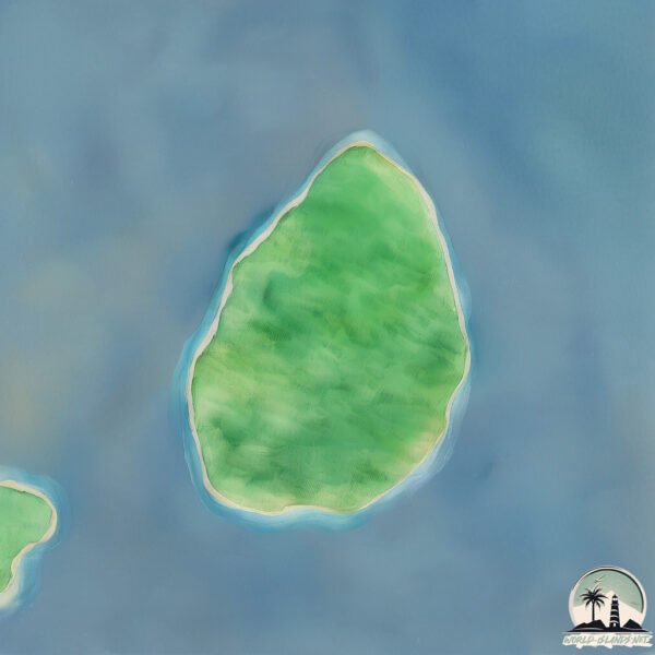
Size: 15.1 km²
Coastline: 15.3 km
Ocean: Pacific Ocean
Sea: Philippine Sea
Continent: Asia
Pulau Marampit is a Medium Island spanning 15 km² with a coastline of 15 km.
Archipel: Malay Archipelago – The world’s largest archipelago, located between mainland Southeast Asia and Australia, known for its immense biodiversity and cultural diversity.
Tectonic Plate: Sunda – Extends across Southeast Asia, encompassing parts of the Sunda Shelf, known for its interaction with the Australian Plate, contributing to volcanic activity in Indonesia.
The geographic heart of the island is pinpointed at these coordinates:
Latitude: 4.75246679 / Longitude: 127.12866176
Climate and weather of Pulau Marampit
Climate Zone: Tropical
Climate Details: Tropical Rainforest Climate
Temperature: Hot
Climate Characteristics: This climate is typified by heavy rainfall throughout the year, high humidity, and consistently high temperatures, leading to lush rainforests and rich biodiversity. Seasonal temperature variations are minimal.
Topography and nature of Pulau Marampit
Timezone: UTC+08:00
Timezone places: Australia/Perth
Max. Elevation: 118 m
Mean Elevation: 55 m
Vegetation: Evergreen Broadleaf Forest
Tree Coverage: 76%
The mean elevation is 55 m. The highest elevation on the island reaches approximately 118 meters above sea level. The island is characterized by Plains: Flat, low-lying lands characterized by a maximum elevation of up to 200 meters. On islands, plains are typically coastal lowlands or central flat areas.
Dominating Vegetation: Evergreen Broadleaf Forest
Characterized by dense, lush canopies of broadleaf trees that retain their leaves year-round. These forests are typically found in tropical and subtropical regions and are known for their high biodiversity. Pulau Marampit has a tree cover of 76 %.
Vegetation: 7 vegetation zones – Very Highly Diverse Island
Islands in this range are ecological powerhouses, showcasing a wide array of vegetation zones. Each zone, from lush rainforests to arid scrublands, coastal mangroves to mountainous regions, contributes to a complex and interdependent ecosystem. These islands are often hotspots of biodiversity, supporting numerous species and intricate ecological processes.
Infrastructure and Travelling to Pulau Marampit
Does the island have a public airport? no.
There is no public and scheduled airport on Pulau Marampit. The nearest airport is Naha Airport, located 211 km away.
Does the island have a major port? no.
There are no major ports on Pulau Marampit. The closest major port is TELUK BEO, approximately 67 km away.
The mean population of Pulau Marampit is 127 per km². Pulau Marampit is Moderately Inhabited. The island belongs to Indonesia.
Continuing your journey, Karakelong is the next notable island, situated merely km away.
MARAMPIT ISLAND, HIDDEN PARADISE IN TALAUD REGENCY
Marampit Island, Hidden Paradise.MARAMPIT ISLAND, HIDDEN PARADISE IN TALAUD REGENCY
Marampit Island, Hidden Paradise.
Marampit Island, Hidden Paradise.
Pulau Marampit, Kab. Kepulauan Talaud, Provinsi Sulawesi Utara (Drone Video)
Pulau Marampit terletak Kecamatan Nanusa, Kabupaten Kepulauan Talaud, ...
Pulau Marampit terletak Kecamatan Nanusa, Kabupaten Kepulauan Talaud, Provinsi Sulawesi Utara, Indonesia Marampit ...
PULAU MARAMPIT: Benteng Terakhir Nusantara - Kisah Dari Pulau Terpencil yang Menjaga Indonesia!
PULAU MARAMPIT: Benteng Terakhir Nusantara - Kisah Dari Pulau ...
PULAU MARAMPIT: Benteng Terakhir Nusantara - Kisah Dari Pulau Terpencil yang Menjaga Indonesia! Di ujung utara Indonesia ...
Pulau Marampit Kepulauan Talaud #kgtrip #kepulauantalaud #perbatasanindonesia #explore #adventure
PULAU MARAMPIT//PULAU PALING UTARA INDONESIA SETELAH MIANGAS
PULAU MARAMPIT//PULAU PALING UTARA INDONESIA SETELAH MIANGAS Pulau ...
PULAU MARAMPIT//PULAU PALING UTARA INDONESIA SETELAH MIANGAS Pulau Marampit adalah salah satu pulau yang ...
pulau marampit #kepulauantalaud #indonesia #sulawesiutara #sulawesi
Pulau Marampit adalah pulau terluar Indonesia yang terletak di laut ...
Pulau Marampit adalah pulau terluar Indonesia yang terletak di laut Sulawesi, dan berbatasan dengan negara Filipina. Pulau ...
Jalan-jalan di Marampit
Jalan-jalan hari Minggu di Pulau Marampit mengunjungi beberapa tempat ...
Jalan-jalan hari Minggu di Pulau Marampit mengunjungi beberapa tempat yg menarik di pulau terluar yaitu kolam Matane dan ...
SISI KEINDAHAN YANG TERABAIKAN DI PULAU MARAMPIT || TALAUD
SISI KEINDAHAN YANG TERABAIKAN DI PULAU MARAMPIT || TALAUD halo sobat ...
SISI KEINDAHAN YANG TERABAIKAN DI PULAU MARAMPIT || TALAUD halo sobat di video saya kali ini, saya menampilkan ...
Pulau Marampit Perbatasan RI - Philipina
Keindahan Tersembunyi Pulau Marampit Sulut! #sulut #sulawesiutara #sulawesi #island
Keindahan Tersembunyi Pulau Marampit Sulut! Channel OKYEDA ingin ...
Keindahan Tersembunyi Pulau Marampit Sulut! Channel OKYEDA ingin memperkenalkan Indonesia di mata Dunia dengan ...
Pulau Marampit | Pulau Terluar di Sulawesi Utara | Indonesia
Pulau Marampit merupakan salah satu pulau terluar di Indonesia yang ...
Pulau Marampit merupakan salah satu pulau terluar di Indonesia yang terletak di laut sulawesi dan berbatasan dengan negara ...
GEMPA 7,1 SR GUNCANGKAN PULAU MARAMPIT SULAWESI UTARA (21 JANUARI 2021)
Hari ini Kamis, 21 Januari 2021 pukul 19.23 WIB wilayah Laut Filipina ...
Hari ini Kamis, 21 Januari 2021 pukul 19.23 WIB wilayah Laut Filipina diguncang gempa tektonik. Hasil analisis BMKG ...
Pulau Marampit
RDTR KPN Pulau Marampit.
RDTR KPN Pulau Marampit.
Pulau Marampit,Pulau terluar NKRI yg berbatasan dg Filipina #Short
Mancing mania di Pulau Marampit perbatasan RI-Philipina
KKN-PPM UGM Pulau Marampit 2016 (SLU-02)
Sebuah cuplikan pengabdian di ujung utara negeri. Memberi segaris ...
Sebuah cuplikan pengabdian di ujung utara negeri. Memberi segaris senyuman untuk perubahan. Notes: Gunakan headset ...
TOUR DE OUTER ISLAND, Kakorotan, Marampit, Karatung, Miangas
Perjalanan kali ini, menjelajahi pulau-pulau terluar Utara Indonesia. ...
Perjalanan kali ini, menjelajahi pulau-pulau terluar Utara Indonesia. Pulau Kakorotan, Pulau Marampit, Pulau Karatung dan pulau ...
Marampit, Pesona Pulau Terluar di Indonesia | Surga di Perbatasan NKRI #shorts
Pulau Marampit Salah satu Destinasi wisata pulau terluar Indonesia ...
Pulau Marampit Salah satu Destinasi wisata pulau terluar Indonesia adalah Pulau Marampit di Sulawesi Utara. Memiliki luas 12 ...
marampit
perjalanan menuju pulau terluar indonesia dgn perjalanan tempuh dri ...
perjalanan menuju pulau terluar indonesia dgn perjalanan tempuh dri talaud ke marampit jarak tempuh ± 5jam , sungguh ...
Transportasi ke pulau marampit (pamboat)
Dengan cuaca yang buruk Kami tim kesehatan khususnya Nusantara Sehat ...
Dengan cuaca yang buruk Kami tim kesehatan khususnya Nusantara Sehat tetap SIAP melayani masyarakat yang berada di ...
Pulau Marampit
omzepro#outdooractivity#GIS#surveyandmapping.
omzepro#outdooractivity#GIS#surveyandmapping.
Pulau Terluar Pulau Marampit Edisi Desa Dampulis
Pulau Marampit adalah salah satu pulau terluar yg berada di laut ...
Pulau Marampit adalah salah satu pulau terluar yg berada di laut sulawesi yg berbatasan dg Filipina.terdapat beberapa desa di ...
EVHAN LEE: KOLAM MATANE MARAMPIT//KOLAM TUA DI TALAUD
EVHAN LEE: KOLAM MATANE MARAMPIT//KOLAM TUA DI TALAUD Yo Teman-teman ...
EVHAN LEE: KOLAM MATANE MARAMPIT//KOLAM TUA DI TALAUD Yo Teman-teman kali ini saya mengeksplore video di ...
Pulau Marampit
omzegeo #surveyandmapping #geografi #infogeografi.
omzegeo #surveyandmapping #geografi #infogeografi.
Indonesia is classified as Emerging region: MIKT: Mexico, Indonesia, South Korea, and Turkey – Economies recognized for their development potential and emerging market status. The level of income is Lower middle income.
News – Latest Updates and Headlines from Pulau Marampit
Stay informed with the most recent news and important headlines from Pulau Marampit. Here’s a roundup of the latest developments.
Loading...
Please note: The data used here has been primarily extracted from satellite readings. Deviations from exact values may occur, particularly regarding the height of elevations and population density. Land area and coastline measurements refer to average values at mean high tide.