Pulau Mausi
Welcome to Pulau Mausi, a Tropical island in the Indian Ocean, part of the majestic Indian Ocean. This guide offers a comprehensive overview of what makes Pulau Mausi unique – from its geography and climate to its population, infrastructure, and beyond. Dive into the details:
- Geography and Size: Explore the island’s size and location.
- Climate and Weather: Weather patterns and temperature.
- Topography and Nature: Uncover the natural wonders of the island.
- Infrastructure and Travelling: Insights on reaching, staying, and making the most of your visit.
- News and Headlines: Latest News.
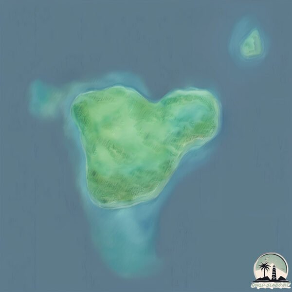
Geography and size of Pulau Mausi
Size: 1.182 km²
Coastline: 4.5 km
Ocean: Indian Ocean
Sea: Indian Ocean
Continent: Asia
Pulau Mausi is a Small Island spanning 1.2 km² with a coastline of 4.5 km.
Archipel: Malay Archipelago – The world’s largest archipelago, located between mainland Southeast Asia and Australia, known for its immense biodiversity and cultural diversity.
Tectonic Plate: Sunda – Extends across Southeast Asia, encompassing parts of the Sunda Shelf, known for its interaction with the Australian Plate, contributing to volcanic activity in Indonesia.
The geographic heart of the island is pinpointed at these coordinates:
Latitude: 1.35645692 / Longitude: 97.10496744
Climate and weather of Pulau Mausi
Climate Zone: Tropical
Climate Details: Tropical Rainforest Climate
Temperature: Hot
Climate Characteristics: This climate is typified by heavy rainfall throughout the year, high humidity, and consistently high temperatures, leading to lush rainforests and rich biodiversity. Seasonal temperature variations are minimal.
Topography and nature of Pulau Mausi
Timezone: UTC+07:00
Timezone places: Asia/Jakarta
Max. Elevation: -7 m
Mean Elevation: -11 m
Vegetation: Evergreen Broadleaf Forest
Tree Coverage: 63%
The mean elevation is -11 m. Remarkably, this unique island barely emerges above the sea level, showcasing nature’s fascinating interplay with the ocean. The island is characterized by Plains: Flat, low-lying lands characterized by a maximum elevation of up to 200 meters. On islands, plains are typically coastal lowlands or central flat areas.
Dominating Vegetation: Evergreen Broadleaf Forest
Characterized by dense, lush canopies of broadleaf trees that retain their leaves year-round. These forests are typically found in tropical and subtropical regions and are known for their high biodiversity. Pulau Mausi has a tree cover of 63 %.
Vegetation: 1 vegetation zones – Minimal Diversity Island
These islands exhibit the most basic level of ecological diversity, often characterized by a single dominant vegetation type. This could be due to extreme environmental conditions, limited land area, or significant human impact. They represent unique ecosystems where specific species have adapted to thrive in these singular environments.
Infrastructure and Travelling to Pulau Mausi
Does the island have a public airport? no.
There is no public and scheduled airport on Pulau Mausi. The nearest airport is Binaka Airport, located 69 km away.
Does the island have a major port? no.
There are no major ports on Pulau Mausi. The closest major port is SIBOLGA, approximately 189 km away.
The mean population of Pulau Mausi is 99 per km². Pulau Mausi is Gently Populated. The island belongs to Indonesia.
Continuing your journey, Nias is the next notable island, situated merely km away.
Mousuni Island Tour | Tarannga Bithi Camp | Kolkata To Mousuni Island | Weekend Trip Near Kolkata


Indonesia is classified as Emerging region: MIKT: Mexico, Indonesia, South Korea, and Turkey – Economies recognized for their development potential and emerging market status. The level of income is Lower middle income.
News – Latest Updates and Headlines from Pulau Mausi
Stay informed with the most recent news and important headlines from Pulau Mausi. Here’s a roundup of the latest developments.
- Light mag. 3.1 earthquake - Indian Ocean, 111 km west of Pulau Simuk Island, North Sumatra, Indonesia, on Thursday, Mar 26, 2026, at 05:41 am (GMT +6) - Volcano Discoveryby "Nias island" - Google News on 26 March 2026
Light mag. 3.1 earthquake - Indian Ocean, 111 km west of Pulau Simuk Island, North Sumatra, Indonesia, on Thursday, Mar 26, 2026, at 05:41 am (GMT +6) Volcano Discovery
- Ingrid disappeared on an Indonesian island in 1976. Now we know what really happened - The Guardianby "Nias island" - Google News on 2 January 2026
Ingrid disappeared on an Indonesian island in 1976. Now we know what really happened The Guardian
- Vice President pushes suspension bridge construction for South Nias - ANTARA Newsby "Nias island" - Google News on 21 December 2025
Vice President pushes suspension bridge construction for South Nias ANTARA News
- Floods and Landslides Hit North Sumatra's South Nias - Tempo.co Englishby "Nias island" - Google News on 11 December 2025
Floods and Landslides Hit North Sumatra's South Nias Tempo.co English
- Indonesia intensifies search for victims after floods and landslides kill 69 people - PBSby "Nias island" - Google News on 27 November 2025
Indonesia intensifies search for victims after floods and landslides kill 69 people PBS
- Earthquake of magnitude 6.4 strikes Indonesia's Sumatra Island - India TV Newsby "Nias island" - Google News on 27 November 2025
Earthquake of magnitude 6.4 strikes Indonesia's Sumatra Island India TV News
- Two Cyclone Seeds Trigger High Waves and Powerful Winds in the Nias Islands - Tempo.co Englishby "Nias island" - Google News on 26 November 2025
Two Cyclone Seeds Trigger High Waves and Powerful Winds in the Nias Islands Tempo.co English
- At least 17 people killed in Indonesia floods, landslides - Al Jazeeraby "Nias island" - Google News on 26 November 2025
At least 17 people killed in Indonesia floods, landslides Al Jazeera
- 17 dead as flash floods wreak havoc across Indonesia’s Sumatra - South China Morning Postby "Nias island" - Google News on 26 November 2025
17 dead as flash floods wreak havoc across Indonesia’s Sumatra South China Morning Post
- Landslides and flash floods on Indonesia's Sumatra island leave at least 23 dead and dozens missing - NBC Newsby "Nias island" - Google News on 26 November 2025
Landslides and flash floods on Indonesia's Sumatra island leave at least 23 dead and dozens missing NBC News
Please note: The data used here has been primarily extracted from satellite readings. Deviations from exact values may occur, particularly regarding the height of elevations and population density. Land area and coastline measurements refer to average values at mean high tide.