Pulau Menjangan
Welcome to Pulau Menjangan, a Tropical island in the Bali Sea, part of the majestic Pacific Ocean. This guide offers a comprehensive overview of what makes Pulau Menjangan unique – from its geography and climate to its population, infrastructure, and beyond. Dive into the details:
- Geography and Size: Explore the island’s size and location.
- Climate and Weather: Weather patterns and temperature.
- Topography and Nature: Uncover the natural wonders of the island.
- Infrastructure and Travelling: Insights on reaching, staying, and making the most of your visit.
- News and Headlines: Latest News.
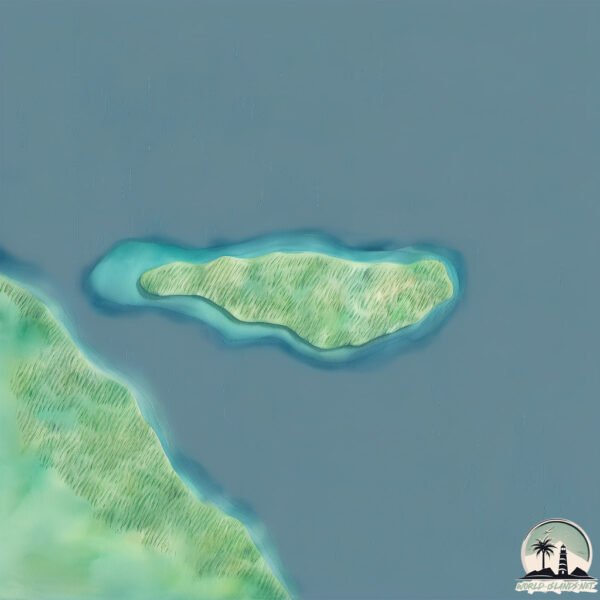
Geography and size of Pulau Menjangan
Size: 1.71 km²
Coastline: 6.4 km
Ocean: Pacific Ocean
Sea: Bali Sea
Continent: Asia
Pulau Menjangan is a Small Island spanning 1.7 km² with a coastline of 6.4 km.
Archipel: Malay Archipelago – The world’s largest archipelago, located between mainland Southeast Asia and Australia, known for its immense biodiversity and cultural diversity.
Tectonic Plate: Timor – A small tectonic plate in the Timor region, primarily under the Timor Sea. It’s involved in the collision between the Australian and Eurasian plates, contributing to the region’s seismic activity and the uplift of the island of Timor.
The geographic heart of the island is pinpointed at these coordinates:
Latitude: -8.09512101 / Longitude: 114.51653903
Climate and weather of Pulau Menjangan
Climate Zone: Tropical
Climate Details: Tropical Monsoon Climate
Temperature: Hot
Climate Characteristics: Characterized by heavy rainfall, high humidity, and uniformly high temperatures, but with a distinct short dry season. It features a seasonal reversal of prevailing wind directions.
Topography and nature of Pulau Menjangan
Timezone: UTC+08:00
Timezone places: Australia/Perth
Max. Elevation: 28 m
Mean Elevation: 22 m
Vegetation: Evergreen Broadleaf Forest
Tree Coverage: 51%
The mean elevation is 22 m. The highest elevation on the island reaches approximately 28 meters above sea level. The island is characterized by Plains: Flat, low-lying lands characterized by a maximum elevation of up to 200 meters. On islands, plains are typically coastal lowlands or central flat areas.
Dominating Vegetation: Evergreen Broadleaf Forest
Characterized by dense, lush canopies of broadleaf trees that retain their leaves year-round. These forests are typically found in tropical and subtropical regions and are known for their high biodiversity. Pulau Menjangan has a tree cover of 51 %.
Vegetation: 4 vegetation zones – Diverse Island
Four distinct vegetation zones mark these islands as ecologically diverse. They might feature varied landscapes such as forests, beaches, grasslands, and rocky areas. Such diversity reflects the island’s complex ecological interactions and varied habitats, which can support a rich array of wildlife and plant species.
Infrastructure and Travelling to Pulau Menjangan
Does the island have a public airport? no.
There is no public and scheduled airport on Pulau Menjangan. The nearest airport is Letkol Wisnu Airstrip, located 11 km away.
Does the island have a major port? no.
There are no major ports on Pulau Menjangan. The closest major port is CELUKAN BAWANG, approximately 35 km away.
The mean population of Pulau Menjangan is 531 per km². Pulau Menjangan is Densely Populated. The island belongs to Indonesia.
Continuing your journey, Bali is the next notable island, situated merely km away.
Menjangan Island Snorkeling Bali – Hidden Gem Better Than Nusa & Gili?


Indonesia is classified as Emerging region: MIKT: Mexico, Indonesia, South Korea, and Turkey – Economies recognized for their development potential and emerging market status. The level of income is Lower middle income.
News – Latest Updates and Headlines from Pulau Menjangan
Stay informed with the most recent news and important headlines from Pulau Menjangan. Here’s a roundup of the latest developments.
Please note: The data used here has been primarily extracted from satellite readings. Deviations from exact values may occur, particularly regarding the height of elevations and population density. Land area and coastline measurements refer to average values at mean high tide.