Pulau Pagai Selatan
Welcome to Pulau Pagai Selatan, a Tropical island in the Indian Ocean, part of the majestic Indian Ocean. This guide offers a comprehensive overview of what makes Pulau Pagai Selatan unique – from its geography and climate to its population, infrastructure, and beyond. Dive into the details:
- Geography and Size: Explore the island’s size and location.
- Climate and Weather: Weather patterns and temperature.
- Topography and Nature: Uncover the natural wonders of the island.
- Infrastructure and Travelling: Insights on reaching, staying, and making the most of your visit.
- News and Headlines: Latest News.
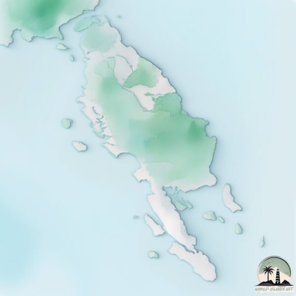
Geography and size of Pulau Pagai Selatan
Size: 868.5 km²
Coastline: 282.9 km
Ocean: Indian Ocean
Sea: Indian Ocean
Continent: Asia
Pulau Pagai Selatan is a Large Island spanning 869 km² with a coastline of 283 km.
Archipel: Malay Archipelago – The world’s largest archipelago, located between mainland Southeast Asia and Australia, known for its immense biodiversity and cultural diversity.
Tectonic Plate: North Bismarck – Located north of New Guinea, it’s involved in complex tectonic interactions with the Pacific and South Bismarck plates, contributing to seismic activity in the region.
The geographic heart of the island is pinpointed at these coordinates:
Latitude: -3.02741236 / Longitude: 100.32783474
Climate and weather of Pulau Pagai Selatan
Climate Zone: Tropical
Climate Details: Tropical Rainforest Climate
Temperature: Hot
Climate Characteristics: This climate is typified by heavy rainfall throughout the year, high humidity, and consistently high temperatures, leading to lush rainforests and rich biodiversity. Seasonal temperature variations are minimal.
Topography and nature of Pulau Pagai Selatan
Timezone: UTC+07:00
Timezone places: Asia/Jakarta
Max. Elevation: 271 m
Mean Elevation: 80 m
Vegetation: Evergreen Broadleaf Forest
Tree Coverage: 70%
The mean elevation is 80 m. The highest elevation on the island reaches approximately 271 meters above sea level. The island is characterized by Hills: Gently sloping landforms with rounded tops, having a maximum elevation between 200 and 500 meters. Hills contribute to a varied landscape on islands.
Dominating Vegetation: Evergreen Broadleaf Forest
Characterized by dense, lush canopies of broadleaf trees that retain their leaves year-round. These forests are typically found in tropical and subtropical regions and are known for their high biodiversity. Pulau Pagai Selatan has a tree cover of 70 %.
Vegetation: 12 vegetation zones – Exceptionally Diverse Island
Islands with more than ten vegetation zones are among the most ecologically rich and varied in the world. These islands are akin to miniature continents, boasting an incredible array of ecosystems. The sheer range of habitats, from high peaks to deep valleys, rainforests to deserts, creates a mosaic of life that is unparalleled. They are crucial for conservation and ecological studies.
Infrastructure and Travelling to Pulau Pagai Selatan
Does the island have a public airport? no.
There is no public and scheduled airport on Pulau Pagai Selatan. The nearest airport is Muko Muko Airport, located 88 km away.
Does the island have a major port? no.
There are no major ports on Pulau Pagai Selatan. The closest major port is TELUK BAYUR, approximately 199 km away.
The mean population of Pulau Pagai Selatan is 14 per km². Pulau Pagai Selatan is Gently Populated. The island belongs to Indonesia.
The name of the island resonates across different cultures and languages. Here is how it is known around the world: Arabic: باغاي الجنوبية; German: Südpagai; Spanish: Pagai del Sur; French: South Pagai; Portuguese: Pagai do Sul; Russian: Южный Пагай; Chinese: 南巴蓋島
Continuing your journey, Pulau Taitaitanopo is the next notable island, situated merely km away.
Mentawai island, south pagai, malakopa village


Indonesia is classified as Emerging region: MIKT: Mexico, Indonesia, South Korea, and Turkey – Economies recognized for their development potential and emerging market status. The level of income is Lower middle income.
News – Latest Updates and Headlines from Pulau Pagai Selatan
Stay informed with the most recent news and important headlines from Pulau Pagai Selatan. Here’s a roundup of the latest developments.
Please note: The data used here has been primarily extracted from satellite readings. Deviations from exact values may occur, particularly regarding the height of elevations and population density. Land area and coastline measurements refer to average values at mean high tide.