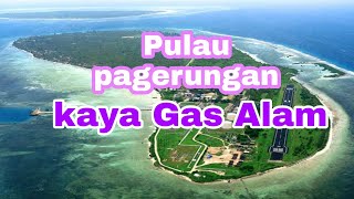
Pulau Pagerungan-besar
Welcome to Pulau Pagerungan-besar, a Tropical island in the Java Sea, part of the majestic Pacific Ocean. This guide offers a comprehensive overview of what makes Pulau Pagerungan-besar unique – from its geography and climate to its population, infrastructure, and beyond. Dive into the details:
- Geography and Size: Explore the island’s size and location.
- Climate and Weather: Weather patterns and temperature.
- Topography and Nature: Uncover the natural wonders of the island.
- Infrastructure and Travelling: Insights on reaching, staying, and making the most of your visit.
- News and Headlines: Latest News.
Geography and size of Pulau Pagerungan-besar
Size: 4.042 km²
Coastline: 10 km
Ocean: Pacific Ocean
Sea: Java Sea
Continent: Asia
Pulau Pagerungan-besar is a Small Island spanning 4 km² with a coastline of 10 km.
Archipel: Greater Sunda Islands – A group of large islands in Southeast Asia, including Borneo, Sumatra, Java, and Sulawesi, known for their rich biodiversity and cultural diversity.
Tectonic Plate: Timor – A small tectonic plate in the Timor region, primarily under the Timor Sea. It’s involved in the collision between the Australian and Eurasian plates, contributing to the region’s seismic activity and the uplift of the island of Timor.
The geographic heart of the island is pinpointed at these coordinates:
Latitude: -6.95583073 / Longitude: 115.91609272
Climate and weather of Pulau Pagerungan-besar
Climate Zone: Tropical
Climate Details: Tropical Savanna, Wet
Temperature: Hot
Climate Characteristics: Defined by distinct wet and dry seasons with high temperatures year-round. Pronounced rainfall occurs during the wet season, while the dry season is marked by drought.
Topography and nature of Pulau Pagerungan-besar
Timezone: UTC+07:00
Timezone places: Asia/Jakarta
Max. Elevation: 5 m
Mean Elevation: 3 m
Vegetation: Cultivated Land
Tree Coverage: 77%
The mean elevation is 3 m. The highest elevation on the island reaches approximately 5 meters above sea level. The island is characterized by Plains: Flat, low-lying lands characterized by a maximum elevation of up to 200 meters. On islands, plains are typically coastal lowlands or central flat areas.
Dominating Vegetation: Cultivated Land
Areas dedicated to agricultural activities, growing crops like grains, vegetables, and fruits. These lands are usually human-modified landscapes. Pulau Pagerungan-besar has a tree cover of 77 %.
Vegetation: 6 vegetation zones – Very Highly Diverse Island
Islands in this range are ecological powerhouses, showcasing a wide array of vegetation zones. Each zone, from lush rainforests to arid scrublands, coastal mangroves to mountainous regions, contributes to a complex and interdependent ecosystem. These islands are often hotspots of biodiversity, supporting numerous species and intricate ecological processes.
Infrastructure and Travelling to Pulau Pagerungan-besar
Does the island have a public airport? no.
There is no public and scheduled airport on Pulau Pagerungan-besar. The nearest airport is Letkol Wisnu Airstrip, located 194 km away.
Does the island have a major port? no.
There are no major ports on Pulau Pagerungan-besar. The closest major port is AMPENAN, approximately 179 km away.
The mean population of Pulau Pagerungan-besar is 522 per km². Pulau Pagerungan-besar is Densely Populated. The island belongs to Indonesia.
Continuing your journey, Pulau Sepanjang is the next notable island, situated merely km away.
EXPLORE PAGERUNGAN BESAR


Indonesia is classified as Emerging region: MIKT: Mexico, Indonesia, South Korea, and Turkey – Economies recognized for their development potential and emerging market status. The level of income is Lower middle income.
News – Latest Updates and Headlines from Pulau Pagerungan-besar
Stay informed with the most recent news and important headlines from Pulau Pagerungan-besar. Here’s a roundup of the latest developments.
Please note: The data used here has been primarily extracted from satellite readings. Deviations from exact values may occur, particularly regarding the height of elevations and population density. Land area and coastline measurements refer to average values at mean high tide.