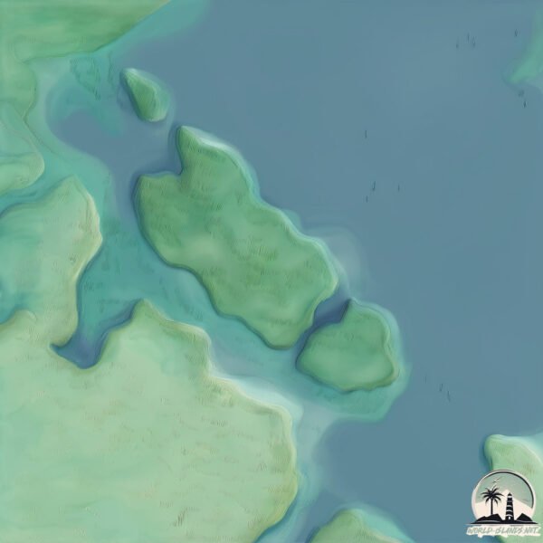
Welcome to Pulau Rekas, a Tropical island in the South China Sea, part of the majestic Pacific Ocean. This guide offers a comprehensive overview of what makes Pulau Rekas unique – from its geography and climate to its population, infrastructure, and beyond. Dive into the details:
Geography and size of Pulau Rekas
Size: 2.055 km²
Coastline: 9.5 km
Ocean: Pacific Ocean
Sea: South China Sea
Continent: Asia
Pulau Rekas is a Small Island spanning 2.1 km² with a coastline of 9.5 km.
Archipel: Greater Sunda Islands – A group of large islands in Southeast Asia, including Borneo, Sumatra, Java, and Sulawesi, known for their rich biodiversity and cultural diversity.
Tectonic Plate: Birds Head – Also known as the Bird’s Head Plate, it is a small tectonic plate in the vicinity of the Bird’s Head Peninsula in West Papua. The plate is noted for its interactions with the Pacific, Australian, and Philippine Sea plates, contributing to the geological complexity of the region.
The geographic heart of the island is pinpointed at these coordinates:
Latitude: 0.08281728 / Longitude: 104.49067902
Climate and weather of Pulau Rekas
Climate Zone: Tropical
Climate Details: Tropical Rainforest Climate
Temperature: Hot
Climate Characteristics: This climate is typified by heavy rainfall throughout the year, high humidity, and consistently high temperatures, leading to lush rainforests and rich biodiversity. Seasonal temperature variations are minimal.
Topography and nature of Pulau Rekas
Timezone: UTC+07:00
Timezone places: Asia/Jakarta
Max. Elevation: 12 m
Mean Elevation: 11 m
Vegetation: Mixed Forest
Tree Coverage: 75%
The mean elevation is 11 m. The highest elevation on the island reaches approximately 12 meters above sea level. The island is characterized by Plains: Flat, low-lying lands characterized by a maximum elevation of up to 200 meters. On islands, plains are typically coastal lowlands or central flat areas.
Dominating Vegetation: Mixed Forest
A combination of both deciduous and evergreen trees, often found in transitional zones between forest types. These forests offer a diverse habitat for various wildlife species. Pulau Rekas has a tree cover of 75 %.
Vegetation: 4 vegetation zones – Diverse Island
Four distinct vegetation zones mark these islands as ecologically diverse. They might feature varied landscapes such as forests, beaches, grasslands, and rocky areas. Such diversity reflects the island’s complex ecological interactions and varied habitats, which can support a rich array of wildlife and plant species.
Infrastructure and Travelling to Pulau Rekas
Does the island have a public airport? no.
There is no public and scheduled airport on Pulau Rekas. The nearest airport is Raja Haji Fisabilillah International Airport, located 92 km away.
Does the island have a major port? no.
There are no major ports on Pulau Rekas. The closest major port is DABO, approximately 64 km away.
The mean population of Pulau Rekas is 41 per km². Pulau Rekas is Gently Populated. The island belongs to Indonesia.
Continuing your journey, Pulau Bakung Besar is the next notable island, situated merely km away.
Golo cucu, Labuan Bajo, Manggarai Barat.
Golo Cucu ,Sala satu tempat wisata, di Manggarai Barat, tepatnya di Kampung Nuri.Golo cucu, Labuan Bajo, Manggarai Barat.
Golo Cucu ,Sala satu tempat wisata, di Manggarai Barat, tepatnya di ...
Golo Cucu ,Sala satu tempat wisata, di Manggarai Barat, tepatnya di Kampung Nuri.
SUNRISE PULAU PADAR X EKSOTISME PULAU KOMODO
Hai Gaes... masih rangkaian liburan di Labuan Bajo. Pagi-pagi kami ...
Hai Gaes... masih rangkaian liburan di Labuan Bajo. Pagi-pagi kami mendaki ke Pulau Padar untuk melihat matahari terbit dari ...
Lembor,Manggarai Barat.#labuanbajo #manggaraibarat #vntimeline #labuanbajotrip #manggarai #ntt
Lembor,Manggarai Barat, NTT.
Lembor,Manggarai Barat, NTT.
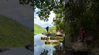
Gunung Mbeliling atap Negeri Labuan Bajo Gunung tertinggi di Labuan Bajo
Gunung Mbeliling adalah Gunung tertinggi di Labuan Bajo yang merupakan ...
Gunung Mbeliling adalah Gunung tertinggi di Labuan Bajo yang merupakan atap Negeri Labuan Bajo, penyumbang oksigen ...
Majestic Komodo Island
Komodo National Park is located in Manggarai Barat Regency, Flores, ...
Komodo National Park is located in Manggarai Barat Regency, Flores, East Nusa Tengara. In 2013, Komodo National Park is ...
The Sea Cave of Sikia, Milos Island
A short video of the majestic sea cave of Sikia. Milos Island, Greece. ...
A short video of the majestic sea cave of Sikia. Milos Island, Greece. Filmed in 2021.
I Like Your Way (Aku Suka Caramu)
Halo teman- teman ! Di video kali ini saya membaca buku " I Like Your ...
Halo teman- teman ! Di video kali ini saya membaca buku " I Like Your Way" . Buku ini ditulis oleh Audelia Agustine, dalam ...
17 DESTINASI WISATA DI LABUAN BAJO || YANG AKAN MEMBUATMU TERCENGANG
Destinasi wisata di Labuan Bajo, Nusa Tenggara Timur menyajikan wahana ...
Destinasi wisata di Labuan Bajo, Nusa Tenggara Timur menyajikan wahana wisata alam yang luar biasa. Lanskap alam yang ...
Dalam Keheningan Hutan Mbeliling Wae Lolos #travel
Pulau Solor
Pulau Solor adalah sebuah pulau yang terletak di Kepulauan Nusa ...
Pulau Solor adalah sebuah pulau yang terletak di Kepulauan Nusa Tenggara, yakni di sebelah timur Pulau Flores. Pulau ini ...
Wisata Pulau Komodo, Labuan Bajo, Nusa Tenggara Timur.
The Magnificent of Raja Ampat
Raja Ampat is located in West Papua. Raja Ampat is consist of many ...
Raja Ampat is located in West Papua. Raja Ampat is consist of many beautiful small islands. Raja Ampat Island can be reached ...
ANAK REKAS LAMAKERA
rekas LAMAKERA #REMAJA KAMPUNG ATAS LAMAKERA #REKAS KEREN.
rekas LAMAKERA #REMAJA KAMPUNG ATAS LAMAKERA #REKAS KEREN.
TARIAN GHEMEH (Inspitari 2014)
Siput Remis atau Ghemeh dalam loghat utara dikenali juga sebagai siput ...
Siput Remis atau Ghemeh dalam loghat utara dikenali juga sebagai siput Lala kecil; sejenis moluska bercengkerang yang boleh ...
Marriage and children lines #palmistry #shorts
Palmistry Expert hand reading All lines on hand | Dolat ki lakeer | ...
Palmistry Expert hand reading All lines on hand | Dolat ki lakeer | Money Line | Wealth line | Astrology | Ilm e jafar | Dolat | Money ...
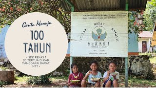
SDK Rekas 1 (Sekolah SD Tertua di Kab. Manggarai Barat, NTT)
SDK Rekas 1 merupakan sekolah SD pertama di Kab. Manggarai Barat, NTT. ...
SDK Rekas 1 merupakan sekolah SD pertama di Kab. Manggarai Barat, NTT. Sekolah ini didirikan pada tahun 1921 oleh ...
Lodok Cancar, Satu-satunya Persawahan di Dunia yang Berbentuk Jaring Laba-laba
Berlayar ke Pulau Ende
Pulau Ende merupakan salah satu kecamatan yang ada di Kab. Ende. Pulau ...
Pulau Ende merupakan salah satu kecamatan yang ada di Kab. Ende. Pulau dengan luas 63,03 km2 ini terletak sekitar 1 km dari ...
TARIAN IKTISYAF
'Iktisyaf' bermaksud 'penemuan' di dalam bahasa Arab. 'Penemuan' ...
'Iktisyaf' bermaksud 'penemuan' di dalam bahasa Arab. 'Penemuan' didefinisikan juga sebagai penemuan kepada Ghazal Pharti, ...
Rindu Rumah #pocoleok #kampungnderu #manggarai #floresntt #friendlyguide #labuanbajo
𝙰𝚗𝚢 𝚑𝚎𝚕𝚙 𝚒𝚗 𝙵𝚕𝚘𝚛𝚎𝚜 𝚊𝚗𝚍 𝙺𝚘𝚖𝚘𝚍𝚘, 𝚙𝚕𝚎𝚊𝚜𝚎 𝚕𝚎𝚝 𝚖𝚎 𝚔𝚗𝚘𝚠. 𝙸 𝚠𝚊𝚜 𝚋𝚘𝚛𝚗 𝚊𝚗𝚍 ...
𝙰𝚗𝚢 𝚑𝚎𝚕𝚙 𝚒𝚗 𝙵𝚕𝚘𝚛𝚎𝚜 𝚊𝚗𝚍 𝙺𝚘𝚖𝚘𝚍𝚘, 𝚙𝚕𝚎𝚊𝚜𝚎 𝚕𝚎𝚝 𝚖𝚎 𝚔𝚗𝚘𝚠. 𝙸 𝚠𝚊𝚜 𝚋𝚘𝚛𝚗 𝚊𝚗𝚍 ...
Diving di Indonesia Timur (Taman Nasional Komodo dan Pulau Alor )
Berikut merupakan kompilasi video daving di Pulau Alor dan Pulau ...
Berikut merupakan kompilasi video daving di Pulau Alor dan Pulau Komodo. Selamat menonton.
Exploring Ende
Hi teman-teman, penasaran apa aja tempat wisata yang ada di Kabupaten ...
Hi teman-teman, penasaran apa aja tempat wisata yang ada di Kabupaten Ende, Flores, NTT? Yuk tonton video ini untuk ...
PUNCAK WARINGIN LABUAN BAJO
Pantai Batu Cincin, Ende 🤩
Pantai Batu Cincin terletak di Kab. Ende, Flores, NTT. Pantai yang ...
Pantai Batu Cincin terletak di Kab. Ende, Flores, NTT. Pantai yang memiliki pemangan yang cantik dan unik ini bisa diakses ...
The Duroa Jhords 2019
Kei Island.
Kei Island.
Indonesia is classified as Emerging region: MIKT: Mexico, Indonesia, South Korea, and Turkey – Economies recognized for their development potential and emerging market status. The level of income is Lower middle income.
News – Latest Updates and Headlines from Pulau Rekas
Stay informed with the most recent news and important headlines from Pulau Rekas. Here’s a roundup of the latest developments.
Loading...
Please note: The data used here has been primarily extracted from satellite readings. Deviations from exact values may occur, particularly regarding the height of elevations and population density. Land area and coastline measurements refer to average values at mean high tide.