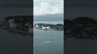
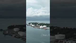
Pulau Sambu

Welcome to Pulau Sambu, a Tropical island in the Singapore Strait, part of the majestic Pacific Ocean. This guide offers a comprehensive overview of what makes Pulau Sambu unique – from its geography and climate to its population, infrastructure, and beyond. Dive into the details:
- Geography and Size: Explore the island’s size and location.
- Climate and Weather: Weather patterns and temperature.
- Topography and Nature: Uncover the natural wonders of the island.
- Infrastructure and Travelling: Insights on reaching, staying, and making the most of your visit.
- News and Headlines: Latest News.
Geography and size of Pulau Sambu
Size: 0.606 km²
Coastline: 3.9 km
Ocean: Pacific Ocean
Sea: Singapore Strait
Continent: Asia
Pulau Sambu is a Tiny Island spanning 0.606 km² with a coastline of 3.9 km.
Archipel: Greater Sunda Islands – A group of large islands in Southeast Asia, including Borneo, Sumatra, Java, and Sulawesi, known for their rich biodiversity and cultural diversity.
Tectonic Plate: Sunda – Extends across Southeast Asia, encompassing parts of the Sunda Shelf, known for its interaction with the Australian Plate, contributing to volcanic activity in Indonesia.
The geographic heart of the island is pinpointed at these coordinates:
Latitude: 1.16037007 / Longitude: 103.89962305
Climate and weather of Pulau Sambu
Climate Zone: Tropical
Climate Details: Tropical Rainforest Climate
Temperature: Hot
Climate Characteristics: This climate is typified by heavy rainfall throughout the year, high humidity, and consistently high temperatures, leading to lush rainforests and rich biodiversity. Seasonal temperature variations are minimal.
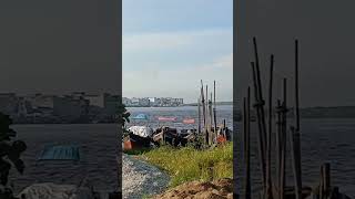
Topography and nature of Pulau Sambu
Timezone: UTC+07:00
Timezone places: Asia/Jakarta
Max. Elevation: 7 m
Mean Elevation: 4 m
Vegetation: Mangrove Forest
Tree Coverage: 87%
The mean elevation is 4 m. The highest elevation on the island reaches approximately 7 meters above sea level. The island is characterized by Plains: Flat, low-lying lands characterized by a maximum elevation of up to 200 meters. On islands, plains are typically coastal lowlands or central flat areas.
Dominating Vegetation: Mangrove Forest
Found in coastal areas and river deltas, these unique wetland ecosystems are adapted to saline conditions and are crucial for coastal protection and biodiversity. Pulau Sambu has a tree cover of 87 %.
Vegetation: 1 vegetation zones – Minimal Diversity Island
These islands exhibit the most basic level of ecological diversity, often characterized by a single dominant vegetation type. This could be due to extreme environmental conditions, limited land area, or significant human impact. They represent unique ecosystems where specific species have adapted to thrive in these singular environments.
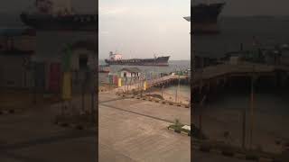
Infrastructure and Travelling to Pulau Sambu
Does the island have a public airport? no.
There is no public and scheduled airport on Pulau Sambu. The nearest airport is Singapore Changi Airport, located 23 km away.
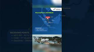
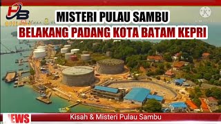
Does the island have a major port? yes.
Pulau Sambu is home to a major port. The following ports are situated on the island: .
The mean population of Pulau Sambu is 1877 per km². Pulau Sambu is Densely Populated. The island belongs to Indonesia.
Continuing your journey, Pulau Lumba Besar is the next notable island, situated merely km away.
Wonder full of Sambu island


Indonesia is classified as Emerging region: MIKT: Mexico, Indonesia, South Korea, and Turkey – Economies recognized for their development potential and emerging market status. The level of income is Lower middle income.
News – Latest Updates and Headlines from Pulau Sambu
Stay informed with the most recent news and important headlines from Pulau Sambu. Here’s a roundup of the latest developments.
Please note: The data used here has been primarily extracted from satellite readings. Deviations from exact values may occur, particularly regarding the height of elevations and population density. Land area and coastline measurements refer to average values at mean high tide.