Welcome to Pulau Sangiang, a Tropical island in the Java Sea, part of the majestic Pacific Ocean. This guide offers a comprehensive overview of what makes Pulau Sangiang unique – from its geography and climate to its population, infrastructure, and beyond. Dive into the details:
Geography and size of Pulau Sangiang
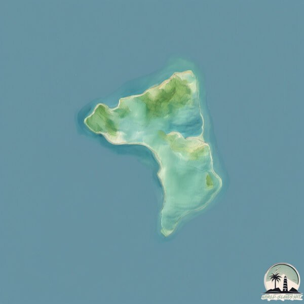
Size: 8.017 km²
Coastline: 17 km
Ocean: Pacific Ocean
Sea: Java Sea
Continent: Asia
Pulau Sangiang is a Small Island spanning 8 km² with a coastline of 17 km.
Archipel: Greater Sunda Islands – A group of large islands in Southeast Asia, including Borneo, Sumatra, Java, and Sulawesi, known for their rich biodiversity and cultural diversity.
Tectonic Plate: Australia – A major tectonic plate covering Australia, New Zealand, and parts of the Indian and Pacific Oceans, known for its relative stability and occasional seismic activity.
The geographic heart of the island is pinpointed at these coordinates:
Latitude: -5.95604007 / Longitude: 105.85200966
Climate and weather of Pulau Sangiang
Climate Zone: Tropical
Climate Details: Tropical Rainforest Climate
Temperature: Hot
Climate Characteristics: This climate is typified by heavy rainfall throughout the year, high humidity, and consistently high temperatures, leading to lush rainforests and rich biodiversity. Seasonal temperature variations are minimal.
Topography and nature of Pulau Sangiang
Timezone: UTC+07:00
Timezone places: Asia/Jakarta
Max. Elevation: 27 m
Mean Elevation: 13 m
Vegetation: Mangrove Forest
Tree Coverage: 70%
The mean elevation is 13 m. The highest elevation on the island reaches approximately 27 meters above sea level. The island is characterized by Plains: Flat, low-lying lands characterized by a maximum elevation of up to 200 meters. On islands, plains are typically coastal lowlands or central flat areas.
Dominating Vegetation: Mangrove Forest
Found in coastal areas and river deltas, these unique wetland ecosystems are adapted to saline conditions and are crucial for coastal protection and biodiversity. Pulau Sangiang has a tree cover of 70 %.
Vegetation: 5 vegetation zones – Highly Diverse Island
With five different vegetation zones, these islands offer a rich tapestry of ecosystems. The variety could include dense forests, open meadows, wetlands, coastal zones, and more. This level of diversity supports an intricate web of life, with each zone playing a vital role in the overall ecological health and balance of the island.
Infrastructure and Travelling to Pulau Sangiang
Does the island have a public airport? no.
There is no public and scheduled airport on Pulau Sangiang. The nearest airport is Soekarno-Hatta International Airport, located 89 km away.
Does the island have a major port? no.
There are no major ports on Pulau Sangiang. The closest major port is ANYER LOR, approximately 10 km away.
The mean population of Pulau Sangiang is 2403 per km². Pulau Sangiang is Densely Populated. The island belongs to Indonesia.
Continuing your journey, Pulau Sebuku is the next notable island, situated merely km away.
ONE DAY TRIP TO PULAU SANGIANG, BANTEN
In this video, I'd like to take you guys to Sangiang Island. This beautiful island located in Banten Province. Wondering how ...ONE DAY TRIP TO PULAU SANGIANG, BANTEN
In this video, I'd like to take you guys to Sangiang Island. This ...
In this video, I'd like to take you guys to Sangiang Island. This beautiful island located in Banten Province. Wondering how ...
One Day Trip Pulau Sangiang
PULAU SANGIANG ANYER || Pulau Terpendam Yang Menakjubkan
Pulau Sangiang adalah pulau kecil penuh sejarah yang terletak di Selat ...
Pulau Sangiang adalah pulau kecil penuh sejarah yang terletak di Selat Sunda, yakni antara Jawa dan Sumatra dengan luas ...
ADA PULAU SEINDAH INI DI BANTEN | SANGIANG ISLAND | BANTEN - DTGV6
Hallo teman seperjalanan! tidak perlu jauh-jauh ke lombok untuk ...
Hallo teman seperjalanan! tidak perlu jauh-jauh ke lombok untuk menikmati privet island dengan keindahan dan landscape yang ...
One Day Trip "Sangiang Island" Pulau Cantik Rasa Private!
Pulau Sangiang - Banten Pulau ini bernama pulau Sangiang adalah sebuah ...
Pulau Sangiang - Banten Pulau ini bernama pulau Sangiang adalah sebuah pulau kecil yang terletak di Selat Sunda, yaitu antara ...
TRIP MURAH PULAU SANGIANG! CUMA 180K!!! VIA @EXPLORESANGIANG
Sangiang, adalah sebuah pulau kecil yang terletak di Selat Sunda, ...
Sangiang, adalah sebuah pulau kecil yang terletak di Selat Sunda, yakni antara Jawa dan Sumatra. Secara administratif, pulau ...
Pulau sangiang | Aerial video | Drone view | Camping di pulau sangiang | Sangiang island Banten
This video is about Pulau sangiang banten.
This video is about Pulau sangiang banten.
Vlog - Pulau Sangiang Part 1 (Mabuk Laut Sebelum Snorkeling)
Terimakasih buat yang udah nonton kali ini aku trip ke Pulau Sangiang ...
Terimakasih buat yang udah nonton kali ini aku trip ke Pulau Sangiang guys bersama Backpacker Jakarta guys Tonton yah.
(Pulau) Sangiang Island at a Glance [Banten, Indonesia] #TRAVELGLIMPSE
Sangiang Island at a Glance Beside Thousands Island, there are many ...
Sangiang Island at a Glance Beside Thousands Island, there are many islands near Jakarta that are beautifull, one of them is ...
Belajar tentang sederhana dari warga Pulau Sangiang-Banten
BeritaTerkini ANTARA - Pulau Sangiang merupakan salah satu dari 81 ...
BeritaTerkini ANTARA - Pulau Sangiang merupakan salah satu dari 81 pulau di perairan Banten. Pulau ini menjadi bagian dari ...
Open Trip Pulau Sangiang - Jelajah Keindahan Banten
Ikut serta open trip kali ketiga dan menyenangkan (tetapi tidak dengan ...
Ikut serta open trip kali ketiga dan menyenangkan (tetapi tidak dengan agen open tripnya, jadi maaf tidak saya mention disini).
CUMA 300RB BISA LIBURAN KAYAK DI BALI!? - Open Trip ke Pulau Sangiang Anyer (snorkling & tracking)
SAFARI POS TNI AL PULAU SANGIANG
PULAU SANGIANG, ANYER | BANTEN
Terima Kasih sudah Subscribe, Comment, Like dan Share Selamat ...
Terima Kasih sudah Subscribe, Comment, Like dan Share Selamat menonton! Our social media : Instagram ...
Explore Pulau Sangiang #AzizJalan2
[Save Sekarang, Next ke Sini] Guys ada rekomendasi trip untuk ke ...
[Save Sekarang, Next ke Sini] Guys ada rekomendasi trip untuk ke daerah Banten. Namanya Pulau Sangiang. Untuk paket ...
Pulau Sangiang, Permata Tersembunyi di Tengah Laut Banten #shorts #pulausangiang
Cantiknya Pulau Sangiang, Spot Eksotis untuk Pecinta Snorkeling di ...
Cantiknya Pulau Sangiang, Spot Eksotis untuk Pecinta Snorkeling di Banten Pulau Sangiang ini merupakan Taman Wisata Laut ...
Mancing dan camping di pulau sangiang || nenda di pulau sangiang bersama sniper squad
Mancing & Camping bersama sniper squad. Ikan no 2 yg penting ...
Mancing & Camping bersama sniper squad. Ikan no 2 yg penting "nganar-nganar kuy!"
TRIP PULAU SANGIANG BANTEN (2023) #PART1
hallo, every one kali ini aku trip ke pulau sangiang yang ada di ...
hallo, every one kali ini aku trip ke pulau sangiang yang ada di anyer, banten kalian langsung dateng aja ke pelabuhan anyer, ...
"Pulau Sangiang Banten, Surga Tersembunyi di Selat Sunda!"
"Pulau Sangiang Banten, Surga Tersembunyi di Selat Sunda!" Pulau ...
"Pulau Sangiang Banten, Surga Tersembunyi di Selat Sunda!" Pulau Sangiang (disebut pula Pulau Sanghyang) di Banten: ...
[Update September 2024] 2D1N Outdoor Tracking Adventure Trip ke Pulau Sangiang di Selat Sunda - #408
Halo semua & ketemu lagi di playlist khusus liburan & jalan-jalan ...
Halo semua & ketemu lagi di playlist khusus liburan & jalan-jalan masih di channel yg sama. Di vlog ke 408 ini, kalian akan saya ...
pulau sangiang anyer Banten
One day trip pulau Sangiang island 🏝️
Backpacker One Day Trip - Pulau Sangiang (Banten)
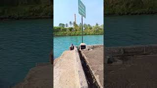
Dermaga penyeberangan ke pulau Sangiang #shorts #pantai anyer paku
Bara Perlawanan Warga Pulau Sangiang | Buka Mata
Jika warga Pulau Rempang di Kepulauan Riau sana beberapa waktu lalu ...
Jika warga Pulau Rempang di Kepulauan Riau sana beberapa waktu lalu jadi sorotan karena bakal diusir dari rumahnya oleh ...
Indonesia is classified as Emerging region: MIKT: Mexico, Indonesia, South Korea, and Turkey – Economies recognized for their development potential and emerging market status. The level of income is Lower middle income.
News – Latest Updates and Headlines from Pulau Sangiang
Stay informed with the most recent news and important headlines from Pulau Sangiang. Here’s a roundup of the latest developments.
Loading...
Please note: The data used here has been primarily extracted from satellite readings. Deviations from exact values may occur, particularly regarding the height of elevations and population density. Land area and coastline measurements refer to average values at mean high tide.


![(Pulau) Sangiang Island at a Glance [Banten, Indonesia] #TRAVELGLIMPSE](https://i.ytimg.com/vi/EINWOnE5Dbc/mqdefault.jpg)


![[Update September 2024] 2D1N Outdoor Tracking Adventure Trip ke Pulau Sangiang di Selat Sunda - #408](https://i.ytimg.com/vi/wdfT_Nid22w/mqdefault.jpg)