Ringold
Welcome to Ringold, a Polar island in the Bering Sea, part of the majestic Pacific Ocean. This guide offers a comprehensive overview of what makes Ringold unique – from its geography and climate to its population, infrastructure, and beyond. Dive into the details:
- Geography and Size: Explore the island’s size and location.
- Climate and Weather: Weather patterns and temperature.
- Topography and Nature: Uncover the natural wonders of the island.
- Infrastructure and Travelling: Insights on reaching, staying, and making the most of your visit.
- News and Headlines: Latest News.
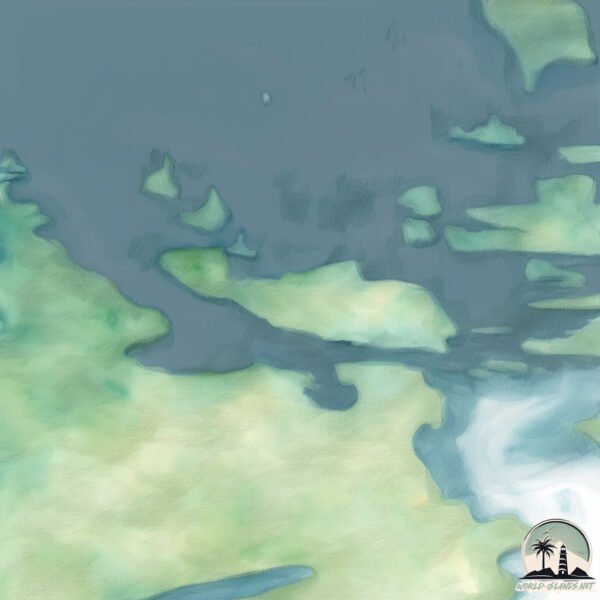
Geography and size of Ringold
Size: 1.51 km²
Coastline: 7.5 km
Ocean: Pacific Ocean
Sea: Bering Sea
Continent: North America
Ringold is a Small Island spanning 1.5 km² with a coastline of 7.5 km.
Archipel: Aleutian Islands – A chain of islands stretching from Alaska to Russia, known for their rugged beauty, abundant wildlife, and volcanic activity.
Tectonic Plate: North America – Covers North America and parts of the Atlantic and Arctic Oceans, characterized by diverse geological features and varying levels of seismic activity.
The geographic heart of the island is pinpointed at these coordinates:
Latitude: 51.80234164 / Longitude: -176.82098981
Climate and weather of Ringold
Climate Zone: Polar
Climate Details: Tundra
Temperature: Cold
Climate Characteristics: The tundra climate features long, extremely cold winters and short, cool summers. Vegetation is limited to mosses, lichens, and small shrubs due to the low temperatures and short growing seasons. Biodiversity is low, but some specialized species thrive.
Topography and nature of Ringold
Timezone: UTC-10:00
Timezone places: Pacific/Honolulu
Max. Elevation: 38 m
Mean Elevation: 30 m
Vegetation: Deciduous Needleleaf Forest
Tree Coverage: 81%
The mean elevation is 30 m. The highest elevation on the island reaches approximately 38 meters above sea level. The island is characterized by Plains: Flat, low-lying lands characterized by a maximum elevation of up to 200 meters. On islands, plains are typically coastal lowlands or central flat areas.
Dominating Vegetation: Deciduous Needleleaf Forest
Consists of needleleaf trees that shed their needles annually. This type of forest is less common and can be found in certain cold, northern regions. Ringold has a tree cover of 81 %.
Vegetation: 4 vegetation zones – Diverse Island
Four distinct vegetation zones mark these islands as ecologically diverse. They might feature varied landscapes such as forests, beaches, grasslands, and rocky areas. Such diversity reflects the island’s complex ecological interactions and varied habitats, which can support a rich array of wildlife and plant species.
Infrastructure and Travelling to Ringold
Does the island have a public airport? no.
There is no public and scheduled airport on Ringold. The nearest airport is Adak Airport, located 20 km away.
Does the island have a major port? no.
There are no major ports on Ringold. The closest major port is ADAK NAVAL AIR STATION, approximately 21 km away.
The mean population of Ringold is 0 per km². Ringold is Uninhabited. The island belongs to United States of America.
The name of the island resonates across different cultures and languages. Here is how it is known around the world: Arabic: جزيرة أداك; German: Adak Island; Spanish: Isla Adak; French: île Adak; Portuguese: Ilha Adak; Russian: Адак; Chinese: 埃達克島
Continuing your journey, Adak is the next notable island, situated merely km away.
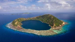
Swell Crew Explores The Ringgold Islands!


United States of America is classified as Developed region: G7: Group of Seven – Major advanced economies, including Canada, France, Germany, Italy, Japan, the United Kingdom, and the United States. The level of income is High income: OECD.
News – Latest Updates and Headlines from Ringold
Stay informed with the most recent news and important headlines from Ringold. Here’s a roundup of the latest developments.
Please note: The data used here has been primarily extracted from satellite readings. Deviations from exact values may occur, particularly regarding the height of elevations and population density. Land area and coastline measurements refer to average values at mean high tide.