Ronde Island
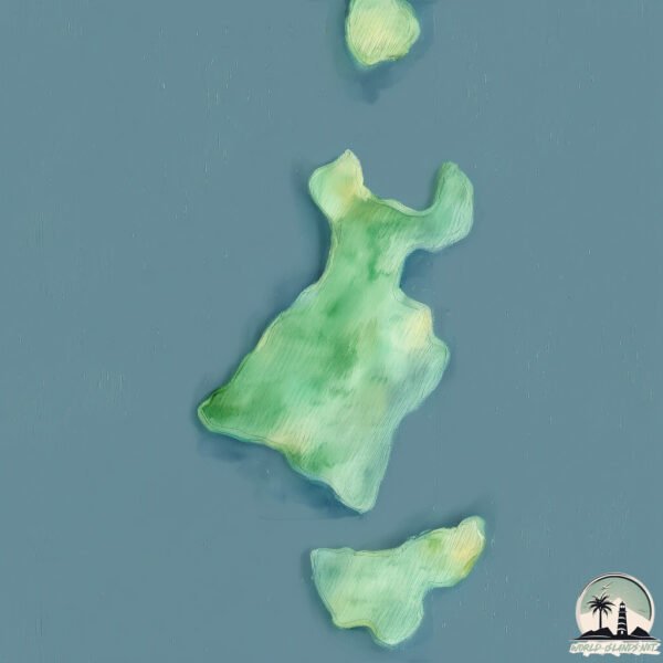
Welcome to Ronde Island, a Tropical island in the Caribbean Sea, part of the majestic Atlantic Ocean. This guide offers a comprehensive overview of what makes Ronde Island unique – from its geography and climate to its population, infrastructure, and beyond. Dive into the details:
- Geography and Size: Explore the island’s size and location.
- Climate and Weather: Weather patterns and temperature.
- Topography and Nature: Uncover the natural wonders of the island.
- Infrastructure and Travelling: Insights on reaching, staying, and making the most of your visit.
- News and Headlines: Latest News.
Geography and size of Ronde Island
Size: 2.558 km²
Coastline: 9.4 km
Ocean: Atlantic Ocean
Sea: Caribbean Sea
Continent: North America
Ronde Island is a Small Island spanning 2.6 km² with a coastline of 9.4 km.
Archipel: Lesser Antilles – A long arc of small islands in the Caribbean Sea, stretching from the Virgin Islands to Trinidad, known for their distinct cultures and tropical landscapes.
Tectonic Plate: Africa – One of the world’s largest tectonic plates, covering the African continent and parts of the surrounding oceans, known for its stability with some active rift zones.
The geographic heart of the island is pinpointed at these coordinates:
Latitude: 12.30463392 / Longitude: -61.58600075
Climate and weather of Ronde Island
Climate Zone: Tropical
Climate Details: Tropical Monsoon Climate
Temperature: Hot
Climate Characteristics: Characterized by heavy rainfall, high humidity, and uniformly high temperatures, but with a distinct short dry season. It features a seasonal reversal of prevailing wind directions.
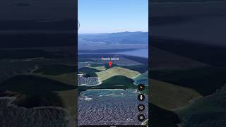
Topography and nature of Ronde Island
Timezone: UTC-04:00
Timezone places: America/La_Paz
Max. Elevation: 59 m
Mean Elevation: 31 m
Vegetation: Evergreen Needleleaf Forest
Tree Coverage: 85%
The mean elevation is 31 m. The highest elevation on the island reaches approximately 59 meters above sea level. The island is characterized by Plains: Flat, low-lying lands characterized by a maximum elevation of up to 200 meters. On islands, plains are typically coastal lowlands or central flat areas.
Dominating Vegetation: Evergreen Needleleaf Forest
Dominated by evergreen coniferous trees such as pines and firs, which retain their needle-like leaves throughout the year. These forests are often found in cooler climates. Ronde Island has a tree cover of 85 %.
Vegetation: 5 vegetation zones – Highly Diverse Island
With five different vegetation zones, these islands offer a rich tapestry of ecosystems. The variety could include dense forests, open meadows, wetlands, coastal zones, and more. This level of diversity supports an intricate web of life, with each zone playing a vital role in the overall ecological health and balance of the island.
Infrastructure and Travelling to Ronde Island
Does the island have a public airport? no.
There is no public and scheduled airport on Ronde Island. The nearest airport is Lauriston Airport, located 21 km away.
Does the island have a major port? no.
There are no major ports on Ronde Island. The closest major port is ST GEORGE’S, approximately 33 km away.
The mean population of Ronde Island is 212 per km². Ronde Island is Moderately Inhabited. The island belongs to Grenada.
Continuing your journey, Grenada is the next notable island, situated merely km away.
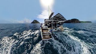
Ronde island in Caribbean Sea #island #travel

Grenada is classified as Developing region: Regions characterized by lower income levels, with economies in the process of industrialization and modernization. The level of income is Upper middle income.
News – Latest Updates and Headlines from Ronde Island
Stay informed with the most recent news and important headlines from Ronde Island. Here’s a roundup of the latest developments.
Please note: The data used here has been primarily extracted from satellite readings. Deviations from exact values may occur, particularly regarding the height of elevations and population density. Land area and coastline measurements refer to average values at mean high tide.