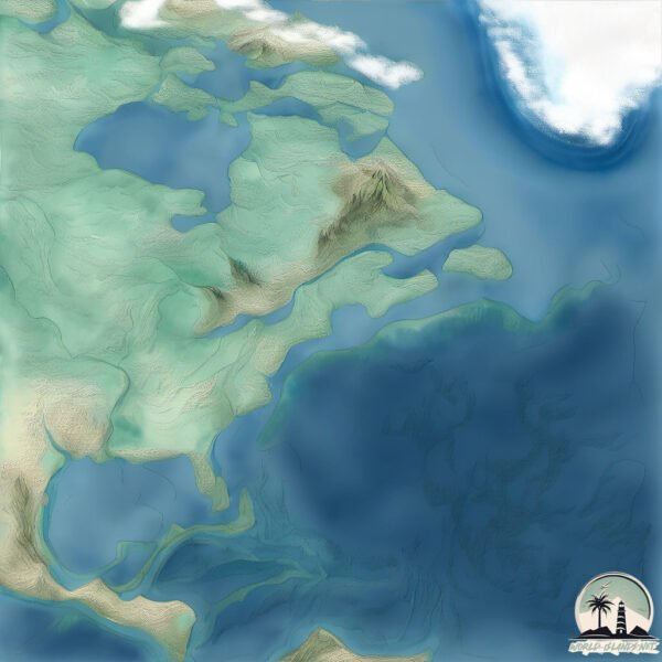
Welcome to Rose Island, a Polar island in the Labrador Sea, part of the majestic Atlantic Ocean. This guide offers a comprehensive overview of what makes Rose Island unique – from its geography and climate to its population, infrastructure, and beyond. Dive into the details:
Geography and size of Rose Island
Size: 5.338 km²
Coastline: 15.7 km
Ocean: Atlantic Ocean
Sea: Labrador Sea
Continent: North America
Rose Island is a Small Island spanning 5.3 km² with a coastline of 15.7 km.
Archipel: Bahama Islands – An archipelago in the Atlantic Ocean, known for their stunning beaches, coral reefs, and vibrant culture.
Tectonic Plate: North America – Covers North America and parts of the Atlantic and Arctic Oceans, characterized by diverse geological features and varying levels of seismic activity.
The geographic heart of the island is pinpointed at these coordinates:
Latitude: 57.55826871 / Longitude: -63.37403135
Climate and weather of Rose Island
Climate Zone: Polar
Climate Details: Tundra
Temperature: Cold
Climate Characteristics: The tundra climate features long, extremely cold winters and short, cool summers. Vegetation is limited to mosses, lichens, and small shrubs due to the low temperatures and short growing seasons. Biodiversity is low, but some specialized species thrive.
Topography and nature of Rose Island
Timezone: UTC-04:00
Timezone places: America/La_Paz
Max. Elevation: 68 m
Mean Elevation: 32 m
Vegetation: Herbaceous Cover
Tree Coverage: 72%
The mean elevation is 32 m. The highest elevation on the island reaches approximately 68 meters above sea level. The island is characterized by Plains: Flat, low-lying lands characterized by a maximum elevation of up to 200 meters. On islands, plains are typically coastal lowlands or central flat areas.
Dominating Vegetation: Herbaceous Cover
Comprising mainly of grasses, herbs, and ferns, these areas are common in prairies, meadows, and savannas, and can vary widely in species composition. Rose Island has a tree cover of 72 %.
Vegetation: 5 vegetation zones – Highly Diverse Island
With five different vegetation zones, these islands offer a rich tapestry of ecosystems. The variety could include dense forests, open meadows, wetlands, coastal zones, and more. This level of diversity supports an intricate web of life, with each zone playing a vital role in the overall ecological health and balance of the island.
Infrastructure and Travelling to Rose Island
Does the island have a public airport? no.
There is no public and scheduled airport on Rose Island. The nearest airport is Lynden Pindling International Airport, located 35 km away.
Does the island have a major port? no.
There are no major ports on Rose Island. The closest major port is NASSAU, approximately 21 km away.
The mean population of Rose Island is 0 per km². Rose Island is Uninhabited. The island belongs to Canada.
Continuing your journey, Jens Haven Island is the next notable island, situated merely km away.
Rose Island | Official Trailer | Netflix
An idealistic engineer builds his own island off the Italian coast and declares it a nation, drawing the world's attention. Values are ...Rose Island | Official Trailer | Netflix
An idealistic engineer builds his own island off the Italian coast and ...
An idealistic engineer builds his own island off the Italian coast and declares it a nation, drawing the world's attention. Values are ...
Republic of Rose Island (A Strange Micronation)
Today we are going to look at the strange story of The Republic of ...
Today we are going to look at the strange story of The Republic of Rose Island. A micronation that became an abandoned island.
Incredible True Story of Rose Island. #shorts #story
interestingfacts #amazingfacts #amazing #island #islandlife #italy ...
interestingfacts #amazingfacts #amazing #island #islandlife #italy #truestory #shortsfeed #shortsvideo #shortsyoutube ...
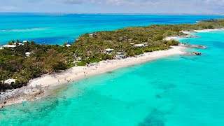
Day Trip to Rose Island Bahamas from Nassau.🌊🏖✨🌴🌞📸⚓🇧🇸
Certainly! Rose Island, located near Nassau in The Bahamas, offers a ...
Certainly! Rose Island, located near Nassau in The Bahamas, offers a delightful day trip experience.
The TRUTH About Rose Island, Bahamas (Sandy Toes Excursion Review)
In this video, I'm taking you with me on the Sandy Toes Rose Island ...
In this video, I'm taking you with me on the Sandy Toes Rose Island excursion—one of the most talked-about day trips from ...
Man Builds a Lawless Island and Declares Independence But Soon He Ends Up in a War
The true story of an engineer who built his own island on ...
The true story of an engineer who built his own island on international waters territory and fought a legal battle against the Italian ...
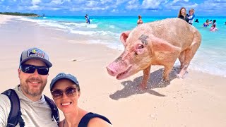
Nassau Snorkeling: Green Cay Sea Turtles and Rose Island Pigs
During our 7 Day Caribbean Cruise with Holland America, Nassau, ...
During our 7 Day Caribbean Cruise with Holland America, Nassau, Bahamas was our last stop. We booked a tour through a local ...
The Republic of Rose Island, a short-lived micronation
The Republic of Rose Island was a short-lived micronation built on a ...
The Republic of Rose Island was a short-lived micronation built on a man-made platform in the Adriatic Sea. In 1968, Italian ...
How to build your own country | story of rose island #shorts
The Real Story of Rose Island | Netflix
The cast and filmmakers of Rose Island discuss the incredible true ...
The cast and filmmakers of Rose Island discuss the incredible true story of how the real Rose Island came to be. Subscribe: ...
They built an island in the ocean || Rose Island (2020) #movie #shorts
The Smallest Country on Earth That was Invaded by Italy
In 1968, a 400 sqm platform off the coast of Italy declared itself an ...
In 1968, a 400 sqm platform off the coast of Italy declared itself an independent country—welcome to the story of Rose Island!
The Absolute BEST Swimming with Pigs Tour | Rose Island | Nassau, Bahamas
Swimming with pig tours have blown up in Nassau, Bahamas recently and ...
Swimming with pig tours have blown up in Nassau, Bahamas recently and there are a ton to choose from, so which one is the best ...
This Man Built His Own Country in International Waters and SHOCKED Everyone
In 1968, Giorgio Rosa created a country in the middle of the ...
In 1968, Giorgio Rosa created a country in the middle of the sea—complete with a flag, currency, and tourists. Italy? They bombed ...
The Lost Micro-Nation of Italy: The Fascinating Story of Rose Island! | CodeRed
youtubeusa #codered #trending #documentery #ytfeed.
youtubeusa #codered #trending #documentery #ytfeed.
A special tour around Rose Island | Rhode Island PBS Weekly
Rose Island's manager Mike Healey gives us a tour of the spectacular ...
Rose Island's manager Mike Healey gives us a tour of the spectacular island and its colorful history. About Rhode Island PBS ...
ROSE ISLAND official Trailer || Andaman Islands ||Andaman tour, trip 2023 || sidhu4you
ROSE ISLAND official Trailer || Andaman Islands ||Andaman tour, trip ...
ROSE ISLAND official Trailer || Andaman Islands ||Andaman tour, trip 2023 || sidhu4you Andaman Islands Rose island Andaman ...
Rose Island Lighthouse | Newport, Rhode Island
Rose Island, a historic 18-acre island in the East Passage of ...
Rose Island, a historic 18-acre island in the East Passage of Narragansett Bay, consists of a wildlife refuge, the lighthouse, and ...
Independent Country Destroyed by Italy
In 1968, Italian engineer Giorgio Rosa declared a platform in the ...
In 1968, Italian engineer Giorgio Rosa declared a platform in the Adriatic Sea an independent nation—Rose Island. Complete ...
Welcome to Rose Island Bahamas #travel #caribbean #bahamas
Rose Island Drone Tour - Sandy Toes - Nassau Excursion
Exploring The Tragic Abandoned Rose Island Amusement Park
Exploring the tragic abandoned Rose Island Amusement Park and resort. ...
Exploring the tragic abandoned Rose Island Amusement Park and resort. What's left? We discover what devastated Rose Island ...
rose island||Andaman and Nicobar||
rose island||Andaman and Nicobar||
rose island||Andaman and Nicobar||
Rose Island 🏝️
Rose Island 🏝️ #shorts #roseisland #naturelovers #beachlife ...
Rose Island 🏝️ #shorts #roseisland #naturelovers #beachlife #beachvibes #beach.
Swimming with pigs at Rose Island in the Bahamas #cruiseexcursion #nassau #bahamas #swimwithpigs
Canada is classified as Developed region: G7: Group of Seven – Major advanced economies, including Canada, France, Germany, Italy, Japan, the United Kingdom, and the United States. The level of income is High income: OECD.
News – Latest Updates and Headlines from Rose Island
Stay informed with the most recent news and important headlines from Rose Island. Here’s a roundup of the latest developments.
Loading...
Please note: The data used here has been primarily extracted from satellite readings. Deviations from exact values may occur, particularly regarding the height of elevations and population density. Land area and coastline measurements refer to average values at mean high tide.