Welcome to Rotan, a Tropical island in the Java Sea, part of the majestic Pacific Ocean. This guide offers a comprehensive overview of what makes Rotan unique – from its geography and climate to its population, infrastructure, and beyond. Dive into the details:
Geography and size of Rotan
Size: 2.224 km²
Coastline: 6 km
Ocean: Pacific Ocean
Sea: Java Sea
Continent: Asia
Rotan is a Small Island spanning 2.2 km² with a coastline of 6 km.
Archipel: Greater Sunda Islands – A group of large islands in Southeast Asia, including Borneo, Sumatra, Java, and Sulawesi, known for their rich biodiversity and cultural diversity.
Tectonic Plate: Sunda – Extends across Southeast Asia, encompassing parts of the Sunda Shelf, known for its interaction with the Australian Plate, contributing to volcanic activity in Indonesia.
The geographic heart of the island is pinpointed at these coordinates:
Latitude: -3.21618763 / Longitude: 108.28074347
Climate and weather of Rotan
Climate Zone: Tropical
Climate Details: Tropical Rainforest Climate
Temperature: Hot
Climate Characteristics: This climate is typified by heavy rainfall throughout the year, high humidity, and consistently high temperatures, leading to lush rainforests and rich biodiversity. Seasonal temperature variations are minimal.
Topography and nature of Rotan
Timezone: UTC+07:00
Timezone places: Asia/Jakarta
Max. Elevation: 10 m
Mean Elevation: 7 m
Vegetation: Mangrove Forest
Tree Coverage: 92%
The mean elevation is 7 m. The highest elevation on the island reaches approximately 10 meters above sea level. The island is characterized by Plains: Flat, low-lying lands characterized by a maximum elevation of up to 200 meters. On islands, plains are typically coastal lowlands or central flat areas.
Dominating Vegetation: Mangrove Forest
Found in coastal areas and river deltas, these unique wetland ecosystems are adapted to saline conditions and are crucial for coastal protection and biodiversity. Rotan has a tree cover of 92 %.
Vegetation: 2 vegetation zones – Low Diversity Island
Islands with two distinct vegetation zones offer slightly more ecological variety. These zones could be due to differences in elevation, moisture, or other environmental factors. While still limited in biodiversity, these islands may offer a contrast between the two zones, such as a coastline with mangroves and an inland area with grassland.
Infrastructure and Travelling to Rotan
Does the island have a public airport? no.
There is no public and scheduled airport on Rotan. The nearest airport is H A S Hanandjoeddin International Airport, located 78 km away.
Does the island have a major port? no.
There are no major ports on Rotan. The closest major port is TANJUNGPANDAN, approximately 88 km away.
The mean population of Rotan is 53 per km². Rotan is Gently Populated. The island belongs to Indonesia.
Continuing your journey, Belitung is the next notable island, situated merely km away.
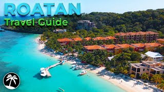
Roatan Honduras: 8 Best Things To Do In Roatan Honduras
Roatan Honduras Welcome to the tropical paradise of Roatan Honduras, where crystal-clear waters, lush jungles, and vibrant ...Roatan Honduras: 8 Best Things To Do In Roatan Honduras
Roatan Honduras Welcome to the tropical paradise of Roatan Honduras, ...
Roatan Honduras Welcome to the tropical paradise of Roatan Honduras, where crystal-clear waters, lush jungles, and vibrant ...
Roatan Honduras Travel Guide 4K - Top 7 Things To Do & Best Resorts To Stay In
Links to the resorts I mentioned (shortened links will redirect you to ...
Links to the resorts I mentioned (shortened links will redirect you to Expedia) Infinity Bay Spa & Beach Resort ...
Landing in Roatan: What You NEED to Know
Just landed in Roatan, Honduras — and if it's your first time flying ...
Just landed in Roatan, Honduras — and if it's your first time flying in, you NEED to see this! From which side of the plane to sit on, ...
NEW Roatan Cruise Port - Let's Explore!
There's a new cruise port in Roatan, Honduras at the Coxen Hole Cruise ...
There's a new cruise port in Roatan, Honduras at the Coxen Hole Cruise terminal! My Harmony of the Seas cruise recently docked ...
I LIKE THE WAY RIDDIM ''Roatán Live Band Dance'' (feat. Joseph James & The Boys)
Provided to YouTube by DistroKid I LIKE THE WAY RIDDIM ''Roatán Live ...
Provided to YouTube by DistroKid I LIKE THE WAY RIDDIM ''Roatán Live Band Dance'' (feat. Joseph James & The Boys) ...
Roatan Is Way Cooler Than You Think!
I just got back from Roatán, Honduras—and this Caribbean island ...
I just got back from Roatán, Honduras—and this Caribbean island totally blew me away. From effortless access to vibrant coral ...
5 Amazing Things Cruisers Can Do in Roatan
Roatan is a popular cruise ship port of call and cruisers can use this ...
Roatan is a popular cruise ship port of call and cruisers can use this cruise hack to swim for free, or use one of these other cruise ...
Roatan Cruise Port: Best Tips, Must-See Spots & What to Avoid!
Roatan in Honduras is a stunning cruise port with crystal-clear ...
Roatan in Honduras is a stunning cruise port with crystal-clear waters, lush mountains, and some of the best snorkeling in the ...
Roatan Honduras Travel Guide | 9 Best Things to Do in 2025
Get ready to explore Roatan Honduras, a Caribbean paradise filled with ...
Get ready to explore Roatan Honduras, a Caribbean paradise filled with adventure, relaxation, and natural beauty. In this travel ...
What Surprised Us at ROATAN's NEW Cruise Port? - Coxen Hole
Join your favorite YouTube Travel Couple as we take you on a walking ...
Join your favorite YouTube Travel Couple as we take you on a walking tour of the Roatan Cruise Port at Coxen Hole. This Port ...
Unique things to do in Roatan Honduras | Less touristy hidden gems! 4K
OK guys let's explore some of the Unique things to do in Roatan, ...
OK guys let's explore some of the Unique things to do in Roatan, Honduras. In this video I've focused on the less touristy places, ...
Little French Key is Unreal! 📍Roatan, Honduras
Roatan, Honduras is still one of our favorite islands we have visited! The coral reefs are the 2nd b
Roatan, Honduras is still one of our favorite islands we have visited! ...
Roatan, Honduras is still one of our favorite islands we have visited! The coral reefs are the 2nd best in the world for snorkeling ...
Roatan Honduras: 8 Best Things to Do in Roatán, Honduras (2025 Travel Guide)
Roatan Honduras Welcome to Roatán, Honduras — the Caribbean's hidden ...
Roatan Honduras Welcome to Roatán, Honduras — the Caribbean's hidden jewel where turquoise waters, lush green hills, and ...
Reggae Calipso Roatan
Provided to YouTube by DistroKid Reggae Calipso Roatan · Tumusica · ...
Provided to YouTube by DistroKid Reggae Calipso Roatan · Tumusica · Jdac Rez · Tumusica Musica Isleña De Roatan ...
Roatan, Honduras: 10 Best Places to Visit in Roatán, Honduras (2025 Travel Guide)
Roatan, Honduras Welcome to Roatán, Honduras — a true Caribbean ...
Roatan, Honduras Welcome to Roatán, Honduras — a true Caribbean paradise where turquoise waters, vibrant coral reefs, and ...
A Guide to the Best Beaches in Roatán
Roatan in the Bay Islands of Honduras is known for many things. Its ...
Roatan in the Bay Islands of Honduras is known for many things. Its northwest coast is bordered by a world-class coral reef, which ...
Fire Fire (feat. Jensen Grant)
Provided to YouTube by DistroKid Fire Fire (feat. Jensen Grant) · ...
Provided to YouTube by DistroKid Fire Fire (feat. Jensen Grant) · Musica Isleña Mundial · Jensen Grant Musica Isleña Para El ...
Inside Roatan: The Island of Extreme Wealth & Poverty
Book Your Adventure! , Stay at My Place in Roatan, Honduras! ...
IS ROATAN SAFE? What to Do in Roatan on a Cruise (& what to avoid)
Are you going to Roatan on a cruise & wondering what to do? Roatan is ...
Are you going to Roatan on a cruise & wondering what to do? Roatan is a cruise port where you're probably better off booking an ...
Best Islands in the Caribbean - Roatan, Honduras - West Bay
Best All Inclusive Resort in Roatan Honduras #travel #cruise #djiavata #drone #beach #infinitybay
The Ultimate Guide to Exploring Roatan, Honduras
If you're taking a cruise to Mahogany Bay or Coxen Hole, and you're ...
If you're taking a cruise to Mahogany Bay or Coxen Hole, and you're looking for things to do in Roatan, here's my top suggestion.
We made it to Roatan Honduras 🔆🩱 Mini vlog travel day 💕
I Found Paradise in Roatan | Top Things Do In The Most Underrated Island
Discover the best of Roatán, Honduras! In this video, I'll share the ...
Discover the best of Roatán, Honduras! In this video, I'll share the top things to do, must-visit places, and where to stay on this ...
Indonesia is classified as Emerging region: MIKT: Mexico, Indonesia, South Korea, and Turkey – Economies recognized for their development potential and emerging market status. The level of income is Lower middle income.
News – Latest Updates and Headlines from Rotan
Stay informed with the most recent news and important headlines from Rotan. Here’s a roundup of the latest developments.
Loading...
Please note: The data used here has been primarily extracted from satellite readings. Deviations from exact values may occur, particularly regarding the height of elevations and population density. Land area and coastline measurements refer to average values at mean high tide.