Rynda
Welcome to Rynda, a Continental island in the The Coastal Waters of Southeast Alaska and British Columbia, part of the majestic Pacific Ocean. This guide offers a comprehensive overview of what makes Rynda unique – from its geography and climate to its population, infrastructure, and beyond. Dive into the details:
- Geography and Size: Explore the island’s size and location.
- Climate and Weather: Weather patterns and temperature.
- Topography and Nature: Uncover the natural wonders of the island.
- Infrastructure and Travelling: Insights on reaching, staying, and making the most of your visit.
- News and Headlines: Latest News.
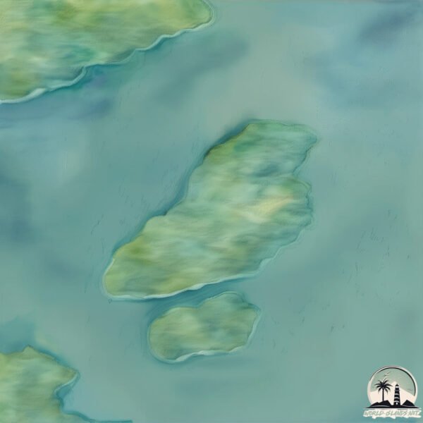
Geography and size of Rynda
Size: 6.772 km²
Coastline: 22.9 km
Ocean: Pacific Ocean
Sea: The Coastal Waters of Southeast Alaska and British Columbia
Continent: North America
Rynda is a Small Island spanning 6.8 km² with a coastline of 22.9 km.
Archipel: Alexander Archipelago – A group of about 1,100 islands off the southeast coast of Alaska, USA, known for their temperate rainforests and indigenous Tlingit culture.
Tectonic Plate: North America – Covers North America and parts of the Atlantic and Arctic Oceans, characterized by diverse geological features and varying levels of seismic activity.
The geographic heart of the island is pinpointed at these coordinates:
Latitude: 56.5416127 / Longitude: -132.54076058
Climate and weather of Rynda
Climate Zone: Continental
Climate Details: Warm-Summer Humid Continental Climate
Temperature: Warm Summer
Climate Characteristics: Features warm summers and cold winters with consistent precipitation, common in higher latitudes.
Topography and nature of Rynda
Timezone: UTC-09:00
Timezone places: America/Anchorage
Max. Elevation: 325 m
Mean Elevation: 155 m
Vegetation: Evergreen Needleleaf Forest
Tree Coverage: 96%
The mean elevation is 155 m. The highest elevation on the island reaches approximately 325 meters above sea level. The island is characterized by Hills: Gently sloping landforms with rounded tops, having a maximum elevation between 200 and 500 meters. Hills contribute to a varied landscape on islands.
Dominating Vegetation: Evergreen Needleleaf Forest
Dominated by evergreen coniferous trees such as pines and firs, which retain their needle-like leaves throughout the year. These forests are often found in cooler climates. Rynda has a tree cover of 96 %.
Vegetation: 5 vegetation zones – Highly Diverse Island
With five different vegetation zones, these islands offer a rich tapestry of ecosystems. The variety could include dense forests, open meadows, wetlands, coastal zones, and more. This level of diversity supports an intricate web of life, with each zone playing a vital role in the overall ecological health and balance of the island.
Infrastructure and Travelling to Rynda
Does the island have a public airport? no.
There is no public and scheduled airport on Rynda. The nearest airport is Wrangell Airport, located 18 km away.
Does the island have a major port? no.
There are no major ports on Rynda. The closest major port is WRANGELL, approximately 17 km away.
The mean population of Rynda is 0 per km². Rynda is Uninhabited. The island belongs to United States of America.
Continuing your journey, Vank is the next notable island, situated merely km away.
The nostalgia in Fionna and wake is amazing #adventuretime #fionnaandcake #childhoodmemories #finn


United States of America is classified as Developed region: G7: Group of Seven – Major advanced economies, including Canada, France, Germany, Italy, Japan, the United Kingdom, and the United States. The level of income is High income: OECD.
News – Latest Updates and Headlines from Rynda
Stay informed with the most recent news and important headlines from Rynda. Here’s a roundup of the latest developments.
Please note: The data used here has been primarily extracted from satellite readings. Deviations from exact values may occur, particularly regarding the height of elevations and population density. Land area and coastline measurements refer to average values at mean high tide.