Welcome to Sado, a Temperate island in the Japan Sea, part of the majestic Pacific Ocean. This guide offers a comprehensive overview of what makes Sado unique – from its geography and climate to its population, infrastructure, and beyond. Dive into the details:
Geography and size of Sado
Size: 862.3 km²
Coastline: 259.6 km
Ocean: Pacific Ocean
Sea: Japan Sea
Continent: Asia
Sado is a Large Island spanning 862 km² with a coastline of 260 km.
Archipel: Japan – An East Asian archipelago comprising four main islands and numerous smaller ones, known for its rich history, technological advances, and distinct culture.
Tectonic Plate: Okhotsk – Located in the northwest Pacific Ocean, the Okhotsk Plate encompasses the Sea of Okhotsk, the Kamchatka Peninsula, and parts of Japan. It’s involved in complex interactions with the Pacific and North American plates, contributing to seismic activity in the region.
The geographic heart of the island is pinpointed at these coordinates:
Latitude: 38.0443993 / Longitude: 138.38945067
Climate and weather of Sado
Climate Zone: Temperate
Climate Details: Humid Subtropical Climate
Temperature: Hot Summer
Climate Characteristics: With continuous rainfall and hot summers, this climate is common in some coastal regions, supporting diverse vegetation.
Topography and nature of Sado
Timezone: UTC+09:00
Timezone places: Asia/Tokyo
Max. Elevation: 998 m
Mean Elevation: 245 m
Vegetation: Deciduous Broadleaf Forest
Tree Coverage: 73%
The mean elevation is 245 m. The highest elevation on the island reaches approximately 998 meters above sea level. The island is characterized by Plateau: Elevated flatlands rising sharply above the surrounding area, with a maximum elevation over 500 meters but a mean elevation less than 300 meters, forming unique highland areas on islands.
Dominating Vegetation: Deciduous Broadleaf Forest
Composed of broadleaf trees that shed their leaves seasonally. These forests are commonly found in temperate zones and experience distinct seasonal changes. Sado has a tree cover of 73 %.
Vegetation: 13 vegetation zones – Exceptionally Diverse Island
Islands with more than ten vegetation zones are among the most ecologically rich and varied in the world. These islands are akin to miniature continents, boasting an incredible array of ecosystems. The sheer range of habitats, from high peaks to deep valleys, rainforests to deserts, creates a mosaic of life that is unparalleled. They are crucial for conservation and ecological studies.
Infrastructure and Travelling to Sado
Does the island have a public airport? yes.
Sado has a public and scheduled airport. The following airports are located on this island: Sado Airport.
Does the island have a major port? yes.
Sado is home to a major port. The following ports are situated on the island: RYOTU KO.
The mean population of Sado is 70 per km². Sado is Gently Populated. The island belongs to Japan.
Continuing your journey, Awa Shima is the next notable island, situated merely km away.
Stepping back in time to Sado Island, Japan - a weekend trip from Tokyo
In December, during my trip to Kochi and Tokyo in Japan, I took a weekend trip to Sado Island, a few hours from Tokyo by train ...Stepping back in time to Sado Island, Japan - a weekend trip from Tokyo
In December, during my trip to Kochi and Tokyo in Japan, I took a ...
In December, during my trip to Kochi and Tokyo in Japan, I took a weekend trip to Sado Island, a few hours from Tokyo by train ...
Staying on Japan's Most Mysterious Island | Sado
Sado Island: We travel out into the sea of Japan to the island of Sado ...
Sado Island: We travel out into the sea of Japan to the island of Sado for the weekend. ▻ WANT to visit Sado? Here's all the info ...
Top 8 Things to do in Sado Island
Stop for a few minutes and travel with us as we give you a summary of ...
Stop for a few minutes and travel with us as we give you a summary of the best things to do while you are in Sado Island.
Sado Island Gold Mines [long ver.](English subtitles)
Sado Island Gold Mines was the world's leading gold producer in the ...
Sado Island Gold Mines was the world's leading gold producer in the 17th century, both in terms of quantity and quality.
Why was Sado Island in Japan known as ‘the Land of Gold’?
In the 1600s, Japan produced nearly a fifth of the world's gold and ...
In the 1600s, Japan produced nearly a fifth of the world's gold and nearly half of that came from Sado. In this episode of Focus, ...
SADO ISLAND, JAPAN: Reasons to visit Sado as a side-trip from Tokyo
Step back in time to Sado Island Taiko drumming, tub boats, and temple ...
Step back in time to Sado Island Taiko drumming, tub boats, and temple adventures await on Sado Island, around three hours ...
Things to do in Sado Island
Let's explore Japan's sixth largest island—Sado Island! This beautiful ...
Let's explore Japan's sixth largest island—Sado Island! This beautiful destination offers rich culture, breathtaking landscapes, ...
This tiny Japanese island is called Sado Shima and it’s off the coast of Niigata ☺️
NIIGATA🇯🇵 Trip to Sado Island🚢 Gold Mine and Shukunegi Village⭐️ Japan travel vlog
Today, I'll take you to Sado Island in Niigata, Japan ٩( ᐛ )و Shooting ...
Today, I'll take you to Sado Island in Niigata, Japan ٩( ᐛ )و Shooting Date : October 10th 00:00 Sado Island Day1 00:24 How to ...
Around SADO Island#cinthitube #japan #sado
Weekend Itinerary on Sado Island, 2024 Japan's Hidden Gem~
Come with me to Sado Island, a small off the beaten path island in the ...
Come with me to Sado Island, a small off the beaten path island in the Japan sea, known for its traditional arts, captivating festivals ...
Japanese Island Port Town Street View | Sado Island (Ryotsu)
Japanese Island Port Town Street View | Sado Island (Ryotsu)
Japanese Island Port Town Street View | Sado Island (Ryotsu)
【HD】English guidance of Sado Island,Cool JAPAN
One of the premier tourist destinations in Japan, Sado Island is ...
One of the premier tourist destinations in Japan, Sado Island is located in the Sea of Japan in Niigata prefecture. With its strong ...
新潟県佐渡島 - Sado Island, Niigata, Japan in 4K
日本国内への移住や観光促進、地元の魅力を発信するために、4Kカメラやドローンを使用しPR動画を作成しております。 最近は ...
日本国内への移住や観光促進、地元の魅力を発信するために、4Kカメラやドローンを使用しPR動画を作成しております。 最近は ...
The Japanese Tradition Fading Away - Tub Boats on Sado Island Japan
If you've seen Spirited Away, you've seen these boats. Hopefully ...
If you've seen Spirited Away, you've seen these boats. Hopefully they're around for much longer! On Sado Island they're still real.
Discover Niigata, Minakami & Sado Island
The Joetsu Shinkansen can transport you from Tokyo to Niigata's ...
The Joetsu Shinkansen can transport you from Tokyo to Niigata's vibrant coastline in a journey that takes you through ...
Ferry to Sado Island Japan
Ferry rides with space to lie down and relax makes a lot of sense! ...
Ferry rides with space to lie down and relax makes a lot of sense! Islands in Japan are very different compared to Tokyo and ...
[Sado Island] Shukunegi Village - Niigata - 宿根木 - 4K Ultra HD
Having been a port since the medieval times, Shukunegi went through a ...
Having been a port since the medieval times, Shukunegi went through a prosperous 17th century brought about by the Sado ...
I had to LEAVE SADO ISLAND (JAPAN) .. and it's not why you think
Sado Island was at the top of my travel bucket list, so why did I ...
Sado Island was at the top of my travel bucket list, so why did I leave early? check out
http://www.ninjasaru.com for more links and ...
One of Japan's COOLEST islands! Sado Island, Niigata Prefecture 佐渡ヶ島
Come with us on a summer camping adventure to Sado Island in Niigata ...
Come with us on a summer camping adventure to Sado Island in Niigata Prefecture. It's easier to get to than most people think ...
"Sado island" ~the island "Oni" have not become extinct ~
Introduction video of Sado island, Niigata, Japan forcused on "Oni" ...
Introduction video of Sado island, Niigata, Japan forcused on "Oni" which mean Shinto Deities in the island. In Sado island, there ...
Sado Island Gold Mines
Sado Island Gold Mines Explore the hidden gems of Sado Island in our ...
Sado Island Gold Mines Explore the hidden gems of Sado Island in our latest video! Journey through the rich history of the Sado ...
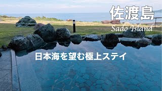
【佐渡島】絶景と美食の極上旅|ホテル大佐渡プレミアム+ロイヤルスイート滞在記
7月に日本海最大の島、新潟県の佐渡島に行ってきました。 佐渡島は2024年7月27日に「佐渡島の金山」として世界文化遺産に ...
7月に日本海最大の島、新潟県の佐渡島に行ってきました。 佐渡島は2024年7月27日に「佐渡島の金山」として世界文化遺産に ...
NIIGATA🇯🇵 Ferry Trip from Sado Island to Niigata🚢 Japan travel vlog⭐️ Japanese countryside
Today, I'll take you to Sado Island in Niigata, Japan ٩( ᐛ )و Shooting ...
Today, I'll take you to Sado Island in Niigata, Japan ٩( ᐛ )و Shooting Date : October 11th Sadokisen (Ferry) websight ...
Japan is classified as Developed region: G7: Group of Seven – Major advanced economies, including Canada, France, Germany, Italy, Japan, the United Kingdom, and the United States. The level of income is High income: OECD.
News – Latest Updates and Headlines from Sado
Stay informed with the most recent news and important headlines from Sado. Here’s a roundup of the latest developments.
Loading...
Please note: The data used here has been primarily extracted from satellite readings. Deviations from exact values may occur, particularly regarding the height of elevations and population density. Land area and coastline measurements refer to average values at mean high tide.


](https://i.ytimg.com/vi/U4RFhg2TIK8/mqdefault.jpg)


![[Sado Island] Shukunegi Village - Niigata - 宿根木 - 4K Ultra HD](https://i.ytimg.com/vi/pP7VdxgkzF0/mqdefault.jpg)