Sangeang
Welcome to Sangeang, a Tropical island in the Flores Sea, part of the majestic Pacific Ocean. This guide offers a comprehensive overview of what makes Sangeang unique – from its geography and climate to its population, infrastructure, and beyond. Dive into the details:
- Geography and Size: Explore the island’s size and location.
- Climate and Weather: Weather patterns and temperature.
- Topography and Nature: Uncover the natural wonders of the island.
- Infrastructure and Travelling: Insights on reaching, staying, and making the most of your visit.
- News and Headlines: Latest News.
Geography and size of Sangeang
Size: 155.1 km²
Coastline: 48.1 km
Ocean: Pacific Ocean
Sea: Flores Sea
Continent: Asia
Sangeang is a Large Island spanning 155 km² with a coastline of 48 km.
Archipel: Malay Archipelago – The world’s largest archipelago, located between mainland Southeast Asia and Australia, known for its immense biodiversity and cultural diversity.
Tectonic Plate: North America – Covers North America and parts of the Atlantic and Arctic Oceans, characterized by diverse geological features and varying levels of seismic activity.
The geographic heart of the island is pinpointed at these coordinates:
Latitude: -8.19500217 / Longitude: 119.05924703
Climate and weather of Sangeang
Climate Zone: Tropical
Climate Details: Tropical Savanna, Wet
Temperature: Hot
Climate Characteristics: Defined by distinct wet and dry seasons with high temperatures year-round. Pronounced rainfall occurs during the wet season, while the dry season is marked by drought.
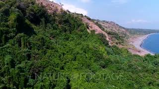
Topography and nature of Sangeang
Timezone: UTC+08:00
Timezone places: Australia/Perth
Max. Elevation: 1949 m Pulau Sangeang
Mean Elevation: 473 m
Vegetation: Evergreen Broadleaf Forest
Tree Coverage: 41%
The mean elevation is 473 m. Dominating the island’s landscape, the majestic “Pulau Sangeang” rises as the highest peak, soaring to impressive heights. The island is characterized by Mountains: High, steeply elevated landforms. Characterized by both a high maximum elevation (over 500 meters) and a high mean elevation, creating rugged, mountainous terrains on islands.
Dominating Vegetation: Evergreen Broadleaf Forest
Characterized by dense, lush canopies of broadleaf trees that retain their leaves year-round. These forests are typically found in tropical and subtropical regions and are known for their high biodiversity. Sangeang has a tree cover of 41 %.
Vegetation: 12 vegetation zones – Exceptionally Diverse Island
Islands with more than ten vegetation zones are among the most ecologically rich and varied in the world. These islands are akin to miniature continents, boasting an incredible array of ecosystems. The sheer range of habitats, from high peaks to deep valleys, rainforests to deserts, creates a mosaic of life that is unparalleled. They are crucial for conservation and ecological studies.
Infrastructure and Travelling to Sangeang
Does the island have a public airport? no.
There is no public and scheduled airport on Sangeang. The nearest airport is Sultan Muhammad Salahuddin Airport, located 49 km away.
Does the island have a major port? no.
There are no major ports on Sangeang. The closest major port is WAINGAPU, approximately 198 km away.
The mean population of Sangeang is 116 per km². Sangeang is Moderately Inhabited. The island belongs to Indonesia.
Continuing your journey, Gili Banta is the next notable island, situated merely km away.
Scuba Diving Off Sangeang Island, Indonesia


Indonesia is classified as Emerging region: MIKT: Mexico, Indonesia, South Korea, and Turkey – Economies recognized for their development potential and emerging market status. The level of income is Lower middle income.
News – Latest Updates and Headlines from Sangeang
Stay informed with the most recent news and important headlines from Sangeang. Here’s a roundup of the latest developments.
Please note: The data used here has been primarily extracted from satellite readings. Deviations from exact values may occur, particularly regarding the height of elevations and population density. Land area and coastline measurements refer to average values at mean high tide.