Santa Cruz-155361

Welcome to Santa Cruz, a Temperate island in the Gulf of California, part of the majestic Pacific Ocean. This guide offers a comprehensive overview of what makes Santa Cruz unique – from its geography and climate to its population, infrastructure, and beyond. Dive into the details:
- Geography and Size: Explore the island’s size and location.
- Climate and Weather: Weather patterns and temperature.
- Topography and Nature: Uncover the natural wonders of the island.
- Infrastructure and Travelling: Insights on reaching, staying, and making the most of your visit.
- News and Headlines: Latest News.
Geography and size of Santa Cruz
Size: 250.7 km²
Coastline: 120.6 km
Ocean: Pacific Ocean
Sea: Gulf of California
Continent: North America
Santa Cruz is a Large Island spanning 251 km² with a coastline of 121 km.
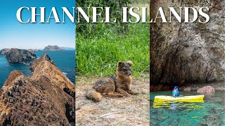
Archipel: Channel Islands of California – Located off the coast of Southern California, these islands are known for their unique ecosystems and as a national park.
Tectonic Plate: Sunda – Extends across Southeast Asia, encompassing parts of the Sunda Shelf, known for its interaction with the Australian Plate, contributing to volcanic activity in Indonesia.
The geographic heart of the island is pinpointed at these coordinates:
Latitude: 33.41267538 / Longitude: -112.96159897
Climate and weather of Santa Cruz
Climate Zone: Temperate
Climate Details: Warm-Summer Mediterranean Climate
Temperature: Warm Summer
Climate Characteristics: Characterized by warm, dry summers and mild, wet winters, typical of coastal areas with abundant sunshine Rain is more common in the winter months, maintaining a moderate climate.
Topography and nature of Santa Cruz
Timezone: UTC-08:00
Timezone places: America/Los_Angeles
Max. Elevation: 594 m
Mean Elevation: 208 m
Vegetation: Herbaceous Cover
Tree Coverage: 20%
The mean elevation is 208 m. The highest elevation on the island reaches approximately 594 meters above sea level. The island is characterized by Plateau: Elevated flatlands rising sharply above the surrounding area, with a maximum elevation over 500 meters but a mean elevation less than 300 meters, forming unique highland areas on islands.
Dominating Vegetation: Herbaceous Cover
Comprising mainly of grasses, herbs, and ferns, these areas are common in prairies, meadows, and savannas, and can vary widely in species composition. Santa Cruz has a tree cover of 20 %.
Vegetation: 13 vegetation zones – Exceptionally Diverse Island
Islands with more than ten vegetation zones are among the most ecologically rich and varied in the world. These islands are akin to miniature continents, boasting an incredible array of ecosystems. The sheer range of habitats, from high peaks to deep valleys, rainforests to deserts, creates a mosaic of life that is unparalleled. They are crucial for conservation and ecological studies.
Infrastructure and Travelling to Santa Cruz
Does the island have a public airport? no.
There is no public and scheduled airport on Santa Cruz. The nearest airport is Santa Barbara Municipal Airport, located 39 km away.
Does the island have a major port? yes.
Santa Cruz is home to a major port. The following ports are situated on the island: PRISONERS.
The mean population of Santa Cruz is 5 per km². Santa Cruz is Gently Populated. The island belongs to United States of America.
Continuing your journey, Marinduque is the next notable island, situated merely km away.
ONE Day at Channel Islands National Park- Santa Cruz Island -PLUS- Helpful Travel Info for You!


United States of America is classified as Emerging region: G20: Group of Twenty – Major economies comprising both developed and emerging countries, representing the world’s largest economies. The level of income is Lower middle income.
News – Latest Updates and Headlines from Santa Cruz
Stay informed with the most recent news and important headlines from Santa Cruz. Here’s a roundup of the latest developments.
Please note: The data used here has been primarily extracted from satellite readings. Deviations from exact values may occur, particularly regarding the height of elevations and population density. Land area and coastline measurements refer to average values at mean high tide.