Sapudi

Welcome to Sapudi, a Tropical island in the Java Sea, part of the majestic Pacific Ocean. This guide offers a comprehensive overview of what makes Sapudi unique – from its geography and climate to its population, infrastructure, and beyond. Dive into the details:
- Geography and Size: Explore the island’s size and location.
- Climate and Weather: Weather patterns and temperature.
- Topography and Nature: Uncover the natural wonders of the island.
- Infrastructure and Travelling: Insights on reaching, staying, and making the most of your visit.
- News and Headlines: Latest News.
Geography and size of Sapudi
Size: 128.1 km²
Coastline: 46.1 km
Ocean: Pacific Ocean
Sea: Java Sea
Continent: Asia
Sapudi is a Large Island spanning 128 km² with a coastline of 46 km.
Archipel: Greater Sunda Islands – A group of large islands in Southeast Asia, including Borneo, Sumatra, Java, and Sulawesi, known for their rich biodiversity and cultural diversity.
Tectonic Plate: South America – A major plate covering the South American continent and part of the Atlantic Ocean, known for the Andes mountain range and significant seismic and volcanic activity.
The geographic heart of the island is pinpointed at these coordinates:
Latitude: -7.1186731 / Longitude: 114.33594568
Climate and weather of Sapudi
Climate Zone: Tropical
Climate Details: Tropical Savanna, Wet
Temperature: Hot
Climate Characteristics: Defined by distinct wet and dry seasons with high temperatures year-round. Pronounced rainfall occurs during the wet season, while the dry season is marked by drought.
Topography and nature of Sapudi
Timezone: UTC+07:00
Timezone places: Asia/Jakarta
Max. Elevation: 113 m
Mean Elevation: 42 m
Vegetation: Agricultural Mosaic
Tree Coverage: 22%
The mean elevation is 42 m. The highest elevation on the island reaches approximately 113 meters above sea level. The island is characterized by Plains: Flat, low-lying lands characterized by a maximum elevation of up to 200 meters. On islands, plains are typically coastal lowlands or central flat areas.
Dominating Vegetation: Agricultural Mosaic
A mix of cropland and natural vegetation, often seen in rural landscapes where agricultural fields are interspersed with patches of natural habitats. Sapudi has a tree cover of 22 %.
Vegetation: 11 vegetation zones – Exceptionally Diverse Island
Islands with more than ten vegetation zones are among the most ecologically rich and varied in the world. These islands are akin to miniature continents, boasting an incredible array of ecosystems. The sheer range of habitats, from high peaks to deep valleys, rainforests to deserts, creates a mosaic of life that is unparalleled. They are crucial for conservation and ecological studies.
Infrastructure and Travelling to Sapudi
Does the island have a public airport? no.
There is no public and scheduled airport on Sapudi. The nearest airport is Letkol Wisnu Airstrip, located 110 km away.
Does the island have a major port? no.
There are no major ports on Sapudi. The closest major port is PANARUKAN, approximately 73 km away.
The mean population of Sapudi is 522 per km². Sapudi is Densely Populated. The island belongs to Indonesia.
Continuing your journey, Pulau Raas is the next notable island, situated merely km away.
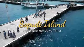
Welcome to Sapudi Island


Indonesia is classified as Emerging region: MIKT: Mexico, Indonesia, South Korea, and Turkey – Economies recognized for their development potential and emerging market status. The level of income is Lower middle income.
News – Latest Updates and Headlines from Sapudi
Stay informed with the most recent news and important headlines from Sapudi. Here’s a roundup of the latest developments.
Please note: The data used here has been primarily extracted from satellite readings. Deviations from exact values may occur, particularly regarding the height of elevations and population density. Land area and coastline measurements refer to average values at mean high tide.