Welcome to Satay, a Tropical island in the South Pacific Ocean, part of the majestic Pacific Ocean. This guide offers a comprehensive overview of what makes Satay unique – from its geography and climate to its population, infrastructure, and beyond. Dive into the details:
Geography and size of Satay
Size: 22.4 km²
Coastline: 19.9 km
Ocean: Pacific Ocean
Sea: South Pacific Ocean
Continent: South America
Satay is a Medium Island spanning 22 km² with a coastline of 20 km.
Archipel: –
Tectonic Plate: North Andes – Located in South America, covering Colombia, Ecuador, and part of Venezuela, it is known for its seismic activity due to interactions with the South American Plate.
The geographic heart of the island is pinpointed at these coordinates:
Latitude: -2.22039401 / Longitude: -79.85306739
Climate and weather of Satay
Climate Zone: Tropical
Climate Details: Tropical Savanna, Wet
Temperature: Hot
Climate Characteristics: Defined by distinct wet and dry seasons with high temperatures year-round. Pronounced rainfall occurs during the wet season, while the dry season is marked by drought.
Topography and nature of Satay
Timezone: UTC-05:00
Timezone places: America/New_York
Max. Elevation: 1 m
Mean Elevation: -2 m
Vegetation: Wetland
Tree Coverage: 48%
The mean elevation is -2 m. The highest elevation on the island reaches approximately 1 meters above sea level. The island is characterized by Plains: Flat, low-lying lands characterized by a maximum elevation of up to 200 meters. On islands, plains are typically coastal lowlands or central flat areas.
Dominating Vegetation: Wetland
These areas are saturated with water, either permanently or seasonally, and support aquatic plants. Wetlands are important for biodiversity and water filtration. Satay has a tree cover of 48 %.
Vegetation: 9 vegetation zones – Very Highly Diverse Island
Islands in this range are ecological powerhouses, showcasing a wide array of vegetation zones. Each zone, from lush rainforests to arid scrublands, coastal mangroves to mountainous regions, contributes to a complex and interdependent ecosystem. These islands are often hotspots of biodiversity, supporting numerous species and intricate ecological processes.
Infrastructure and Travelling to Satay
Does the island have a public airport? no.
There is no public and scheduled airport on Satay. The nearest airport is José Joaquín de Olmedo International Airport, located 5 km away.
Does the island have a major port? no.
There are no major ports on Satay. The closest major port is GUAYAQUIL, approximately 1 km away.
The mean population of Satay is 956 per km². Satay is Densely Populated. The island belongs to Ecuador.
Continuing your journey, Santa Ana is the next notable island, situated merely km away.
🌋 Indonesian Satay Burger | Chicken & Peanut Sauce | Smart Foods 🍔 Island Fire Bite
Welcome to Smart Foods — Where Global Taste Meets Culture! Embark on a flavorful journey to Indonesia , where vibrant ...🌋 Indonesian Satay Burger | Chicken & Peanut Sauce | Smart Foods 🍔 Island Fire Bite
Welcome to Smart Foods — Where Global Taste Meets Culture! Embark on a ...
Welcome to Smart Foods — Where Global Taste Meets Culture! Embark on a flavorful journey to Indonesia , where vibrant ...
2025.09.06 Pangkor Island Motor Tour Ep9: Klang Satay Eng Seng
Klang Satay Eng Seng – Pangkor Island, Malaysia If you're in Pulau ...
Klang Satay Eng Seng – Pangkor Island, Malaysia If you're in Pulau Pangkor, don't miss Klang Satay Eng Seng – one of the ...
Best SATAY spot in Singapore 🤩 | Singapore Foodie @OchieBon
EASY Thai Peanut Sauce
This quick and easy Thai peanut sauce recipe is perfect for peanut ...
This quick and easy Thai peanut sauce recipe is perfect for peanut noodles, chicken satay, or as a flavorful sauce or dressing.
Chicken satay skewers with peanut satay sauce, chicken satay recipe #chickensatay, #sataysauce
This is an easy recipe for chicken satay skewers with peanut satay ...
This is an easy recipe for chicken satay skewers with peanut satay sauce. Everyone loves chicken satay and it has been a ...
Spicy Satay Noodles, Gulangyu Island #China #travel #food #chinesefood #satay #noodles #shorts
Malaysian Satay Beach Dining - Delicious Island Food
Savoring mouth-watering Malaysian satay right by the beach! This ...
Savoring mouth-watering Malaysian satay right by the beach! This incredible chicken satay with peanut sauce was an absolute ...
Chicken Satay with Peanut Sauce - How to cook the Authentic Indonesian Chicken Satay
Chicken Satay was first created on the Island of Java and quickly ...
Chicken Satay was first created on the Island of Java and quickly spread not just across Indonesia, but it's also now a delicacy in ...
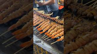
Best Satay On The Island | BBQ Pork Skewers With Coconut Charcoal
If you are looking for a delicious bbq recipe to enjoy than look no more.
If you are looking for a delicious bbq recipe to enjoy than look no more.
Best of the Best Satay in Brunei | Satay Hj Ibrahim | Brunei | BSB | 4ywen Foodie
If you enjoy the highlight, please hit the Like button & Subscribe to ...
If you enjoy the highlight, please hit the Like button & Subscribe to my channel. Thank you for the support & I promise you that I will ...
Chicken satay #thaifood #shorts #delicious #yummy
ISLAND SON CANDA: Hallowed Satay | Hot Sauce *REVIEW*
ISLAND SON CANDA: Hallowed Satay | Hot Sauce *REVIEW* ...
ISLAND SON CANDA: Hallowed Satay | Hot Sauce *REVIEW*
https://islandson.ca/ Please Like, Comment And Subscribe For ...
"Hainanese Pork Satay: Exploring the Flavors of China's Hainan Island" #imagenishvideos #viral
"Hainanese Pork Satay, a culinary gem from the tropical paradise of ...
"Hainanese Pork Satay, a culinary gem from the tropical paradise of Hainan Island, China , is a dish that tantalizes the taste ...
🇮🇩Bali🇮🇩 Nusa Series 🏖 Satay 😋 Ceningan Island Tour 🏄🏼♂️ Surfer Paradise 🏄♀️ Stardust Villas🛖 2025
Hotel experience and review at the end.
Hotel experience and review at the end.
What’s Cooking in Madagascar: Zebu Satay Skewers with Green Papaya Acar | PART 1 | SLICE
Madagascar is an island paradise, where breathtaking landscapes and ...
Madagascar is an island paradise, where breathtaking landscapes and warm-hearted people are just the beginning.
Lombok Island Food Tours: Sample 15+ Local Delicacies in One Afternoon
Experience Lombok's vibrant food scene! Dive into 15+ local delicacies ...
Experience Lombok's vibrant food scene! Dive into 15+ local delicacies like Ayam Taliwang and Sate Rembiga. It's not just a meal ...
Chicken skewers in spicy sauce thai street food | Koh Lanta island #thailand #streetfood #shorts
Chicken skewers in spicy sauce thai street food | Koh Lanta island ...
Chicken skewers in spicy sauce thai street food | Koh Lanta island #thailand #streetfood #shorts #travel #kohlanta #tour #tourism ...
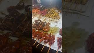
Huge Satay
shorts, #food, #foodlover, #satay, #skewers, #pork, #chicken, ...
shorts, #food, #foodlover, #satay, #skewers, #pork, #chicken, #chickensatay, #togo, #takeout, #orangecounty, #shortvideo, ...
Yummy Satay Jelly Fish bought from Pangkor Island,used to eat it during my school time #shorts
How to Cook: Indonesian Peanut Sauce on Nikoi Island
PEANUT SAUCE 150g fried peanuts 10g garlic (2 garlic cloves) 1/3 ...
PEANUT SAUCE 150g fried peanuts 10g garlic (2 garlic cloves) 1/3 teaspoon makrut lime zest 10g kencur (aromatic ginger), ...
Kakak Ini Laris Manis Jualan Sate Pusut Khas P. Lombok #shortsfeed #streetfood #sate
Video ini adalah konten mukbang virtual berbasis AI. Tidak menampilkan ...
Video ini adalah konten mukbang virtual berbasis AI. Tidak menampilkan aktivitas makan nyata. Konten dibuat hanya untuk ...
Satay Penang // Penang Popular Food
What To Eat In Penang? Satay Satay is skewered and grilled meat, ...
What To Eat In Penang? Satay Satay is skewered and grilled meat, served with a peanut sauce. A popular snack, maybe meal, ...
Indonesian Sate (Satay) #shorts #satay #sate #indonesia #food #traditional
Satay or sate in Indonesian spelling, is a Southeast Asian dish of ...
Satay or sate in Indonesian spelling, is a Southeast Asian dish of seasoned, skewered and grilled meat, served with a sauce.
Sate maranggi khas jawa barat (Satay originated on the Indonesian island of West Java.)
Sate maranggi.
Sate maranggi.
HK VLOG 🇭🇰 | sailboat to po toi island, satay beef noodles, queen street food market
Thanks for stopping by! #hongkong #foodvlog #whatieatinaday #mukbang ...
Thanks for stopping by! #hongkong #foodvlog #whatieatinaday #mukbang #cafe #asmr ♀️WORKOUTS: ...
Ecuador is classified as Developing region: Regions characterized by lower income levels, with economies in the process of industrialization and modernization. The level of income is Upper middle income.
News – Latest Updates and Headlines from Satay
Stay informed with the most recent news and important headlines from Satay. Here’s a roundup of the latest developments.
Loading...
Please note: The data used here has been primarily extracted from satellite readings. Deviations from exact values may occur, particularly regarding the height of elevations and population density. Land area and coastline measurements refer to average values at mean high tide.