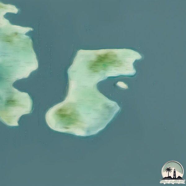
Welcome to Seekoo Island, a Polar island in the The Northwestern Passages, part of the majestic Arctic Ocean. This guide offers a comprehensive overview of what makes Seekoo Island unique – from its geography and climate to its population, infrastructure, and beyond. Dive into the details:
Geography and size of Seekoo Island
Size: 3.022 km²
Coastline: 12.5 km
Ocean: Arctic Ocean
Sea: The Northwestern Passages
Continent: North America
Seekoo Island is a Small Island spanning 3 km² with a coastline of 12.5 km.
Archipel: Canadian Arctic Archipelago – A vast and remote region in northern Canada, consisting of a series of large and small islands known for their extreme Arctic environment and unique wildlife.
Tectonic Plate: North America – Covers North America and parts of the Atlantic and Arctic Oceans, characterized by diverse geological features and varying levels of seismic activity.
The geographic heart of the island is pinpointed at these coordinates:
Latitude: 65.62429039 / Longitude: -84.53165499
Climate and weather of Seekoo Island
Climate Zone: Polar
Climate Details: Tundra
Temperature: Cold
Climate Characteristics: The tundra climate features long, extremely cold winters and short, cool summers. Vegetation is limited to mosses, lichens, and small shrubs due to the low temperatures and short growing seasons. Biodiversity is low, but some specialized species thrive.
Topography and nature of Seekoo Island
Timezone: UTC-05:00
Timezone places: America/New_York
Max. Elevation: 33 m
Mean Elevation: 0 m
Vegetation: Herbaceous Cover
Tree Coverage: 54%
The mean elevation is 0 m. The highest elevation on the island reaches approximately 33 meters above sea level. The island is characterized by Plains: Flat, low-lying lands characterized by a maximum elevation of up to 200 meters. On islands, plains are typically coastal lowlands or central flat areas.
Dominating Vegetation: Herbaceous Cover
Comprising mainly of grasses, herbs, and ferns, these areas are common in prairies, meadows, and savannas, and can vary widely in species composition. Seekoo Island has a tree cover of 54 %.
Vegetation: 2 vegetation zones – Low Diversity Island
Islands with two distinct vegetation zones offer slightly more ecological variety. These zones could be due to differences in elevation, moisture, or other environmental factors. While still limited in biodiversity, these islands may offer a contrast between the two zones, such as a coastline with mangroves and an inland area with grassland.
Infrastructure and Travelling to Seekoo Island
Does the island have a public airport? no.
There is no public and scheduled airport on Seekoo Island. The nearest airport is Coral Harbour Airport, located 204 km away.
Does the island have a major port? no.
There are no major ports on Seekoo Island. The closest major port is POND INLET, approximately 1170 km away.
The mean population of Seekoo Island is 0 per km². Seekoo Island is Uninhabited. The island belongs to Canada.
Continuing your journey, Bushnan Island is the next notable island, situated merely km away.
Thanda island , Tanzania Most Expensive Private Island 2021
Thanda Island is located in the Shungimbili Island Marine Reserve, between the mainland of Tanzania and Mafia Island.Thanda island , Tanzania Most Expensive Private Island 2021
Thanda Island is located in the Shungimbili Island Marine Reserve, ...
Thanda Island is located in the Shungimbili Island Marine Reserve, between the mainland of Tanzania and Mafia Island.
Cool Wete city on Pemba island, Zanzibar archipelago
h.
h.
Mayotte, The Island In The Lagoon
00:00 Encircled by one of the world's largest enclosed lagoons, the ...
00:00 Encircled by one of the world's largest enclosed lagoons, the 101st French department is a real cultural crossroads between ...
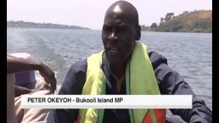
Life on Lake Victoria's remote Bukooli Islands
The little- known Bukooli Islands in Lake Victoria is inhabited by a ...
The little- known Bukooli Islands in Lake Victoria is inhabited by a big population of Ugandans and Kenyans. The islands, part of ...
Beautiful Prison Island in Zanzibar
Karibu Zantime, kituo chako cha kipekee cha kupata habari, makala, ...
Karibu Zantime, kituo chako cha kipekee cha kupata habari, makala, uchambuzi, na burudani kutoka Zanzibar, Tanzania, ...
Siku Bamboo Pan Pipes - Sound Demo
The Peruvian Siku panpipes is a new woodwind musical instrument that ...
The Peruvian Siku panpipes is a new woodwind musical instrument that is made from natural bamboo. It is the largest set of ...
Visited The Most Protected Island In Africa 🇰🇪 🇺🇬 ( Migingo Island )
Migingo island is populated with more than 3000 people that live ...
Migingo island is populated with more than 3000 people that live there, I didn't expect to see Kenya police officers living in a bad ...
Sesoko Beach 瀬底ビーチ 세소코 비치 #okinawa #japan
Majua Sikkom Gaon River Island In Assam jiya Bharali River #Dipu_das_vlogs🚣🚣♀️🛶
Dipu_das_vlogs #River_island_majua_Sikkom_gaon ...
Dipu_das_vlogs #River_island_majua_Sikkom_gaon #River_island_in_sonitpur_assam #largest_island_jiya_bharali_river ...
Tensions continue to rise over disputed East African island
In the heart of Lake Victoria, at the frontier between Kenya and ...
In the heart of Lake Victoria, at the frontier between Kenya and Uganda, lies the tiny disputed island of Migingo. Barely an acre in ...
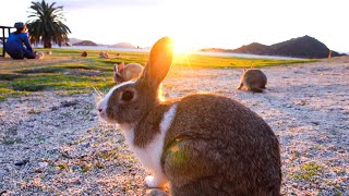
Kawaii!The Only RABBIT ISLAND in the World - Uninhabited with 700 Wild Rabbits | Japanese Island
What is Ohkunojima? An uninhabited island belonging to Takehara City, ...
What is Ohkunojima? An uninhabited island belonging to Takehara City, Hiroshima Prefecture It takes about 15 minutes by boat ...
Illegal islands that you can never visit #shorts
How much i spent 24 HRS in Zanzibar #shorts #zanzibar
Welcome to zanzibar island the most beautiful Island in Africa. Bluest ...
Welcome to zanzibar island the most beautiful Island in Africa. Bluest waters, friendly people and amaizing food follow me on ...
Building SIKU Shelter Island
description.
description.
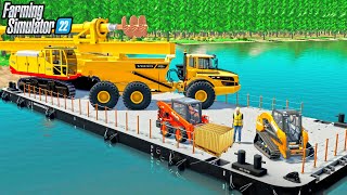
I BOUGHT A $4,000,000 ISLAND FOR GOLD MINING!
Buying an island to expand the Gold Mine! The new island will only ...
Buying an island to expand the Gold Mine! The new island will only work if the new barge can become operational to transport the ...
Siku river (aka Kalapani) of East Siang, Arunachal Pradesh | Popular summer hangout place
siku river #kalapani #eastsiang #arunachalpradeshtourism.
siku river #kalapani #eastsiang #arunachalpradeshtourism.
bagi yang belum tau anime island waifu Simulator New update
Association Island RV Park Review (Unique Place to Stay)
We stayed at Association Island and were able to go out and see the ...
We stayed at Association Island and were able to go out and see the different areas in the Thousand Island area. We hung out it ...
The Migingo Island Row
The conflict over who, between Kenya and Uganda, has territorial ...
The conflict over who, between Kenya and Uganda, has territorial rights over the Migingo Island in Lake Victoria seems to be far ...
Samal Beach Island | Samal Island | Philippines Vlog_12
Samal Beach Island Beach day Samal Davao City which is a short boat ...
Samal Beach Island Beach day Samal Davao City which is a short boat ride from Davao City, Philippines. I hung out at Cavanico ...
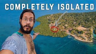
I SURVIVED in a tree house ON TANZANIA'S MOST ISOLATED ISLAND!
I spent 3 days on the most isolated island in Tanzania, Chole Island. ...
I spent 3 days on the most isolated island in Tanzania, Chole Island. This is what my experience was like. Learn How To Film ...
IKAN LANGKA DI PULAU BARU GO FISHING ROBLOX ! #ligerto #roblox #gofishing #mancing #mancingmania
MARI KITA MABAR ROBLOX ! #roblox #ligerto #trending #robloxlive ...
MARI KITA MABAR ROBLOX ! #roblox #ligerto #trending #robloxlive #robloxmabar #ligertoo LIGERTO GAME ROBLOX ...
Tanzania: Paradise Kilwa Island
Tanzania: Paradise Kilwa Island Coming from Dar Es Salaam by car we ...
Tanzania: Paradise Kilwa Island Coming from Dar Es Salaam by car we arrived in KILWA without any problem to spent one day at ...
Luxury hotels of Zanzibar #tanzania #eastafrica #africa
Sadia Silu - Corn Island (Lado A)
Canada is classified as Developed region: G7: Group of Seven – Major advanced economies, including Canada, France, Germany, Italy, Japan, the United Kingdom, and the United States. The level of income is High income: OECD.
News – Latest Updates and Headlines from Seekoo Island
Stay informed with the most recent news and important headlines from Seekoo Island. Here’s a roundup of the latest developments.
Loading...
Please note: The data used here has been primarily extracted from satellite readings. Deviations from exact values may occur, particularly regarding the height of elevations and population density. Land area and coastline measurements refer to average values at mean high tide.